Traditional land development workflows often rely on fragmented data: outdated satellite imagery, manual ground walkthroughs, and sporadic site visits that capture only a fraction of the reality on the ground. High-resolution drone mapping changes this equation by providing a comprehensive, digital twin of your project site from day one. Integrating these datasets into your strategy isn't just about "having cool photos"; it is about streamlining the entitlement process, reducing design errors, and maintaining absolute control over site conditions in Southwest Florida's unique terrain.
The Strategic Shift: Drone-First Site Assessment
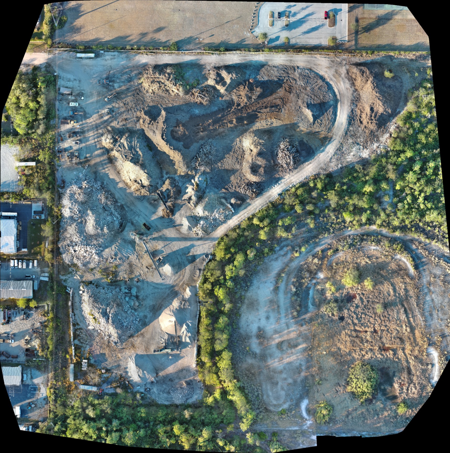
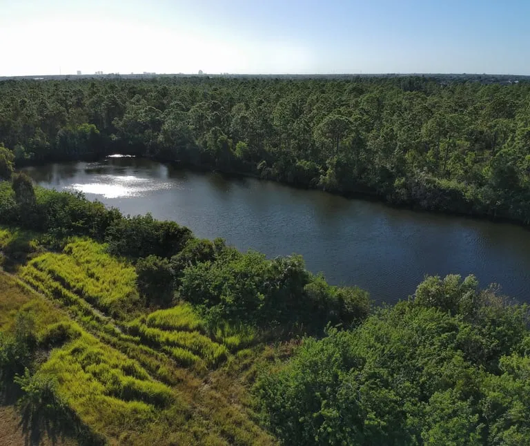
The most successful developers in Cape Coral and the surrounding region are moving toward a drone-first assessment model. Instead of waiting for a crew to clear brush or mark boundaries manually, an initial aerial scan provides a high-resolution orthomosaic: a composite image made of hundreds of individual photos stitched together to create a geometrically corrected map.
Why It Matters
- Rapid Baseline Data: Capture 100-acre sites in less than an hour, providing an immediate visual record of existing conditions.
- Environmental Clarity: Identify wetlands, drainage patterns, and vegetation density before the first boots hit the ground.
- Stakeholder Alignment: Provide investors, engineers, and municipal planners with a shared, high-definition visual reference that eliminates ambiguity.
By initiating drone surveys at the start of the project, you capture baseline data before submitting entitlement applications. This proactive approach can reduce site assessment time by up to 60% compared to traditional ground methods, allowing your team to identify potential "deal-breakers" or topographical challenges before significant capital is committed.
Technical Precision: Enterprise Hardware Specs
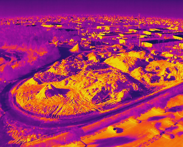
At Cape UAV, we utilize the Autel Robotics EVO Lite 6T Enterprise (also known as the EVO Lite 640T). This platform is specifically chosen for land development because it carries a dual-sensor payload: a 50MP visual camera and a 640×512 thermal sensor.
Hardware Capabilities for Mapping:
- 50MP Visual Sensor: Delivers incredible detail for high-resolution orthomosaics, allowing you to zoom in on specific site features like utility markers or individual trees without losing clarity.
- 640×512 Thermal Sensor: Features a 12um pixel pitch, which is critical for identifying subsurface moisture patterns or heat anomalies in industrial contexts.
- Rapid Deployment: The compact nature of the Enterprise series allows our FAA Part 107 certified pilots to deploy quickly, even in tight urban infill sites or remote acreage.
Disclaimer: Autel Robotics is a trademark of its respective owner; Cape UAV is not affiliated with or endorsed by Autel Robotics. Results depend on environmental conditions.
Seamless Integration with CAD and GIS Workflows
One of the biggest hurdles in adopting new technology is data compatibility. High-resolution drone mapping is designed to slot directly into the software your team already uses. Whether your engineers work in AutoCAD, Civil 3D, or ArcGIS, the outputs from a drone mission are ready for import.
From Pixels to Points
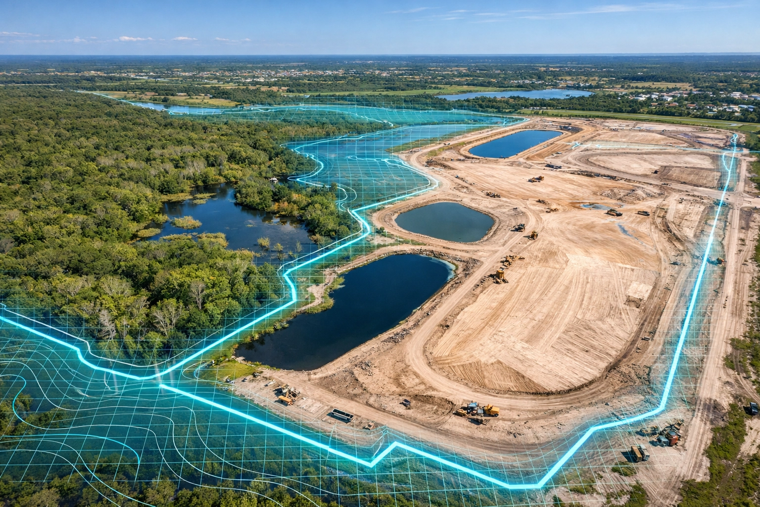
The mapping process generates more than just a 2D image. By using photogrammetry, we create 3D point clouds and Digital Surface Models (DSM). These datasets allow your design team to:
- Overlay CAD Designs: View your proposed site plan directly on top of current, high-resolution aerial data.
- Analyze Topography: Identify high and low spots that will impact stormwater management and grading.
- Calculate Volumetrics: Determine exactly how much earth needs to be moved or how many stockpiles are currently on-site.
ROI Advantage
Integrating aerial data with GIS systems improves coordination among teams and allows for smoother operations on-site. Modern drone service providers offer tools that connect directly with construction management software, eliminating translation steps that introduce delays and errors.
Accelerating the Entitlement and Permitting Process
In Southwest Florida, the permitting process can be a bottleneck. Providing municipal agencies with clear, defensible documentation can significantly shorten review cycles. High-resolution mapping provides objective evidence of site conditions, which is particularly useful for environmental reviewers.
Why This Matters
Drone-based systems capture detailed elevation data across entire properties. This reveals drainage patterns and terrain features that determine habitat quality and wildlife corridors. One comprehensive dataset can serve multiple purposes: wetland boundary delineation, utility line identification, and stormwater system design optimization.
Developers who use drone mapping early in the process have seen zoning and entitlement approval turnarounds improve by up to 40%. The quality of the documentation reduces "requests for clarification" from planning staff because the visual context is undeniable.
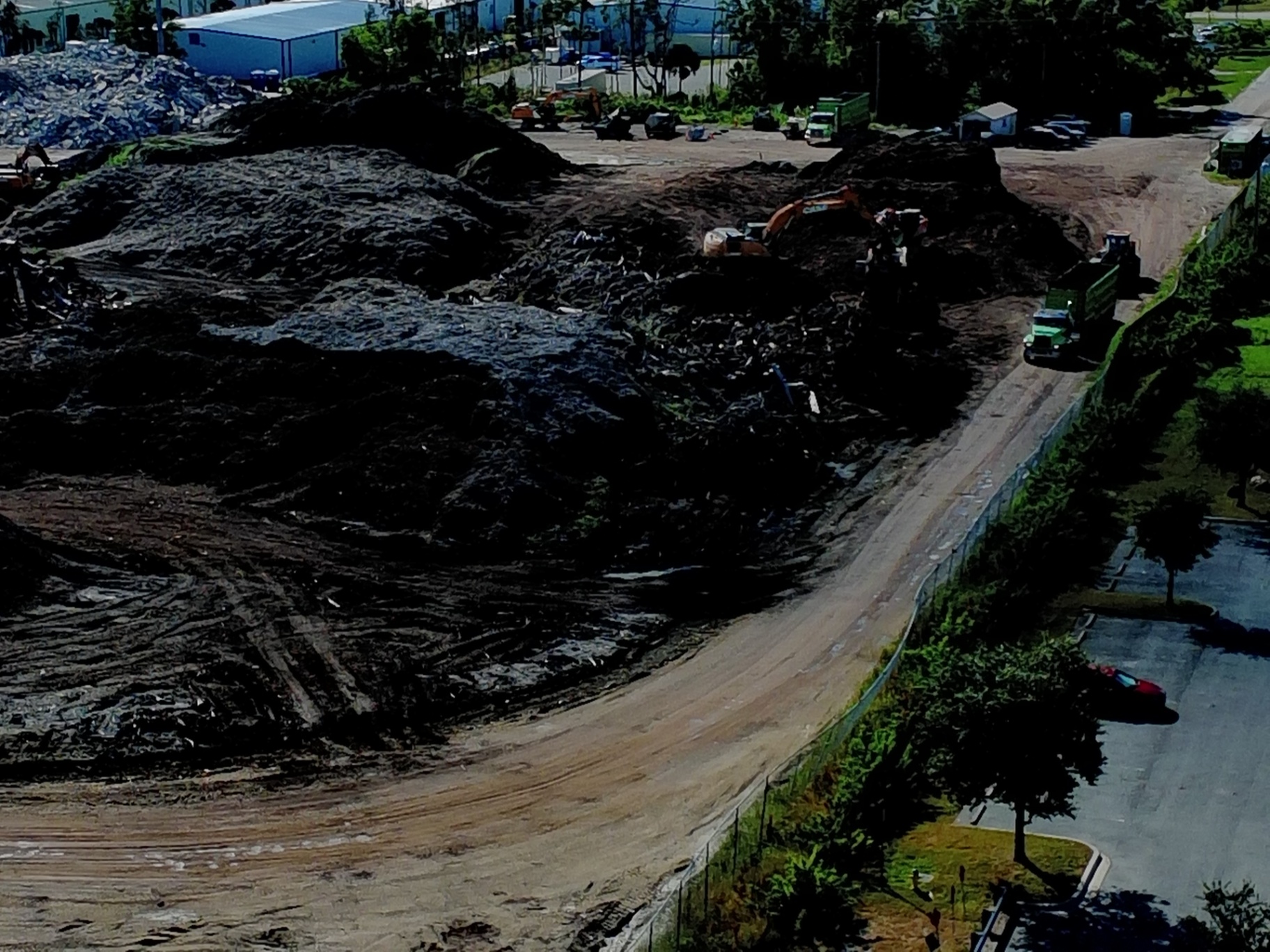
Thermal Imaging for Site Preparation and Maintenance
While visual mapping is the standard, thermal imaging provides a "secret weapon" for land development, especially in industrial or utility-heavy sites. Using the 640×512 thermal sensor on our Autel platform, we can identify issues that the naked eye simply cannot see.
Thermal Use Cases in Development:
- Identifying Buried Infrastructure: Detecting heat signatures from underground steam pipes or active utility lines.
- Moisture Detection: Finding areas of saturated soil or hidden drainage issues that could compromise structural foundations.
- Solar Inspections: If your development includes renewable energy, thermal imaging is the gold standard for identifying malfunctioning cells or wiring issues.
The 12um pixel pitch on our thermal sensor ensures that we capture fine temperature gradients, providing a level of detail that lower-resolution sensors miss. This is essential for preventing costly design changes later in the construction phase.
Operational Implementation: How to Start
Integrating drone mapping into your strategy doesn't require you to become a drone pilot. It requires a partnership with a technical expert who understands the nuances of Part 107 regulations and the specific needs of the drone-mapping industry.
The Implementation Checklist:
- Define Your Deliverables: Do you need a 2D orthomosaic, a 3D model, or a thermal map? Review our guide on orthomosaic vs 3D model to decide.
- Schedule Baseline Scans: Get the drone in the air before any site clearing begins to document the "before" state.
- Set a Recurring Flight Cadence: Monthly or bi-weekly flights provide a chronological record of progress, which is invaluable for dispute resolution and progress payments.
- Integrate with Project Management: Upload your maps to platforms like Procore or Autodesk Build to ensure the entire team has access.
Strategic Advantages for Southwest Florida Developers
Operating in Cape Coral and the surrounding areas presents specific challenges: flat terrain that makes drainage tricky, dense mangroves, and rapid weather changes. High-resolution drone mapping provides the industrial clarity needed to navigate these hurdles.
ROI Advantage
- Travel Savings: Project managers can inspect sites remotely with high-resolution detail, reducing the need for daily site visits.
- Error Reduction: Catching a grading mistake early: via a 3D model: can save tens of thousands of dollars in rework.
- Safety: Eliminate the need for staff to walk through unstable terrain or near heavy machinery to take measurements.
Drone mapping isn't just an "add-on" service; it is the foundation of a modern land development strategy. By providing clarity, confidence, and control, it allows developers to move faster and build with greater precision.
Important Disclaimer
Mapping Disclaimer: Our data is for planning purposes and is not a substitute for a licensed land survey.
Thermal Disclaimer: Thermal results indicate anomalies and are not a substitute for evaluation by a licensed professional.
Important Disclaimer
The information provided in this blog post, including all mapping and thermal data, is intended for documentation and planning purposes only. Cape UAV does not provide licensed land surveying services. All boundary determinations and legal site assessments must be performed by a licensed professional surveyor. Similarly, thermal imaging results identify temperature anomalies and should be verified by a licensed contractor or professional engineer before any structural or mechanical repairs are undertaken.
For more information on how we can support your next project, visit our drone-services page or contact us today for a consultation.