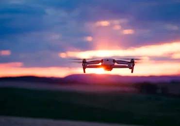
The Federal Aviation Administration (FAA) maintains a strict regulatory distinction between recreational drone use and commercial operations. For businesses in Southwest Florida, understanding this distinction is the difference between a successful project and a significant legal liability. If any part of a drone flight is intended to further a business: including marketing, site inspections, or progress monitoring: it falls under FAA Part 107 regulations.
Operating without a Licensed Drone Pilot is not just a safety concern; it is a regulatory violation that carries heavy financial penalties for both the pilot and the organization that hired them.
The Legal Requirement: Understanding FAA Part 107
Commercial drone operations in the United States are governed by the Part 107 Remote Pilot Certificate. This license ensures that the operator understands the complexities of the National Airspace System (NAS), weather patterns, and emergency procedures.
Why It Matters
- Federal Compliance: Any flight performed for "compensation or hire": or in the furtherance of a business: requires a Part 107 certificate.
- Airspace Authorization: Licensed pilots have the training to secure LAANC (Low Altitude Authorization and Notification Capability) approvals in controlled airspace, such as areas surrounding Southwest Florida International Airport (RSW).
- Knowledge of Restrictions: Certified pilots stay updated on Temporary Flight Restrictions (TFRs) and No Fly Zones that recreational users often overlook.
ROI Advantage: Hiring a certified professional eliminates the risk of federal intervention and project shutdowns.
The Financial Risks of Unlicensed Operations
Choosing a "DIY" approach or hiring an uncertified hobbyist creates a chain of liability. The FAA has the authority to issue significant civil penalties for unauthorized commercial flights. These fines can exceed $1,100 per violation for the pilot and significantly more for the business entity authorizing the flight.
Liability and Insurance Gaps
Most general liability insurance policies explicitly exclude "aircraft" operations. If an unlicensed pilot crashes into a structure or causes an injury, the business owner is often left personally liable for the damages. Professional Commercial Drone Services carry specialized aviation insurance that protects the client, the public, and the property.
Technical Superiority: Enterprise vs. Consumer Hardware
There is a vast gap between consumer-grade drones and enterprise platforms used by professionals. At Cape UAV, our primary platform is the Autel Robotics EVO Lite 6T Enterprise (EVO Lite 640T). This equipment is designed specifically for technical applications in construction and property management.
(Note: Autel Robotics is a trademark of its respective owner; Cape UAV is not affiliated with or endorsed by Autel Robotics.)
Key Technical Specifications
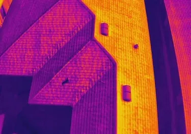
- 640×512 Thermal Sensor: High-resolution thermal data allows for the detection of anomalies not visible to the naked eye.
- 50MP Visual Camera: Delivers extreme detail for high-resolution orthomosaics and progress documentation.
- Stability and Range: Enterprise drones feature superior wind resistance: crucial for the gusty coastal conditions of Cape Coral and Fort Myers.
Why This Matters: High-resolution data prevents rework. When you can see the exact condition of a rooftop or a job site with 50MP clarity, decisions are based on data rather than assumptions.
Thermal Inspection: Beyond the Visible Spectrum
For property managers and industrial site owners, thermal imaging provides a proactive maintenance tool. However, interpreting thermal data requires more than just owning a drone; it requires an understanding of emissivity, reflection, and thermal physics.
Detecting Hidden Issues
- Moisture Intrusion: Identify water trapped beneath roof membranes before leaks manifest inside the building.
- Electrical Faults: Detect overheating components in HVAC systems or electrical grids.
- Energy Efficiency: Identify areas of significant heat loss to support energy efficiency improvements.
Important Disclaimer: Thermal results indicate anomalies and are not a substitute for evaluation by a licensed professional.
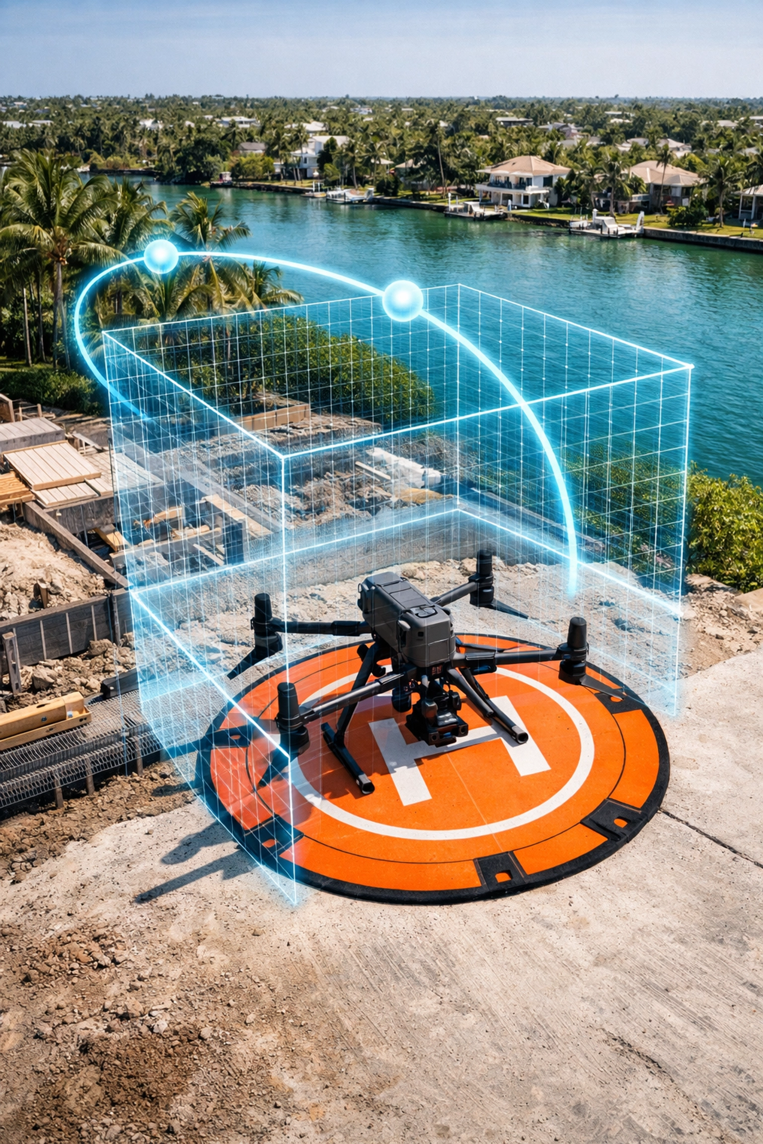
Safety and Mission Planning in Southwest Florida
Southwest Florida presents unique challenges for aerial operations, including rapid weather changes, high humidity, and complex airspace near coastal regions. A Licensed Drone Pilot follows a rigorous pre-flight workflow to mitigate these risks.
The Professional Workflow
- Site Assessment: Reviewing obstacles, power lines, and pedestrian traffic patterns.
- Airspace Clearance: Checking for local flight restrictions and obtaining necessary FAA authorizations.
- Weather Monitoring: Tracking wind speeds and precipitation levels to ensure flight stability.
- Hardware Calibration: Ensuring sensors and GPS systems are functioning for precise data capture.
High-Resolution Mapping for Land Development
In construction and land development, high-resolution orthomosaics serve as a foundation for planning and documentation. These maps provide a bird's-eye view of a project's lifecycle, allowing stakeholders to track progress without being physically present on-site.
Deliverables and Their Uses
- Orthomosaic Maps: Stitching hundreds of images together to create a single, high-resolution top-down view.
- 3D Modeling: Providing visual context for site topography and structure placement.
- Progress Documentation: Creating a historical record of construction phases for stakeholders and investors.
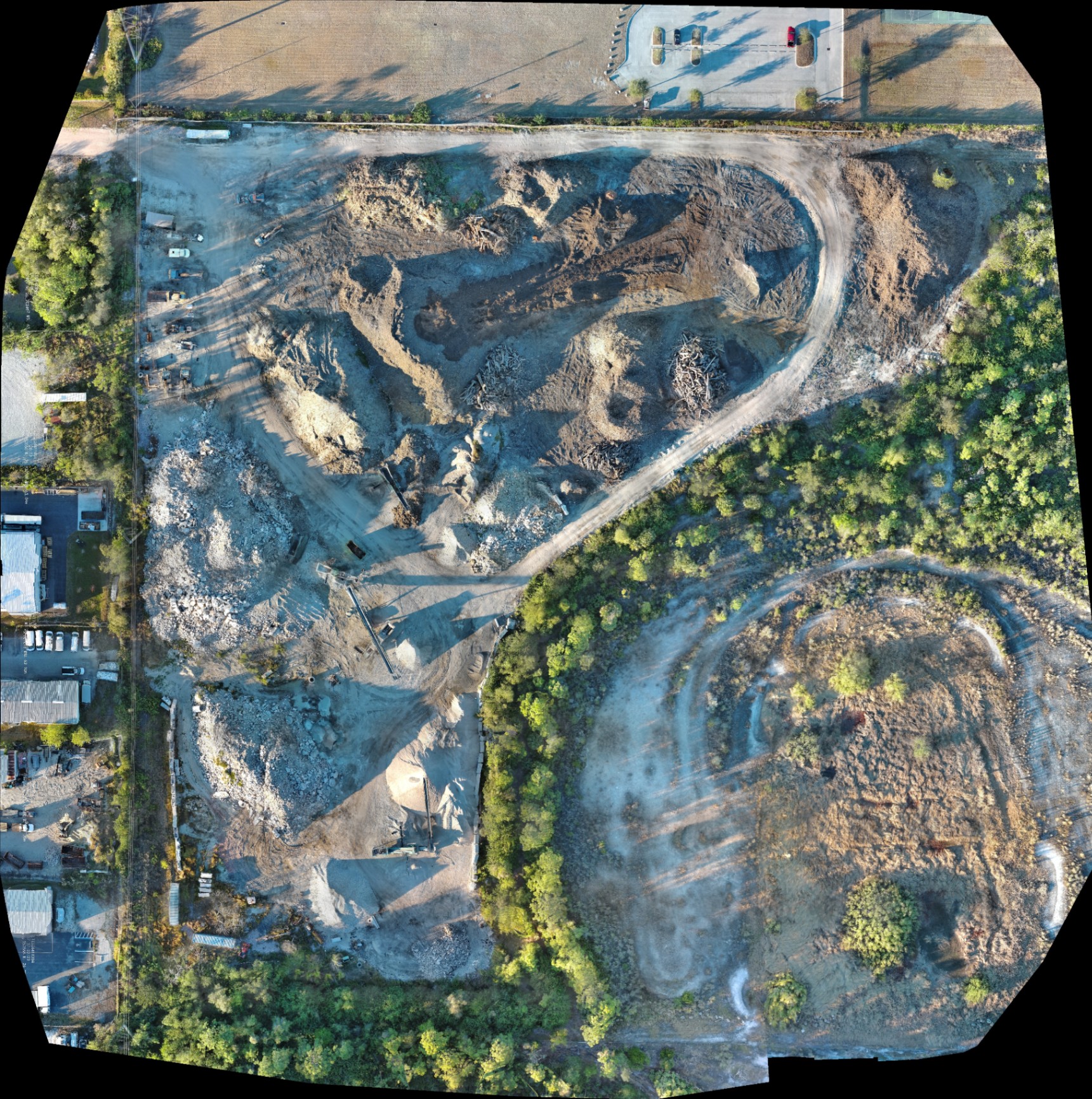
Why This Matters: Clear documentation reduces disputes and provides a reliable record for insurance and compliance purposes.
Important Disclaimer: Our data is for planning purposes and is not a substitute for a licensed land survey.
The Choice: DIY vs. Professional Commercial Drone Services
When evaluating whether to handle aerial visuals in-house or hire a professional, consider the following comparison:
| Feature | Unlicensed/Hobbyist | FAA Part 107 Professional (Cape UAV) |
|---|---|---|
| Legal Compliance | High risk of FAA fines | Fully compliant with federal law |
| Insurance | Likely zero coverage for commercial work | Specialized aviation liability insurance |
| Equipment | Consumer-grade (low res/no thermal) | Enterprise-grade (Autel EVO Lite 6T) |
| Airspace Access | Restricted/Illegal in many areas | Authorized via LAANC and FAA waivers |
| Data Quality | Subjective/Visual only | Data-focused (Thermal/Orthomosaic) |
Protecting Your Investment
In the B2B sector, the goal of aerial imaging is to save time and reduce costs. Hiring an unlicensed pilot achieves the opposite by introducing legal and financial risks that far outweigh any perceived savings on the service fee.
By choosing a professional provider like Cape UAV, you ensure that your project is documented with technical precision, backed by proper certification, and executed with a focus on safety.
ROI Summary
- Eliminate Liability: Shift the risk of aerial operations to a certified and insured provider.
- Enhance Accuracy: Utilize 50MP visual and 640T thermal sensors for superior site intelligence.
- Streamline Workflows: Integrate high-resolution data directly into your project management processes.
Important Disclaimer
Cape UAV provides high-resolution aerial data and thermal imaging for informational and documentation purposes only. We are not a licensed professional land surveying or engineering firm and do not provide those services. Thermal results indicate anomalies and are not a substitute for evaluation by a licensed professional. Our data is for planning purposes and is not a substitute for a licensed land survey.