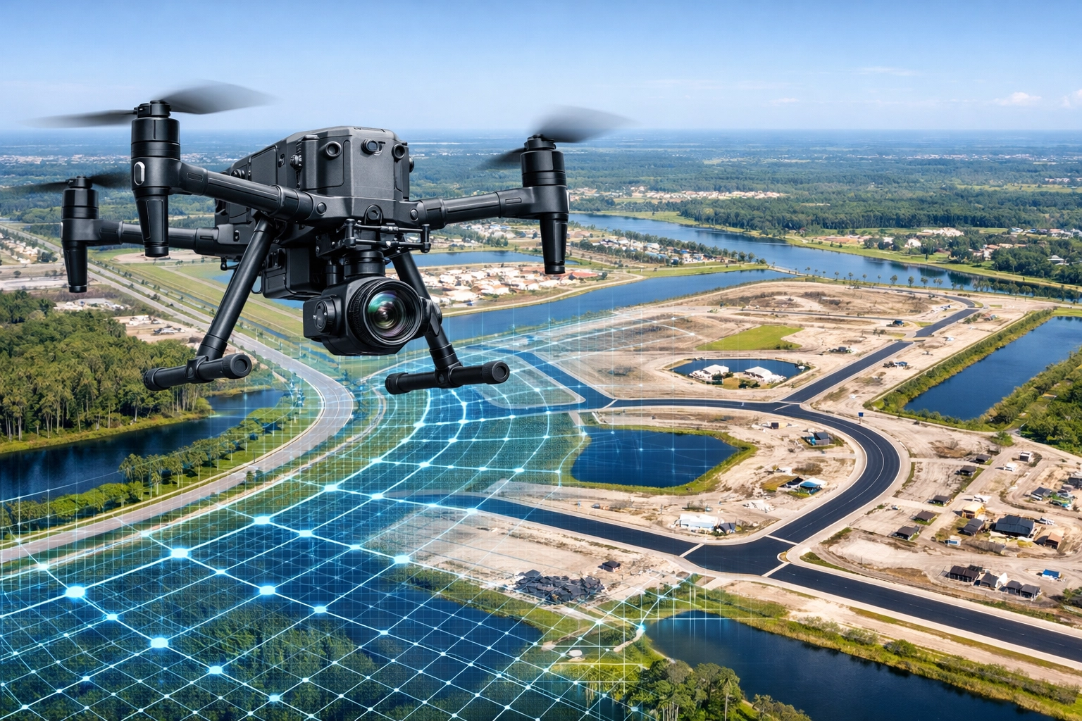
Construction projects in Southwest Florida are high-stakes environments where even a minor oversight can spiral into a six-figure delay. Whether you are managing a luxury residential build in Cape Coral or a massive industrial expansion, the way you monitor your site determines your bottom line.
Traditional site monitoring: relying on ground-level "boots on the ground" inspections and hand-held camera photos: is increasingly inadequate. It is slow, prone to human error, and provides a fragmented view of the project’s reality.
At Cape UAV, we see project managers making the same recurring mistakes that lead to rework, safety incidents, and budget overruns. Here are the seven most common mistakes in construction site monitoring and how precision drone mapping solves them.
1. Relying Solely on Ground-Level Perspectives
Most site managers walk the site with a smartphone or a digital camera. While this captures specific details, it fails to provide context. You see the wall being framed, but you miss how the entire site’s drainage is reacting to a recent Florida downpour.
Why This Matters:
Ground-level photos suffer from perspective distortion. They cannot be used to understand spatial relationships between different site elements accurately.
The Drone Fix:
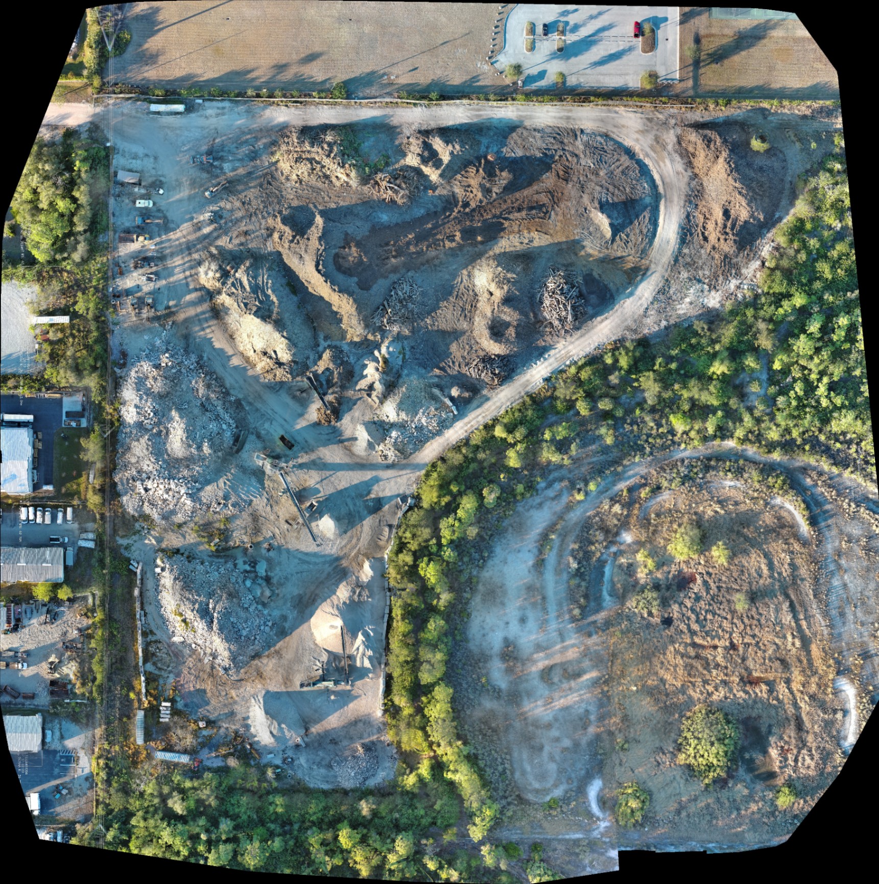
High-resolution aerial orthomosaics provide a top-down, "bird’s-eye" view of the entire project. Using enterprise-grade equipment like the Autel Robotics EVO Lite 6T Enterprise, we capture thousands of high-resolution images and stitch them into a single, georeferenced map. This gives you a comprehensive view of the site, allowing you to see how every piece of the puzzle fits together in real-time.
2. Inadequate Documentation of Existing Conditions
One of the costliest mistakes happens before the first shovel hits the dirt. Failing to document the baseline state of the site and adjacent properties leaves you vulnerable to litigation and insurance disputes later.
Why This Matters:
If a neighboring property owner claims your excavation caused a crack in their foundation, your lack of "before" documentation becomes an expensive legal liability.
The Drone Fix:
Before mobilization, Cape UAV performs a baseline mapping mission. We create a digital record of the street conditions, adjacent structures, and existing vegetation. This serves as an "insurance policy" for the duration of the build.
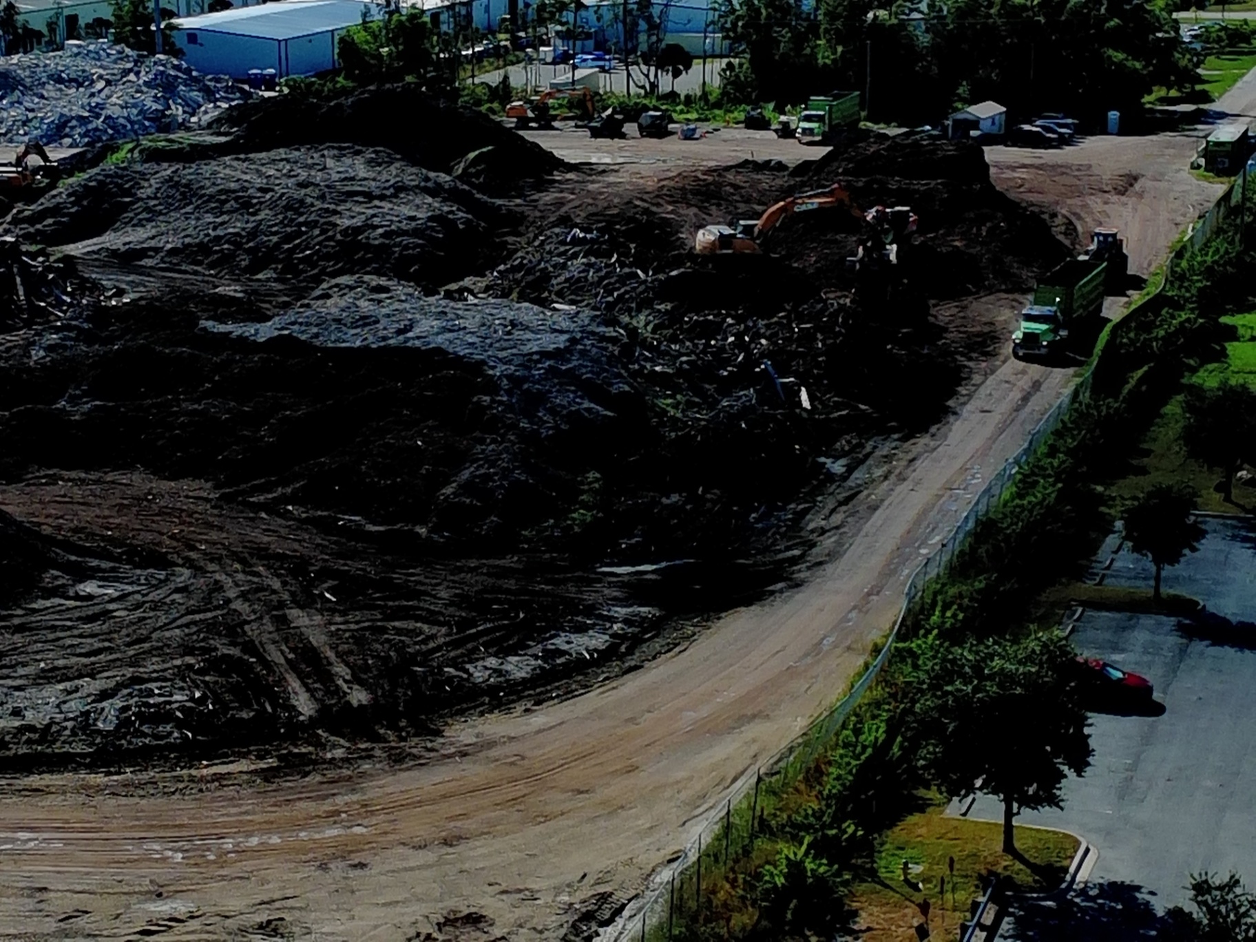
3. "Eyeballing" Stockpiles and Material Volumetrics
In land development, dirt is money. Relying on manual estimations for soil, gravel, or debris piles is notoriously inaccurate. If your estimates are off by even 10%, you are either paying for trucks you don’t need or stalling the project while waiting for more material.
Why This Matters:
Manual measurements are time-consuming and often involve crew members climbing over unstable piles, creating a significant safety risk.
The Drone Fix:
Using drone mapping, we generate 3D models and point clouds. While not a substitute for a licensed land survey, these models allow for rapid volumetric analysis. You can calculate the volume of a stockpile in minutes rather than hours, ensuring your inventory management stays lean and efficient.
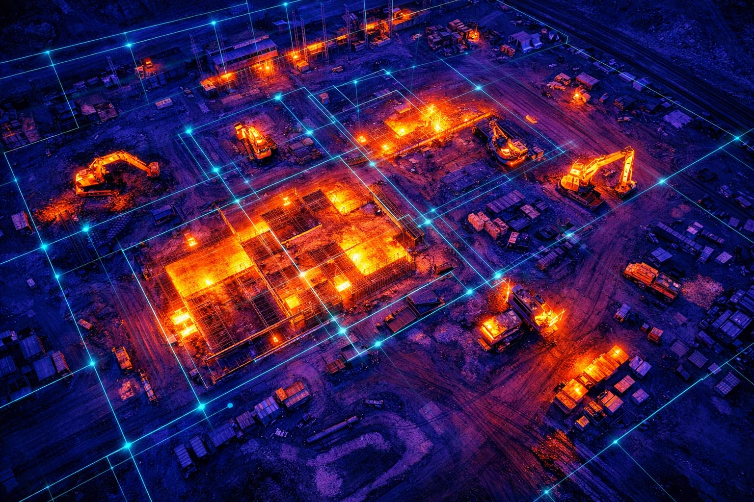
4. Ignoring Subsurface and Thermal Anomalies
Construction monitoring isn't just about what is visible to the naked eye. Problems like moisture intrusion, curing issues in concrete, or overheating electrical components often stay hidden until they cause a failure.
Why This Matters:
Identifying a leak after the drywall is up is ten times more expensive than finding it during the framing stage.
The Drone Fix:
This is where technical specs make the difference. We utilize the EVO Lite 640T equipped with a 640×512 thermal sensor and a 12um pixel pitch. This high-resolution thermal imaging allows us to detect temperature variations that signal moisture trapped under roofing membranes or electrical "hot spots" in temporary site power setups.
Note: Autel Robotics is a trademark of its respective owner; Cape UAV is not affiliated with or endorsed by Autel Robotics.
5. Infrequent Monitoring Cycles
Many projects only get a "progress check" once a month. In a fast-moving environment like Southwest Florida, a lot can go wrong in 30 days.
Why This Matters:
"Project drift" happens when small errors accumulate over weeks. By the time a monthly inspection catches a mistake: like a foundation being poured slightly out of alignment: the cost of fixing it is astronomical.
The Drone Fix:
Drone services allow for weekly or even daily site overflights. Because the drone follows an automated, repeatable flight path, we can produce "time-machine" comparisons. You can overlay Tuesday’s map over last Friday’s map to see exactly what has changed, identifying deviations immediately.
6. Communication Silos Between Stakeholders
On a typical site, the architect is in one city, the owner is in another, and the subcontractors are on the ground. Miscommunication leads to delays.
Why This Matters:
Describing a site issue over the phone is ineffective. Everyone has a different mental image of the problem, leading to "meeting fatigue" and slow decision-making.
The Drone Fix:
Digital twins and 3D models act as a single source of truth. By sharing a web-based link to a high-resolution orthomosaic, all stakeholders can view the same data. This streamlines coordination and ensures everyone is working from the same current site reality.
7. Exposing Staff to Unnecessary Safety Risks
Sending a foreman to walk the edge of an excavation pit or climb a roof for an inspection is a liability you don't need.
Why This Matters:
Falls are the leading cause of death in construction. Reducing the number of times personnel have to enter "high-risk zones" directly lowers your EMR (Experience Modification Rate) and insurance premiums.
The Drone Fix:
Drones move the inspector from the hazard to the ground. Our FAA Part 107-certified pilots can capture high-resolution imagery of high-reach areas or hazardous terrain without a single person leaving the safety of the ground.
Traditional Monitoring vs. Drone-Integrated Mapping
| Feature | Traditional Methods | Cape UAV Drone Mapping |
|---|---|---|
| Perspective | Limited ground-level views | Complete 2D & 3D site overviews |
| Data Density | Sparse (few hundred photos) | Millions of data points |
| Safety Risk | High (personnel in active zones) | Low (remote operation) |
| Turnaround | Days to compile reports | Same-day or Next-day data |
| Thermal Insights | Manual/Handheld (limited) | High-res 640×512 Aerial Thermal |
| Documentation | Subjective/Inconsistent | Consistent, Repeatable, Georeferenced |
The ROI Advantage: Why Technical Specs Matter
When choosing a partner for site monitoring, the hardware is just as important as the pilot. At Cape UAV, we prioritize the Autel Robotics EVO Lite 6T Enterprise for its dual-sensor capabilities.
- 50MP Visual Camera: Provides the clarity needed to zoom in on structural bolts or serial numbers from 200 feet up.
- 640×512 Thermal Sensor: The industry standard for detecting heat loss and moisture. A lower resolution sensor (like 160×120) simply doesn't have the "grain" to identify small anomalies before they become big problems.
- 12um Pixel Pitch: This ensures higher sensitivity and better image quality in the challenging lighting conditions of Florida’s early mornings or late afternoons.
By investing in precision mapping, construction firms typically see an ROI within the first three months through the elimination of rework alone. When you consider the added value of safety compliance and stakeholder transparency, drone mapping isn't just a "nice-to-have": it's a competitive necessity.
Moving Toward Proactive Management
The shift from reactive to proactive site management requires data. High-resolution aerial photography for real estate and industrial sites provides the clarity you need to make decisions with confidence.
If you’re still relying on a guy with a clipboard and a smartphone, you’re leaving your project’s success to chance. It's time to fix the mistakes of the past with the technology of the future.
Important Disclaimer
Mapping Disclaimer: Our data is for planning purposes and is not a substitute for a licensed land survey.
Thermal Disclaimer: Thermal results indicate anomalies and are not a substitute for evaluation by a licensed professional.
Important Disclaimer
The information provided by Cape UAV, including all mapping, 3D models, and thermal inspections, is intended for documentation and planning purposes only. Cape UAV does not provide licensed land surveying services. Thermal imaging identifies temperature anomalies which should be further investigated by a licensed contractor or engineer. Equipment used includes models such as the Autel Robotics EVO Lite 6T Enterprise; results are subject to environmental conditions and "up to" specifications provided by the manufacturer.