Drone mapping is the process of using unmanned aerial vehicles (UAVs) to capture high-resolution aerial data that is then processed into detailed 2D maps and 3D models. In the world of land development and construction, this technology has moved from a "nice-to-have" novelty to a mission-critical tool for site visualization, progress tracking, and stakeholder communication.
At Cape UAV, we utilize enterprise-grade platforms: specifically the Autel Robotics EVO Lite 6T Enterprise: to provide developers and project managers in Southwest Florida with clear, actionable insights. By leveraging a 50MP visual camera and a 640×512 thermal sensor with a 12um pixel pitch, we deliver clarity that traditional ground-based methods simply cannot match.
Understanding the Core Deliverables
When a drone flies a mapping mission, it isn't just taking a single photo. It is capturing hundreds, sometimes thousands, of overlapping images. These images are processed using photogrammetry software to create several distinct types of deliverables.
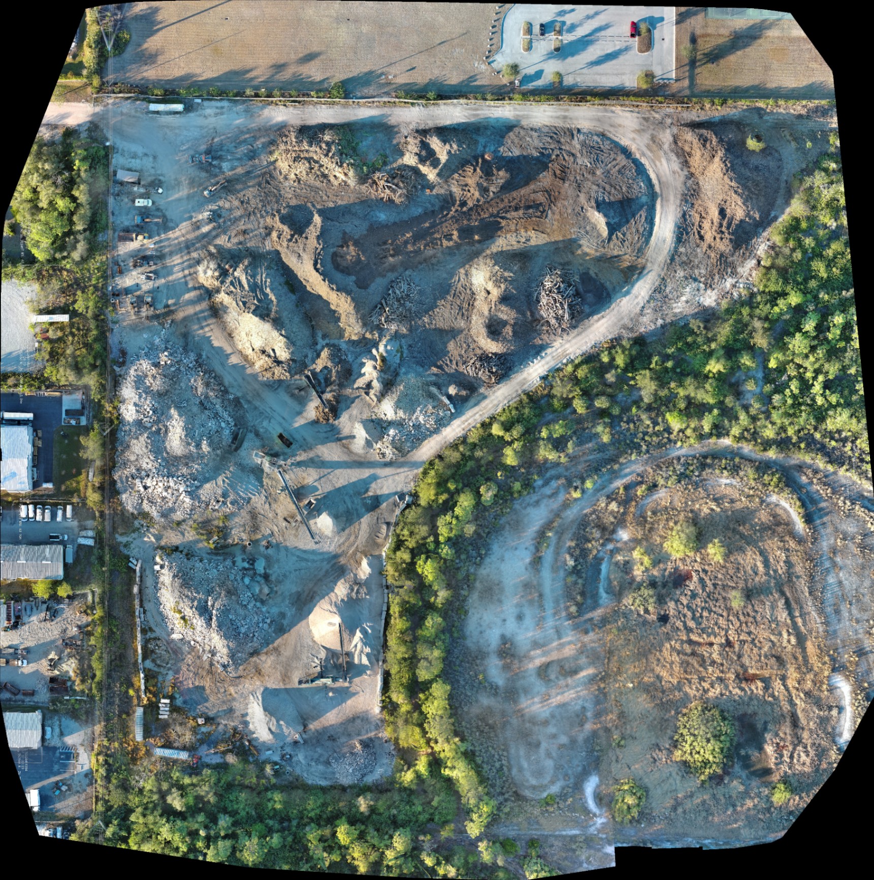
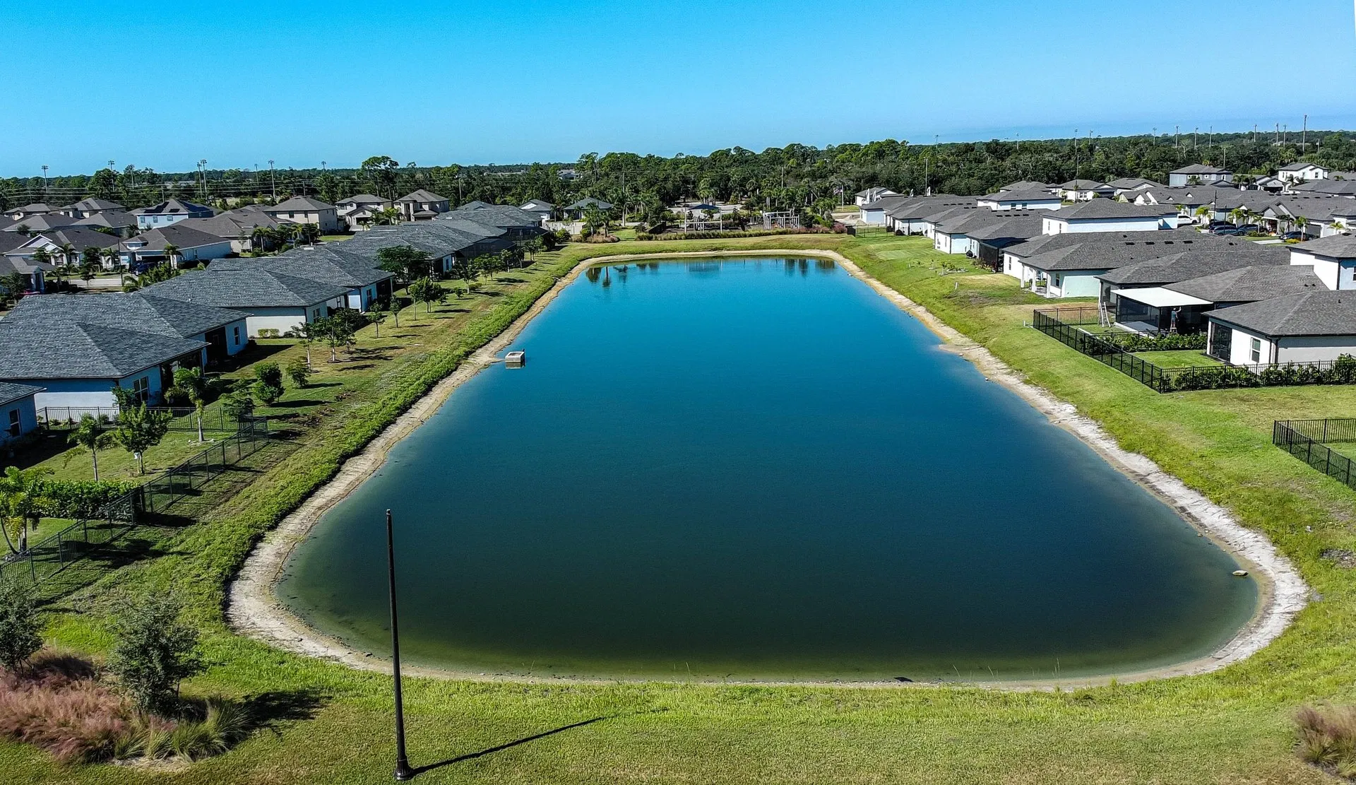
High-Resolution Orthomosaics
An orthomosaic is a geometrically corrected aerial photograph composed of many individual images stitched together. Unlike a standard aerial photo, an orthomosaic is uniform in scale. This means it can be used for planning and documentation across the entire project site without the perspective distortion found in single high-altitude shots.
Why This Matters:
- Site Layouts: Overlaying CAD drawings onto a current orthomosaic helps identify discrepancies between the plan and the actual ground state.
- Documentation: It provides a definitive "point-in-time" record of the site for insurance, legal, or compliance purposes.
3D Point Clouds and Textured Models
By analyzing the parallax between overlapping images, software can generate a 3D point cloud: a set of data points in space representing the external surface of an object or terrain. This is then "draped" with the visual imagery to create a photorealistic 3D model.
Why This Matters:
- Stakeholder Buy-In: 3D models allow investors and clients to "walk" through a site virtually.
- Topographic Awareness: It reveals the undulations and slopes of the land, which is critical for drainage planning and grading.
Digital Surface Models (DSM) and Terrain Models (DTM)
These maps represent elevation data. A DSM includes everything on the surface (buildings, trees, equipment), while a DTM filters out those objects to show only the bare earth.
The Technical Specs: Why Sensor Quality Dictates Results
In the drone industry, the sensor is the most important component. At Cape UAV, we emphasize technical specifications because they directly impact the quality of the planning data we provide to our B2B clients in Cape Coral and Fort Myers.
50MP Visual Precision
The 50MP visual camera on our primary platform allows for an incredibly low Ground Sampling Distance (GSD). GSD is the distance between two consecutive pixel centers measured on the ground. A lower GSD means more detail. This allows us to capture fine details: like the condition of a silt fence or the placement of utility markers: from a safe and efficient flight altitude.
640×512 Thermal Integration
For land development, thermal imaging isn't just for roofs. Using a sensor with a 12um pixel pitch allows us to detect subtle temperature variations on the ground. This can be used to identify subsurface moisture, buried infrastructure, or potential drainage issues before they become expensive problems during excavation.
ROI Advantage: Identifying a hidden drainage issue before heavy machinery moves in can save thousands in rework and schedule delays.
The Drone Mapping Workflow
Successful drone mapping follows a rigid, technical workflow to ensure the data is reliable for planning purposes.
1. Mission Planning
Before the drone ever leaves the ground, we program a precise flight path. This is typically a "lawnmower" pattern that ensures a 70% front overlap and 60% side overlap between images. This overlap is what allows the photogrammetry software to calculate depth and perspective.
2. Ground Control Implementation
To align the aerial data with real-world coordinates, we use Ground Control Points (GCPs). These are physical targets placed on the ground that have been marked with high-precision coordinates.
3. Data Capture
Operated by FAA Part 107 certified pilots, the drone executes the flight autonomously. During this phase, the pilot-in-command monitors for airspace safety, weather changes, and hardware performance.
4. Processing and Analysis
The raw data is uploaded to high-performance servers where millions of pixels are aligned. The result is a suite of digital assets ready for integration into your project management or GIS software.
Applications in Land Development
From initial site acquisition to the final walkthrough, drone mapping provides value at every stage of the land development lifecycle.
Pre-Construction Assessments
Before the first shovel hits the ground, a high-resolution map provides a clear view of the existing terrain, vegetation, and water boundaries. This is essential for environmental monitoring and site planning in the unique wetlands and coastal regions of Southwest Florida.
Site Progress Monitoring
Regular mapping flights (weekly or monthly) create a time-series record of the project. This allows project managers to verify that work is being completed according to the schedule and documented against the original plans.
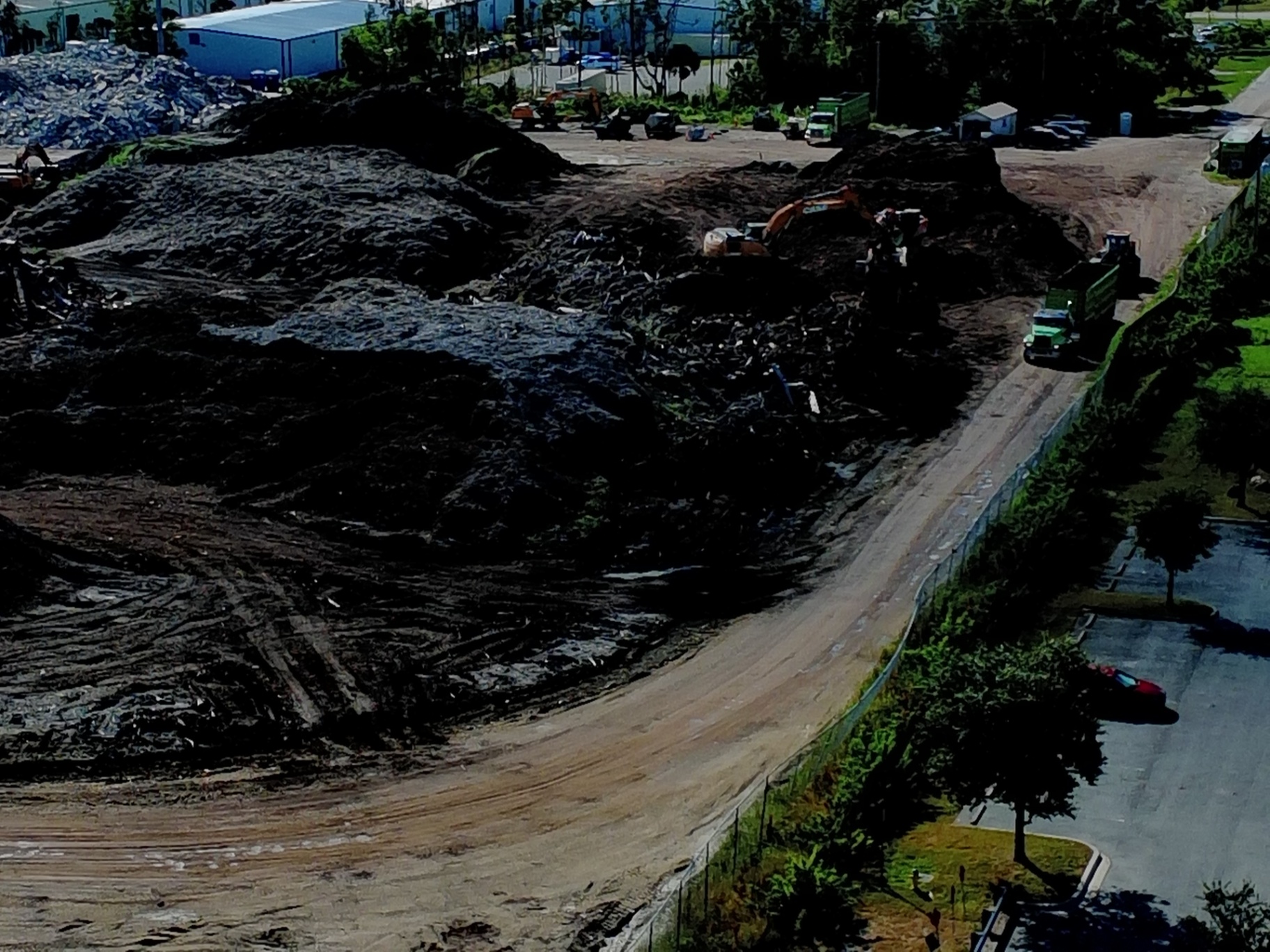
Inventory and Stockpile Management
Drone mapping allows for the visualization of material stockpiles: sand, gravel, and debris. By generating a 3D model of a stockpile, developers can quickly estimate the volume of material on-site, aiding in logistics and inventory management.
ROI Advantage: Reducing the time spent manually estimating material volumes translates directly to lower labor costs and better material ordering accuracy.
Thermal Inspection for Construction Sites
While visual mapping is the standard, adding a thermal layer provides a new dimension of site oversight. Thermal drone images can highlight heat distribution across a site, identifying anomalies in newly poured concrete or detecting moisture trapped under waterproof membranes.
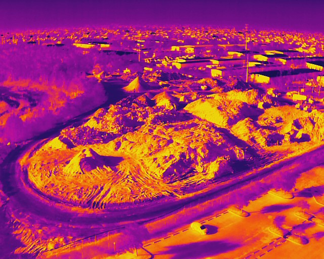
Using our enterprise equipment, such as the Autel Robotics EVO Lite 640T, we can perform these inspections without the need for ladders or manual site walks, significantly reducing safety risks for site personnel.
The ROI of Drone Visualization
The primary goal of adopting drone mapping is to increase efficiency while reducing risk. For land development projects in Southwest Florida, the ROI manifests in three key areas:
- Time Savings: A drone can map a 50-acre site in a fraction of the time it would take a ground crew to walk it.
- Communication: Providing a visual "truth" of the site reduces disputes between contractors and developers.
- Accuracy in Planning: High-resolution orthomosaics ensure that planning decisions are based on the current state of the land, not an outdated satellite image.
Whether you are managing a luxury real estate development or an industrial excavation project, the ability to visualize your land in high resolution is an investment that pays for itself through avoided errors and streamlined workflows.
Important Disclaimer
Our data is for planning purposes and is not a substitute for a licensed land survey. Thermal results indicate anomalies and are not a substitute for evaluation by a licensed professional.
Partner with Cape UAV
At Cape UAV, we specialize in technical, data-focused aerial services designed for the B2B sector. We understand the complexities of construction and land development in Southwest Florida. Our team is fully FAA Part 107 certified, and we utilize the latest enterprise technology to deliver the precision your project requires.
Ready to see your project from a new perspective? Explore our drone mapping services or contact us today for a consultation on how we can support your next land development project.
Important Disclaimer:
Our data is for planning purposes and is not a substitute for a licensed land survey. Thermal results indicate anomalies and are not a substitute for evaluation by a licensed professional. Autel Robotics is a trademark of its respective owner; Cape UAV is not affiliated with or endorsed by Autel Robotics. Performance results depend on environmental conditions.