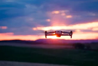
Commercial drone operations in the United States are governed by the Federal Aviation Administration (FAA) under Title 14 of the Code of Federal Regulations (CFR) Part 107. For businesses in Southwest Florida: ranging from luxury real estate developers in Cape Coral to industrial facility managers: hiring a drone partner isn't just about finding someone with a high-end camera. It is about ensuring your service provider operates within a strict legal framework that protects your company from liability and ensures the safety of the National Airspace System (NAS).
At Cape UAV, we prioritize technical precision and legal adherence. Whether we are deploying the Autel Robotics EVO Lite 6T Enterprise for a thermal roof inspection or generating high-resolution orthomosaics for a 100-acre land development project, Part 107 compliance is the foundation of every mission.
1. The Remote Pilot Certificate
Every individual operating a drone for commercial purposes must hold a Remote Pilot Certificate with a small UAS (Unmanned Aircraft System) rating. This is not a "hobbyist" permit; it requires passing an FAA Aeronautical Knowledge Test covering airspace classifications, weather, loading, and emergency procedures.
Why This Matters
Hiring an uncertified pilot exposes your business to significant FAA fines and nullifies most commercial insurance policies. A certified pilot demonstrates a professional understanding of aviation law and safety protocols.
ROI Advantage
- Liability Protection: Eliminates the risk of legal action stemming from unauthorized commercial operations.
- Professionalism: Ensures the pilot can communicate effectively with Air Traffic Control (ATC) when working near regional airports like RSW.
2. Mandatory Drone Registration
Under Part 107, every drone used for commercial work must be registered via the FAADroneZone. Each aircraft is assigned a unique N-Number (tail number) that must be physically displayed on the exterior of the drone.
Technical Spec: The Fleet
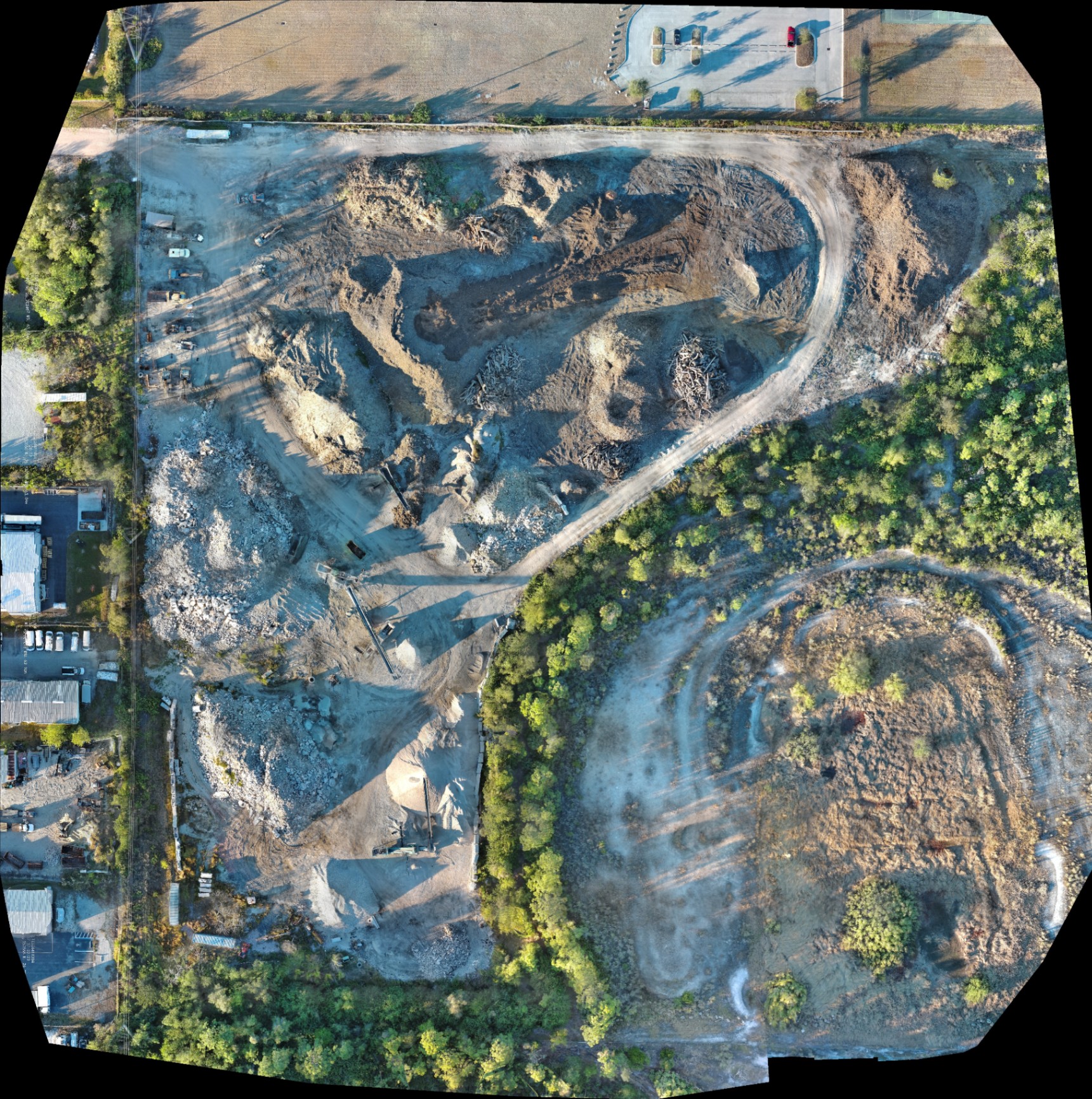
Our primary platform, the Autel Robotics EVO Lite 6T Enterprise, is fully registered and compliant. This enterprise-grade UAS is equipped with a 640×512 thermal sensor and a 50MP visual camera, allowing us to deliver high-fidelity data while remaining within federal identification standards.
3. Strict Weight Limitations
Part 107 applies to drones weighing less than 55 pounds at takeoff, including payload (cameras, sensors, and batteries). If a drone exceeds this weight, it requires a Section 44807 exemption, which is a much more complex legal hurdle.
Why This Matters
In industrial and construction settings, adding heavy LiDAR or specialized thermal sensors can quickly increase a drone's weight. Using streamlined enterprise equipment like the EVO Lite 640T ensures we remain under the 55 lb threshold while still delivering 12um pixel pitch thermal accuracy.
4. Visual Line of Sight (VLOS) Requirements
The FAA requires the Remote Pilot in Command (RPIC) to maintain Visual Line of Sight with the drone at all times. While a Visual Observer (VO) can assist, the pilot must be able to see the aircraft to avoid other traffic and obstacles without the use of binoculars or on-board cameras alone.
The ROI of Safety
- Collision Avoidance: Maintains the safety of workers on active construction sites.
- Regulatory Adherence: Prevents "fly-aways" or accidents in densely populated residential areas.
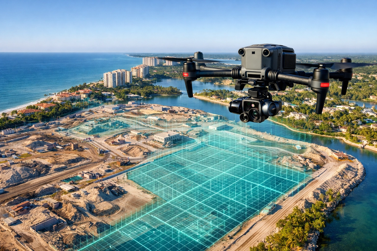
5. Airspace Authorizations and LAANC
Not all sky is "open." Southwest Florida features complex controlled airspace (Class B, C, D, and E). Operating within these areas requires prior authorization. Professional partners use LAANC (Low Altitude Authorization and Notification Capability) to receive near-instant approval for flights in controlled zones.
| Airspace Class | Requirement | Common Locations |
|---|---|---|
| Class G | No authorization needed | Rural land development sites |
| Class B/C/D | LAANC or FAA Authorization | Near airports and city centers |
| Prohibited | Flight strictly forbidden | Government facilities |
Why This Matters
If your project is near a municipal airport, an amateur pilot might fly illegally. A professional partner like Cape UAV secures the necessary digital "green light" before the props even spin.
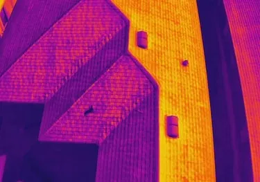
6. Operations at Night and Twilight
Recent updates to Part 107 allow for night operations provided the pilot has completed the necessary FAA training and the drone is equipped with anti-collision lighting visible for at least three statute miles.
Thermal Inspection Precision
Night and civil twilight are often the best times for thermal imaging. Using our 640×512 thermal sensor, we can detect heat signatures: such as moisture trapped under a commercial roof: more effectively when the "solar loading" from the sun has dissipated.
7. Operating Over People and Moving Vehicles
The FAA has specific categories (Category 1-4) for flying over people. Generally, commercial drones cannot hover directly over anyone not involved in the operation unless the drone meets specific weight and safety-shroud requirements.
Why This Matters
For luxury real estate photography, we must carefully plan flight paths to avoid flying over neighbors or pedestrians. This ensures privacy and safety while capturing the high-resolution visuals needed for premium listings.
8. Remote ID Compliance
As of 2024, almost all drones operating in the U.S. must broadcast Remote ID information: a "digital license plate" that shares the drone's position and the pilot's base station location.
Technical Expert Note
Our enterprise fleet is fully Remote ID compliant. This transparency is vital when working on industrial sites or near public infrastructure, as it allows authorities to verify that the flight is authorized and professional.
9. Incident Reporting and Maintenance Logs
Part 107 pilots are required to report any accident to the FAA within 10 days if it results in serious injury, loss of consciousness, or property damage exceeding $500. Furthermore, pilots must maintain maintenance logs to ensure the aircraft is in a safe condition for flight.
Why This Matters
Professional maintenance prevents equipment failure. When we are conducting precision drone mapping, our clients need to know that our gear is calibrated and flight-ready.
10. The Necessity of Part 107 Waivers
Standard Part 107 rules have limits (e.g., 400ft altitude ceiling). If a project requires going higher: perhaps to inspect a tall communication tower: the pilot must apply for and receive an FAA waiver.
Why This Matters
If a drone provider tells you they can "just go higher" without a waiver, they are breaking federal law. A professional partner understands the waiver process and builds that lead time into the project schedule.
ROI Advantage: Why Compliance Saves You Money
Hiring a compliant, technical expert isn't just a "check-the-box" exercise. It delivers tangible business outcomes:
- Reduced Downtime: Professional pilots handle the paperwork, meaning your project isn't delayed by legal "cease and desist" orders.
- Superior Data: Part 107-certified pilots often use enterprise equipment, like the Autel EVO Lite 640T, providing 50MP visuals and 12um thermal precision that hobbyist drones simply cannot match.
- Risk Mitigation: Professional insurance only pays out if the pilot was operating legally. If an uncertified pilot crashes into a luxury home or an industrial transformer, you could be on the hook for the costs.
Choosing Your Partner in Southwest Florida
At Cape UAV, we combine the technical specs of the Autel Robotics EVO Lite 6T Enterprise with a deep commitment to Part 107 standards. Whether you need an orthomosaic for land development or a thermal scan for a facility maintenance plan, our team provides the clarity and control required for modern commercial projects.
Important Disclaimer
Mapping: Our data is for planning purposes and is not a substitute for a licensed land survey.
Thermal: Thermal results indicate anomalies and are not a substitute for evaluation by a licensed professional.
Important Disclaimer
Our data is for planning purposes and is not a substitute for a licensed land survey. Thermal results indicate anomalies and are not a substitute for evaluation by a licensed professional. Autel Robotics is a trademark of its respective owner; Cape UAV is not affiliated with or endorsed by Autel Robotics.