For developers and construction firms in Cape Coral and across Southwest Florida, the traditional methods of land assessment are rapidly evolving. The days of waiting weeks for site data are being replaced by high-precision digital workflows. 3D drone modeling: a process technically known as photogrammetry: transforms hundreds of high-resolution aerial images into a detailed, three-dimensional representation of a site.
At Cape UAV, we provide these high-resolution drone mapping services to help teams make informed decisions during the planning and development phases. If you are looking to integrate this technology into your workflow, here are 10 critical things you should know about 3D drone modeling and how it impacts your bottom line.
1. Accuracy is Driven by RTK and PPK Technology
Traditional drones rely on standard GPS, which can have a margin of error of several meters. For professional land development, this isn't enough. Precision mapping requires RTK (Real-Time Kinematic) or PPK (Post-Processed Kinematic) technology.
These systems use a base station or a network of satellites to correct GPS data in real-time, bringing horizontal accuracy down to the centimeter level. When combined with ground control points (GCPs), these models provide a highly reliable digital twin of the landscape.
Why It Matters:
- Eliminates guesswork in site planning.
- Provides consistent data across large-scale projects.
- Ensures that digital models align with real-world coordinates.
2. Sensor Quality Dictates Data Integrity
Not all drone cameras are created equal. The density and clarity of a 3D model depend entirely on the sensor capturing the raw imagery. At Cape UAV, our primary platform for these missions is the Autel Robotics EVO Lite 6T Enterprise (EVO Lite 640T).
This enterprise-grade drone features a 50MP visual camera, allowing us to capture incredible detail from a safe flight altitude. A higher megapixel count means we can achieve a smaller Ground Sample Distance (GSD): the actual distance on the ground represented by a single pixel in an image.
ROI Advantage:
High-resolution sensors capture finer details of the terrain, reducing the likelihood of missing small but critical features like utility markers or subtle elevation changes.
3. Understanding Ground Sample Distance (GSD)
GSD is the most important metric in drone mapping. It defines the "resolution" of your 3D model. If a drone has a GSD of 1 cm/pixel, it means each pixel in the final map represents one square centimeter on the ground.
A lower GSD provides more detail but requires flying at lower altitudes or using higher-resolution sensors. For construction sites in Southwest Florida, a low GSD is essential for identifying drainage patterns or minor site obstructions.
Technical Spec Highlight:
Our use of the 50MP visual sensor on the EVO Lite 6T Enterprise allows us to maintain a tight GSD even when flying at altitudes that maximize site coverage.
4. Overlap and Flight Geometry are Critical
Creating a 3D model isn't as simple as taking a few photos. To stitch images together into a point cloud or a 3D mesh, the software needs "overlap." Typically, we fly missions with at least 70–80% front and side overlap.
This ensures that every point on the ground is captured from multiple angles. This redundancy allows the software to calculate depth and elevation accurately, creating a seamless 3D reconstruction rather than a flat, distorted image.
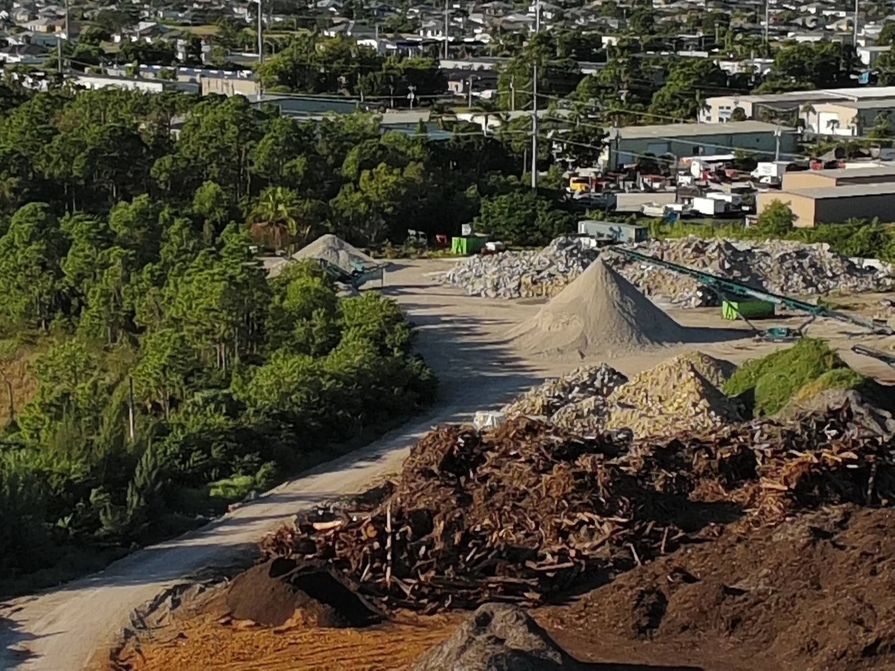
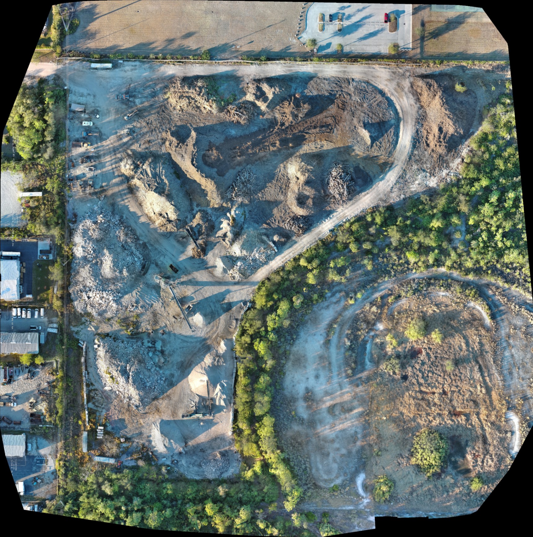
5. Volumetric Analysis for Better Inventory Management
One of the biggest advantages for construction and industrial sites is volumetric analysis. Because 3D drone models capture elevation data (Z-axis), we can calculate the volume of stockpiles: such as fill dirt, gravel, or debris: with high precision.
Instead of manual measurements or estimations, a drone flight can provide volume data for an entire site in a fraction of the time. You can learn more about how we apply this to industrial sites at our Cape Coral Industrial page.
Why This Matters:
- Accurate inventory tracking for materials.
- Better budgeting for hauling and excavation.
- Reduces the need for personnel to climb on unstable stockpiles.
6. Multiple Deliverables from a Single Flight
A common misconception is that you only get a "3D picture." In reality, a single automated drone mission produces a suite of deliverables that integrate directly into your existing software (like AutoCAD or ArcGIS):
- Orthomosaic Maps: A high-resolution, top-down map that is geometrically corrected.
- Digital Elevation Models (DEM): A representation of the bare ground surface.
- Point Clouds: A collection of millions of individual data points in 3D space.
- 3D Textured Meshes: A realistic visual model for presentations and stakeholder meetings.
If you're unsure which one you need, check out our guide on Orthomosaic vs. 3D Model vs. 2D Map.
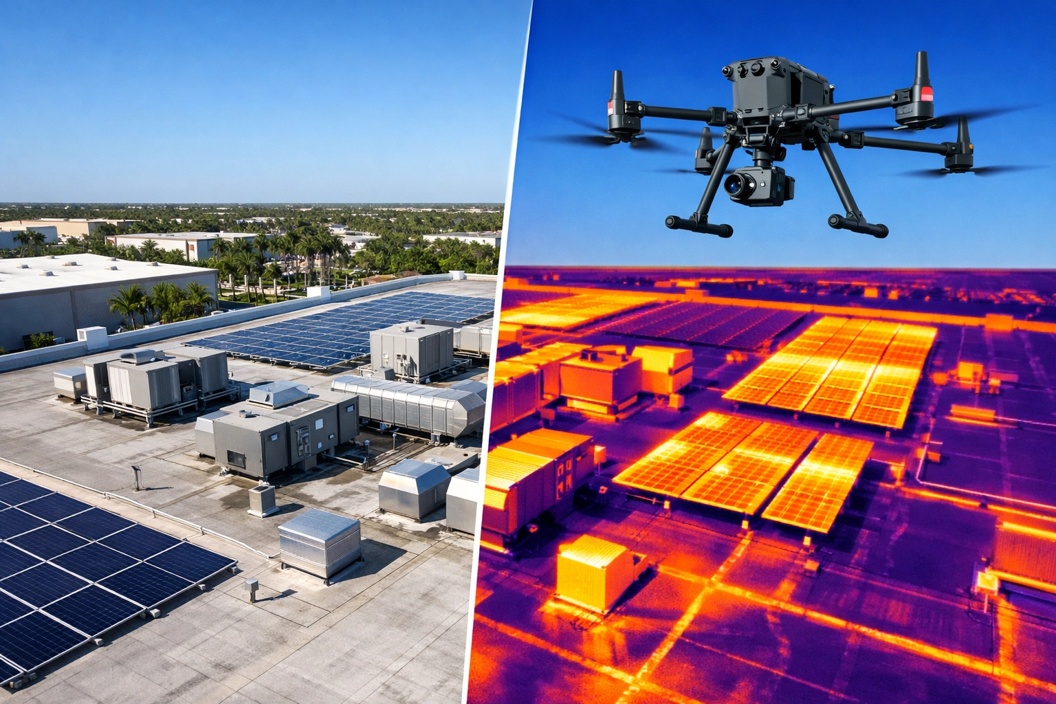
7. Integrating Thermal Data for Site Inspections
In land development and facility maintenance, visual data is only half the story. The EVO Lite 6T Enterprise is equipped with a 640×512 thermal sensor featuring a 12um pixel pitch. This allows us to overlay thermal data onto our 3D models.
This is particularly useful for identifying subsurface moisture, irrigation leaks, or heat anomalies in industrial equipment. For property managers, this dual-data approach provides a comprehensive view of asset health. For more on this, visit our thermal imaging services.
ROI Advantage:
Detecting a subsurface leak during the land development phase can prevent costly foundation issues or landscape erosion before the project is completed.
8. Speed and Efficiency at Scale
Traditional land assessment can take days or even weeks to complete, especially on large, rugged tracts of land in Florida. A drone can cover 100 acres in about an hour.
This speed doesn't just save time; it provides a "snapshot in time" for the entire site. On active construction projects, these flights can be repeated weekly to provide a detailed history of progress, allowing project managers to spot delays or deviations from the site plan early.
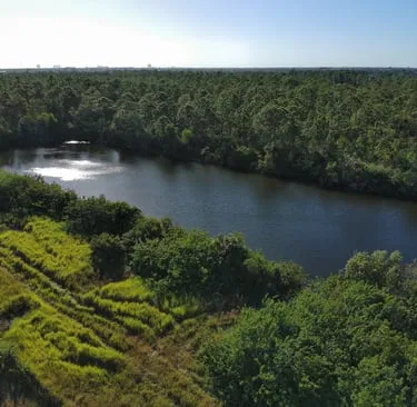
9. Environmental and Wetland Mapping
In Southwest Florida, navigating wetlands and dense vegetation is a constant challenge for development. Drones provide a non-invasive way to map these areas without sending crews into potentially hazardous or difficult terrain.
High-resolution imagery helps identify land-water boundaries and vegetation patterns, which is essential for environmental assessments and permitting. You can view examples of our drone mapping for land development here.
10. Data for Planning, Not Legal Boundary Determination
It is vital to understand the role of drone data in the legal landscape. While 3D drone modeling is incredibly precise and provides invaluable data for engineering, site planning, and volume calculations, it is not a replacement for a licensed land survey when it comes to legal boundaries.
We work alongside project managers and engineers to provide the high-density data they need for daily operations and planning, which complements the work of traditional surveyors.
The ROI of 3D Drone Modeling
The financial case for 3D drone modeling is clear. By reducing the time spent on-site and providing more frequent, higher-density data, firms can:
- Reduce Rework: Catching a grading error early through a 3D model saves thousands in corrective excavation.
- Improve Safety: Eliminating the need for staff to walk active sites or climb stockpiles reduces insurance risks.
- Enhance Communication: Providing stakeholders with a 3D visual of progress builds trust and accelerates approvals.
For professional drone services in Cape Coral and the surrounding areas, working with an FAA Part 107-certified pilot is non-negotiable for safety and compliance. Cape UAV is committed to delivering the technical precision required for the most demanding construction and industrial applications.
Important Disclaimer:
Our data is for planning purposes and is not a substitute for a licensed land survey. Thermal results indicate anomalies and are not a substitute for evaluation by a licensed professional.
Autel Robotics is a trademark of its respective owner; Cape UAV is not affiliated with or endorsed by Autel Robotics. Results depend on environmental conditions and flight parameters.
For more information on how we can support your next project, visit our Contact Page or explore our full range of drone services.
Important Disclaimer
Our data is for planning purposes and is not a substitute for a licensed land survey. Thermal results indicate anomalies and are not a substitute for evaluation by a licensed professional.