
Precision drone mapping is fundamentally transforming construction progress tracking by delivering centimeter-level precision, real-time visibility, and complete site documentation in a fraction of traditional timelines. What once required weeks of manual effort now takes hours: enabling project teams to make faster, more informed decisions. At Cape UAV, we utilize high-resolution aerial imaging and advanced thermal sensors to provide Southwest Florida developers with a data-driven view of their assets.
In the fast-paced world of land development and commercial construction, information lag is the primary driver of budget overruns. When site data is outdated or incomplete, errors go unnoticed and rework becomes inevitable. Precision mapping eliminates this information gap by providing a digital twin of the job site that is updated as often as needed.
The Shift from Photography to Data-Driven Mapping
Traditional aerial photography provides a visual record, but precision drone mapping provides a measurable data set. By using photogrammetry: the process of stitching hundreds or thousands of high-resolution images together: we create orthomosaic maps where every pixel contains geographic data.
Why This Matters:
- Visual Context: See the entire site in a single, high-resolution image rather than piecing together individual shots.
- Measurable Data: While not a substitute for a licensed land survey, these maps allow for rapid planning, distance checking, and area calculations.
- Time-Lapse Capability: Overlaying maps from different dates reveals exactly how much progress has been made week-over-week.
Enterprise-Grade Hardware: The Technical Edge
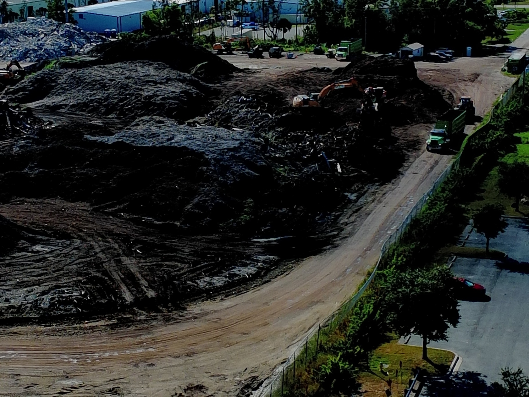
At Cape UAV, our primary platform for construction and industrial missions is the Autel Robotics EVO Lite 6T Enterprise (EVO Lite 640T). This is not a consumer-grade hobby drone; it is a specialized tool designed for precision and reliability in demanding environments.
The EVO Lite 6T Enterprise features a dual-camera system that is critical for comprehensive site tracking. The visual camera boasts a 50MP sensor, capturing extreme detail even from high altitudes. This allows for the creation of crisp, high-resolution orthomosaics where even small site features: like utility markings or specific hardware: remain visible upon zooming.
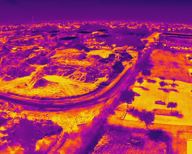
Complementing the visual sensor is a 640×512 thermal sensor with a 12um pixel pitch. This high-resolution thermal capability allows us to detect anomalies that are invisible to the naked eye, such as moisture intrusion in roofing or underground thermal leaks.
ROI Advantage:
Using enterprise-grade sensors ensures that the data collected is high-fidelity. Low-resolution sensors lead to blurred maps and missed details, which can result in costly oversights during the planning phase.
High-Resolution Orthomosaics and 3D Modeling
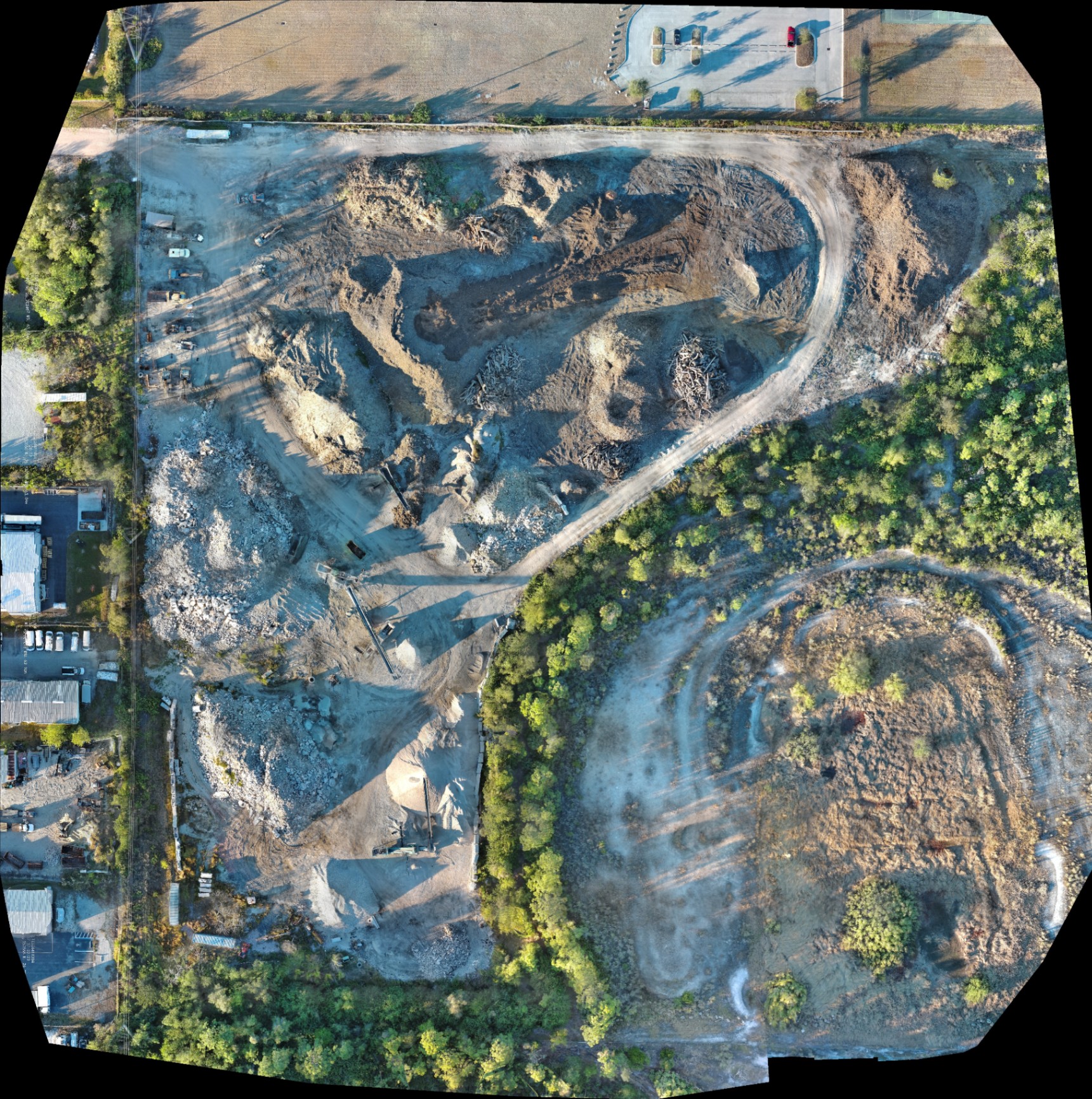
The core deliverable of our mapping service is the orthomosaic: a top-down map that has been geometrically corrected to remove lens distortion and perspective tilt. This results in a uniform scale across the entire image.
Beyond 2D maps, we generate 3D point clouds and textured meshes. These models provide a three-dimensional perspective of the site, allowing project managers to visualize elevation changes, stockpiles, and structural progress from any angle.
Comparison: Traditional Tracking vs. Precision Drone Mapping
| Feature | Traditional Ground Inspections | Cape UAV Precision Mapping |
|---|---|---|
| Collection Time | Days or Weeks | Hours |
| Data Density | Limited to specific points | Millions of data points |
| Perspectives | Ground-level only | Full site top-down & 3D |
| Error Detection | Manual and reactive | Automated and proactive |
| Accessibility | Physical site visits required | Cloud-based digital twin |

Thermal Mapping: Identifying Invisible Risks
A critical component of our current service focus is the integration of thermal imaging into construction workflows. By utilizing the 640×512 thermal sensor on our enterprise platforms, we provide a layer of data that traditional visual mapping cannot replicate.
In construction, thermal mapping is used to identify:
- Subsurface Anomalies: Detecting heat signatures that indicate moisture under roof membranes or within building envelopes.
- Concrete Curing: Monitoring temperature distribution during large-scale concrete pours to ensure structural integrity.
- Infrastructure Integrity: Identifying "hot spots" in electrical systems or HVAC units before they are fully enclosed or commissioned.
Why This Matters:
Thermal results indicate anomalies and are not a substitute for evaluation by a licensed professional, but they serve as an invaluable early-warning system. Identifying a moisture leak in a new build before the interior finishes are installed can save tens of thousands of dollars in potential mold remediation and rework.
Volumetric Analysis and Inventory Management
For land development and earthworks, tracking the movement of materials is one of the most difficult logistical challenges. Traditional methods of estimating stockpile volumes involve manual measurements and significant guesswork.
Precision drone mapping allows for rapid volumetric analysis. By capturing a 3D model of soil, gravel, or debris piles, software can calculate the volume of material on-site with high consistency.
The Value of Volumetric Data:
- Inventory Tracking: Know exactly how much material is on hand for the next phase of the project.
- Subcontractor Verification: Validate that the amount of earth moved matches the invoices submitted.
- Site Planning: Determine if excavated material can be repurposed elsewhere on-site or needs to be hauled away.
Early Error Detection and Rework Prevention
The most significant drain on a construction budget is rework. According to industry data, rework can account for up to 5% to 15% of total project costs. Precision mapping mitigates this risk by providing a "truth" layer that can be compared against the original CAD designs.
When we fly a site weekly, we create a chronological record of progress. If a foundation is poured slightly off-axis or a utility trench is dug in the wrong location, these deviations are immediately apparent when the drone map is overlaid with the site plans.
ROI Advantage:
Detecting a grading error early eliminates the need to tear out and re-pour concrete. The cost of a weekly drone flight is a fraction of the cost of a single day of major rework.
Streamlining Stakeholder Collaboration
Construction projects involve dozens of stakeholders, from owners and investors to architects and subcontractors. Keeping everyone on the same page is a constant struggle.
Digital maps and 3D models act as a centralized "source of truth." These files can be shared digitally, allowing an architect in another city to inspect site progress as if they were standing on the ground in Cape Coral.
Benefits for Remote Management:
- Reduced Travel: Stakeholders can monitor multiple sites without needing to be physically present at every location.
- Documented History: If a dispute arises months after a project is finished, the historical mapping data provides an indisputable record of what was installed and when.
- Safety Compliance: Documenting safety measures and site conditions from the air reduces the risk of insurance claims and ensures compliance with site regulations.
Safety and Compliance: The Cape UAV Standard
Operating enterprise-level drones on an active construction site requires more than just high-end gear. It requires a commitment to safety and a deep understanding of federal regulations.
Every mission at Cape UAV is conducted by FAA Part 107-certified pilots. We manage the complexities of airspace authorizations: especially critical in the Cape Coral and Southwest Florida regions: ensuring that your project documentation is handled legally and professionally.
Beyond flight safety, drone mapping improves overall site safety by keeping personnel off the ground in high-risk areas. Inspecting a roof or a steep embankment via drone eliminates the need for ladders, scaffolding, or fall-arrest systems.

The Financial Case for Precision Mapping
When evaluating drone services, it is helpful to view them as an investment in risk mitigation rather than a line-item expense. The clarity, confidence, and control provided by high-resolution orthomosaics translate directly to the bottom line.
Summary of ROI Factors:
- Time Savings: 50% to 75% faster data turnaround compared to traditional ground-based documentation.
- Accuracy: Centimeter-level precision for planning and documentation.
- Cost Avoidance: Early detection of errors before they escalate into major rework.
- Informed Decisions: Real-time data on stockpile volumes and site grading.
- Enhanced Communication: Visual evidence that accelerates approvals and reduces disputes.
Precision drone mapping is no longer a futuristic concept; it is a standard tool for the modern construction site. For developers and project managers in Southwest Florida, the ability to see a site with total clarity ensures that projects stay on schedule, within budget, and built to the highest standards of quality.
Important Disclaimer
Mapping Disclaimer: Our data is for planning purposes and is not a substitute for a licensed land survey.
Thermal Disclaimer: Thermal results indicate anomalies and are not a substitute for evaluation by a licensed professional.
Important Disclaimer:
Autel Robotics is a trademark of its respective owner; Cape UAV is not affiliated with or endorsed by Autel Robotics. Mapping data is for planning purposes and is not a substitute for a licensed land survey. Thermal results indicate anomalies and are not a substitute for evaluation by a licensed professional.