
Land development in Southwest Florida moves fast. Between navigating local zoning in Cape Coral and managing large-scale earthmoving projects in Fort Myers, developers are under constant pressure to stay on schedule and under budget. Traditional land assessment methods: while reliable: often create bottlenecks that stall progress before the first shovel even hits the dirt.
Drone mapping has evolved from a "nice-to-have" aerial photo to a critical technical asset. By leveraging high-resolution orthomosaics and 3D modeling, developers can now visualize, plan, and monitor sites with a level of detail that was previously impossible or cost-prohibitive.
The Core of Modern Mapping: Photogrammetry and High-Resolution Sensors
At its simplest, drone mapping uses photogrammetry: a process that captures hundreds of overlapping high-resolution images and triangulates them to create accurate 2D maps and 3D models. However, the quality of the data is entirely dependent on the hardware.
At Cape UAV, we utilize enterprise-grade platforms like the Autel Robotics EVO Lite 6T Enterprise (also known as the EVO Lite 640T). This equipment is a powerhouse for land development because it carries a 50MP visual camera. This high megapixel count allows us to capture incredibly fine details on the ground from safe flight altitudes, ensuring that every rock, pipe, and property marker is documented for your planning team.
Why It Matters:
- Data Density: We generate millions of data points per acre, compared to the dozens or hundreds collected by traditional manual methods.
- Visual Clarity: 50MP resolution means you can zoom into your site map to inspect specific equipment or soil conditions without losing clarity.
- Rapid Deployment: We can map a 50-acre site in a single afternoon, providing a comprehensive dataset while your competitors are still waiting for a site visit.
Phase 1: Feasibility and Preliminary Planning
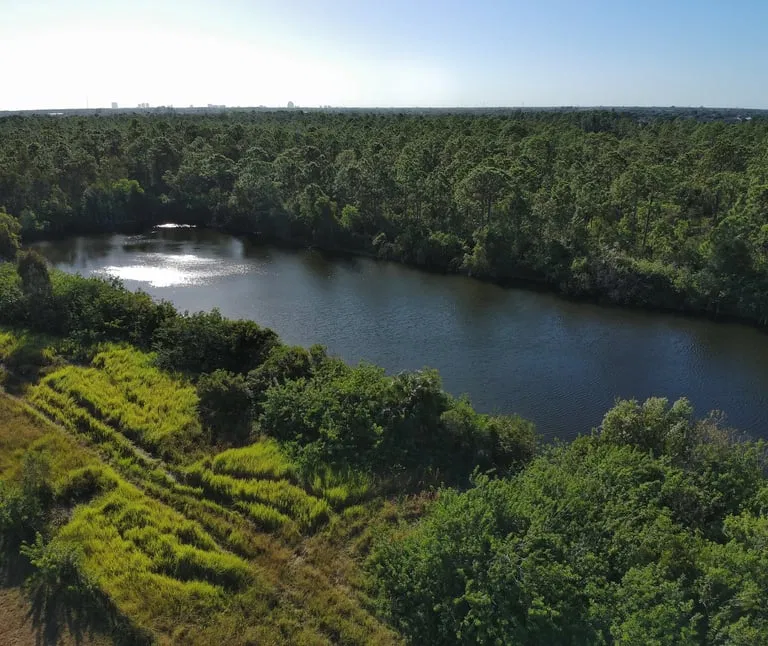
Every successful project begins with an accurate assessment of what you’re actually working with. During the feasibility stage, drone mapping provides a "macro" view of the land that satellite imagery simply cannot match.
Identifying Constraints Early
Satellite maps are often years out of date. A drone flight provides a real-time snapshot of the property. We help developers identify:
- Encroachments from neighboring properties.
- Existing drainage patterns and low-lying wet areas.
- Vegetation density and access points for heavy machinery.
By using high-resolution drone-mapping deliverables, your team can estimate earthwork volumes and evaluate site compatibility before committing to a purchase or a final design.
ROI Advantage: Identifying a major drainage issue or an undisclosed structure during feasibility can save six figures in "surprise" remediation costs later.
Phase 2: Pre-Design and Topographic Insight
Once a project moves into the design phase, civil engineers need more than just a photo; they need data that integrates with their existing workflows.
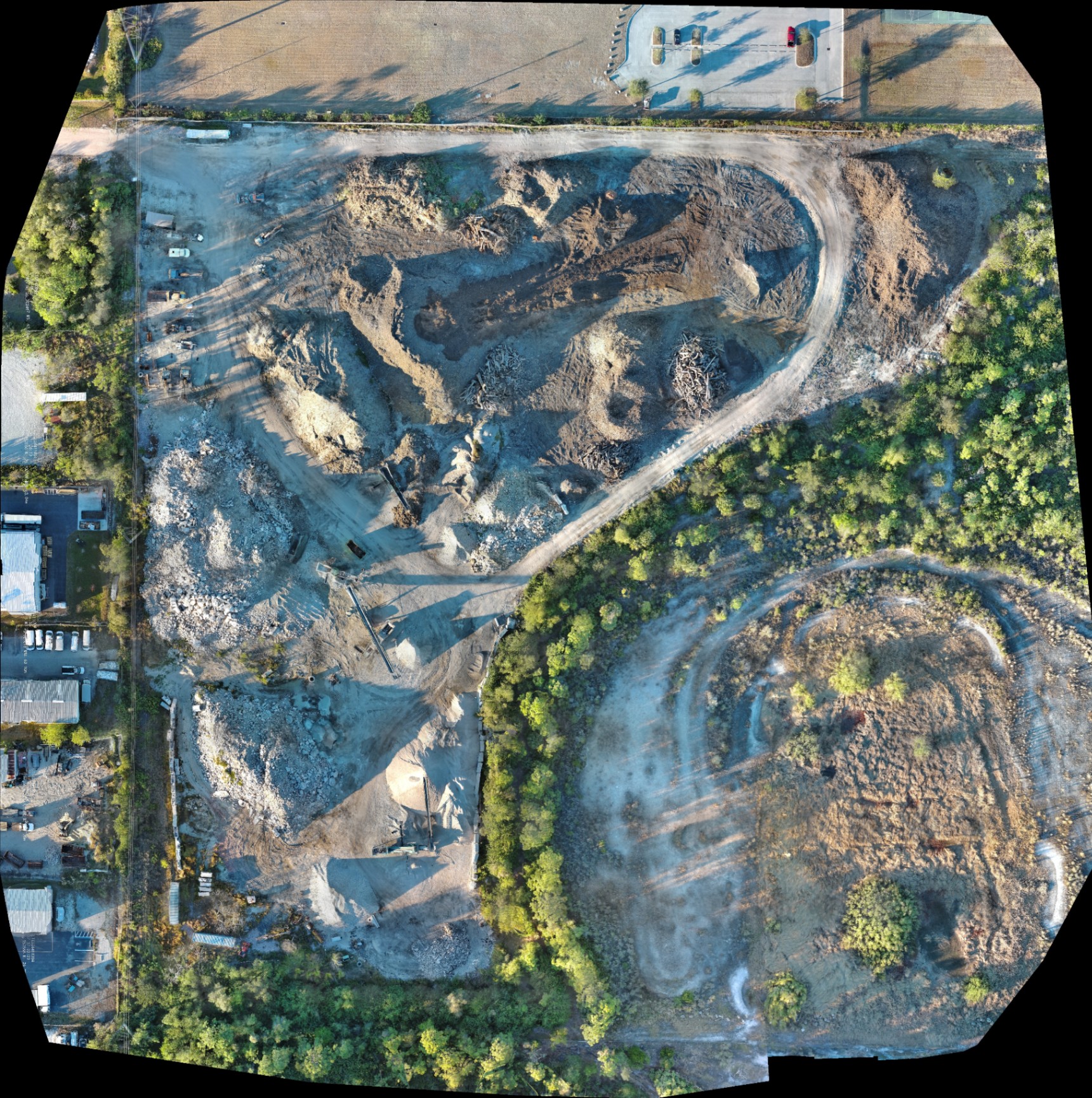
We deliver georeferenced orthomosaics and Digital Surface Models (DSM) that can be imported directly into CAD or GIS software. While these deliverables are for planning purposes, they provide the high-density topographic insight needed to optimize grading designs.
Earthwork Design Optimization
Earthmoving is often the single largest variable cost in land development. If your design requires importing or exporting massive amounts of fill, your margins disappear.
- Cut-and-Fill Analysis: Use our 3D models to calculate exactly how much dirt needs to move from Point A to Point B.
- Mass Haul Optimization: Minimize the distance material travels on-site.
- Inventory Management: Track exactly how much fill you have on-site in stockpiles at any given time.
Phase 3: Construction Progress Monitoring
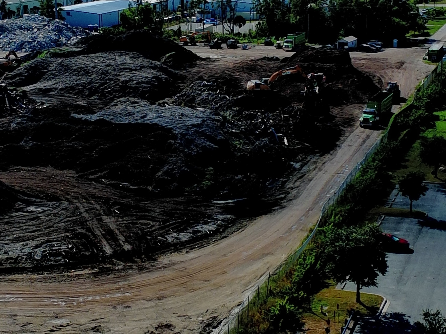
Once the equipment is on-site, the drone becomes your "eye in the sky" for project management. Frequent mapping flights: weekly or bi-weekly: provide a historical record of progress that a clipboard and a camera can’t provide.
Stakeholder Alignment and Documentation
In Southwest Florida, weather and supply chain issues can cause frequent delays. High-resolution aerial updates keep investors and stakeholders informed without requiring them to step foot on a dusty, active site.
- Visual Proof: Document the installation of underground utilities before they are buried.
- Subcontractor Accountability: Verify that work is being completed according to the timeline.
- Dispute Resolution: If a disagreement arises regarding site conditions or work completed, you have a time-stamped, high-resolution visual record to consult.
The Technical Edge: For projects requiring infrastructure inspection, our use of the 640×512 thermal sensor on the Autel Lite 6T allows us to identify thermal anomalies in newly installed systems or identify moisture trapped under membranes: issues that are invisible to the naked eye.
Phase 4: Final As-Built Documentation
As the project nears completion, drone mapping provides the ultimate close-out tool. A final high-resolution map allows you to compare the finished site against the original approved plans.
This "As-Built" documentation is invaluable for:
- Handing off the project to property managers.
- Marketing the development to prospective buyers or tenants via real estate drone photography.
- Finalizing municipal permits and environmental compliance.
Technical Specifications: Why the Equipment Matters
Not all drones are created equal. When hiring a drone service provider for industrial applications, the hardware dictates the quality of the output.
| Feature | Cape UAV Spec (Autel Lite 6T) | Why It Matters for Developers |
|---|---|---|
| Visual Resolution | 50 Megapixels | Extreme detail for identifying small site features. |
| Thermal Sensor | 640 × 512 | Detects heat signatures for utility and HVAC inspections. |
| Pixel Pitch | 12μm (Thermal) | Superior sensitivity for identifying anomalies. |
| Flight Time | Up to 40 minutes | Allows us to map larger sites in a single mission. |
Disclaimer: Autel Robotics is a trademark of its respective owner; Cape UAV is not affiliated with or endorsed by Autel Robotics.
Navigating the Legal and Safety Landscape
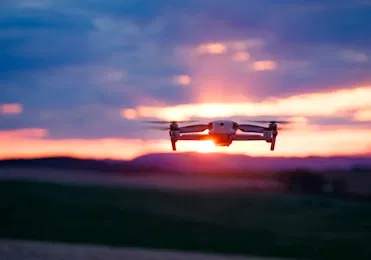
Operating drones in a commercial capacity requires more than just owning the hardware. At Cape UAV, we prioritize safety and legal compliance to protect our clients' interests.
FAA Part 107 Certification
Every flight we conduct is under the command of an FAA Part 107-certified pilot. This ensures that we are compliant with federal airspace regulations, which is especially critical in the busy corridors of Southwest Florida.
Understanding the Data
It is vital to distinguish between drone mapping for planning and a licensed land survey. While our maps are incredibly detailed and provide a wealth of data for engineering and development, they serve as a supplement to, not a replacement for, traditional surveying.
Important Disclaimer
- Mapping Disclaimer: Our data is for planning purposes and is not a substitute for a licensed land survey.
- Thermal Disclaimer: Thermal results indicate anomalies and are not a substitute for evaluation by a licensed professional.
The ROI of Professional Drone Mapping
The question for most developers isn't whether drone mapping is cool: it’s whether it pays for itself. When you factor in the time saved by your engineering team, the reduction in earthmoving errors, and the speed of stakeholder communication, the ROI is clear.
- Reduce Rework: Catching a grading error a week early can save tens of thousands of dollars in equipment time.
- Shorten Schedules: Faster data collection means faster design cycles and quicker project starts.
- Enhance Safety: Capture data on steep slopes or hazardous areas without putting personnel at risk.
If you are ready to bring technical precision to your next land development project in Cape Coral or the surrounding Southwest Florida area, we are here to help. From initial feasibility to the final as-built, our team provides the clarity and data you need to succeed.
For more information on our specific services, visit our drone services page or contact us to discuss your next project.
Important Disclaimer
Our data is for planning purposes and is not a substitute for a licensed land survey. Thermal results indicate anomalies and are not a substitute for evaluation by a licensed professional. Results depend on environmental and site conditions.