Commercial drone services live or die on image quality. When you're documenting a 200,000-square-foot roof membrane, mapping a 40-acre construction site, or surveying a solar array for underperforming strings, the sensor specifications determine whether you walk away with actionable data: or expensive guesswork.
Cape UAV flies the Autel Robotics EVO Lite 640T Enterprise as our primary inspection and mapping platform. The dual-camera system combines a 640×512 radiometric thermal sensor with a 48-megapixel (8000×6000) visual camera on a 1/2-inch CMOS sensor. These are not arbitrary numbers. They define what we can detect, measure, and deliver.
Autel Robotics is a trademark of its respective owner. Cape UAV is not affiliated with or endorsed by Autel Robotics.
Why 640×512 Thermal Resolution Is the Practical Benchmark for Roof and Solar Inspections
Thermal imaging detects infrared radiation emitted by surfaces and converts it into a visual heat map. The resolution: measured in pixels: determines how much spatial detail the sensor captures across a given area.
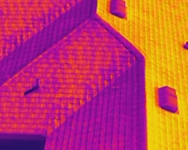
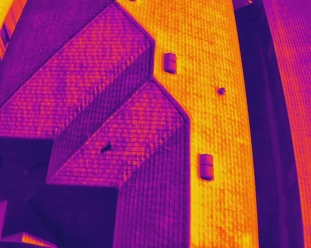
A 640×512 thermal sensor produces 327,680 individual temperature measurement points per frame. That pixel density translates to clearer separation between thermal anomalies and surrounding areas: critical when you're distinguishing wet insulation from dry membrane, identifying solar panel hot spots, or detecting electrical heat buildup in junction boxes.
Why Higher Thermal Resolution Matters
Lower-resolution thermal sensors (320×240 or 160×120) deliver thermal imagery, but they lack the pixel count to resolve small-scale patterns or maintain clarity at safe standoff distances. On a commercial roof inspection, this creates three problems:
- Reduced anomaly detection: Smaller temperature variations blur together, making it harder to isolate discrete problem areas from normal surface texture or environmental reflections
- Increased proximity requirements: To capture usable detail, the aircraft must fly closer to the roof: raising collision risk and reducing coverage efficiency
- Lower confidence in findings: When thermal patterns are ambiguous, field teams and contractors hesitate to act on the data
A 640×512 sensor addresses these limitations by delivering more pixels on target. The result is improved thermal pattern clarity, safer standoff distances during flight operations, and documentation that supports confident decision-making.
Application-Specific Value
Roof inspections: Wet insulation creates thermal lag: it retains heat differently than dry material. A 640×512 sensor resolves these patterns across membrane seams, flashing details, and penetrations with enough clarity to prioritize contractor follow-up.
Solar array diagnostics: Underperforming panels, faulty bypass diodes, and string-level issues generate distinct heat signatures. Higher thermal resolution makes these anomalies easier to identify and isolate from normal operational temperature variations.
Electrical infrastructure: Overloaded circuits, loose connections, and failing components produce localized heat. The pixel density of a 640×512 sensor helps distinguish real electrical issues from environmental factors like sun loading or reflections.
Note: Thermal imaging effectiveness depends on flight planning and environmental conditions: sun angle, wind, time since precipitation, roof material, electrical loading, and surface emissivity all influence thermal patterns. Mission planning is not optional.
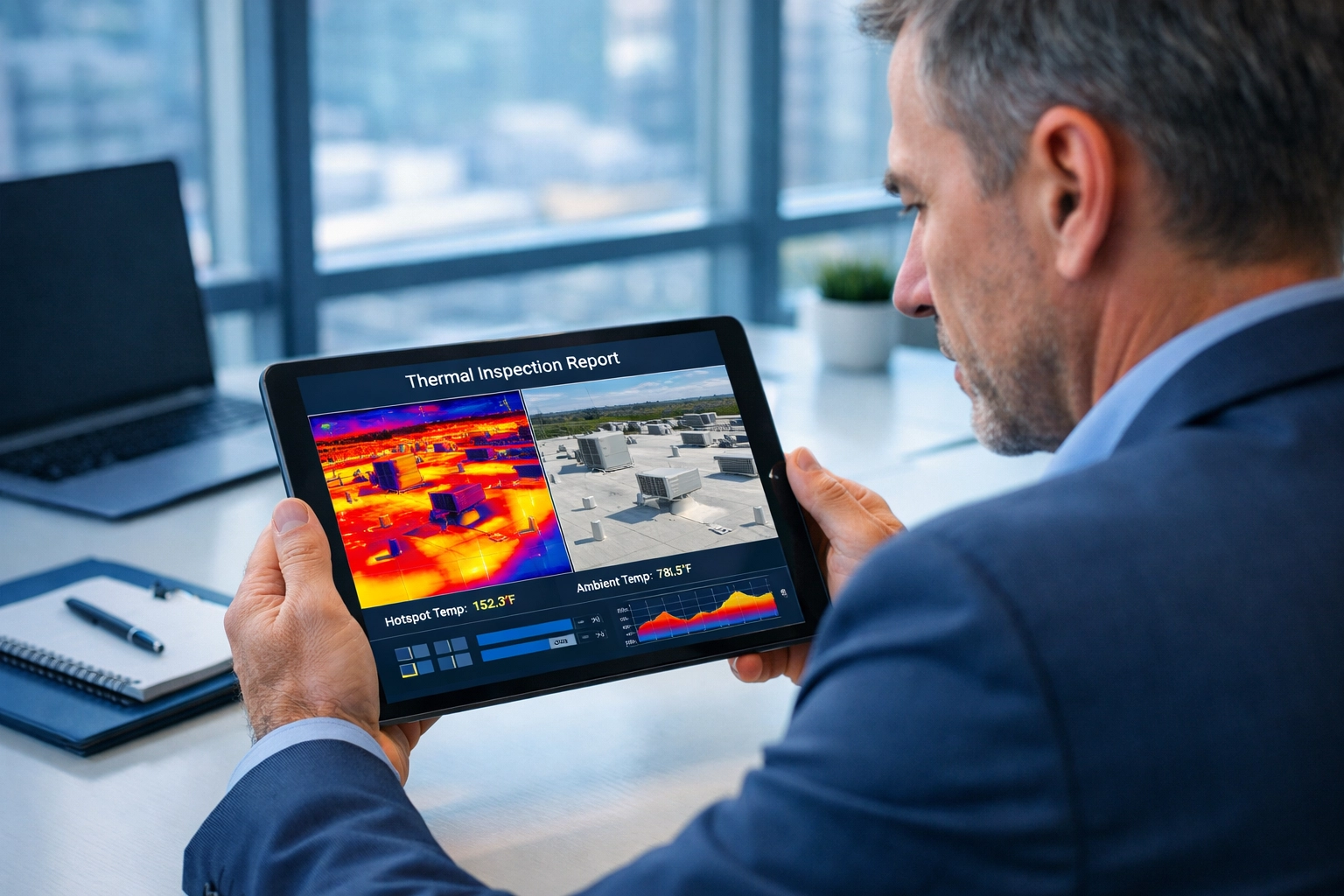
Radiometric Data: What Property Managers Gain Beyond Visual Heat Maps
Standard thermal imagery shows relative temperature differences: hotter areas appear in warmer colors (reds, yellows), cooler areas in blues and purples. This qualitative view helps identify problem zones but lacks quantitative measurement data.
Radiometric thermal imaging embeds actual temperature values into each pixel. The EVO Lite 640T captures this data across a measurement range of -20°C to 550°C with up to ±3°C or ±3% accuracy, enabling spot temperature readings and regional analysis (minimum, maximum, and average temperature across a defined area).
Why Radiometric Capability Changes Property Management Workflows
Property managers operate under constant triage pressure: limited budgets, tight maintenance windows, and the need to prioritize spending across multiple buildings and systems. Radiometric data supports faster, more informed decision-making:
- Storm damage assessment: After severe weather, radiometric thermal surveys help identify compromised roof sections before visible leaks appear: flag areas for contractor evaluation and allocate repair budgets based on severity
- Preventive maintenance prioritization: Temperature data reveals which HVAC units are running inefficiently, which roof sections show heat retention patterns, and which electrical panels warrant follow-up inspection
- Vendor coordination: Radiometric reports provide contractors with specific problem locations and context: reducing diagnostic time on-site and improving repair accuracy
Advanced Radiometric Reporting (Add-On Service)
For clients who require structured deliverables for internal tracking, vendor coordination, or insurance documentation, Cape UAV offers Advanced Radiometric Reporting. This enhanced package includes:
- Annotated thermal/visual image pairs: Each thermal anomaly is matched with a corresponding high-resolution visible photo for context
- Regional temperature statistics: Minimum, maximum, and average temperature data for areas of concern: not just single-point measurements
- Environmental conditions summary: Flight date/time, weather conditions, and site-specific factors that influence thermal readings
- Prioritized review list: A structured summary of flagged areas with recommended next steps for contractor evaluation
Radiometric temperature measurement disclaimer: Temperature readings from radiometric thermal images can be affected by emissivity, reflectivity, distance, atmospheric conditions, viewing angle, and environmental factors. Our reports are intended to support maintenance decision-making and contractor coordination: not to replace evaluation, diagnosis, or repair recommendations from licensed roofing, electrical, HVAC, or other qualified trade professionals.
How 48MP Visual Data Drives Mapping Precision and Structural Documentation
The EVO Lite 640T's visual camera captures 8000×6000-pixel still images: 48 million data points per frame. That resolution level changes what's possible in photogrammetry and orthomosaic generation.
The Link Between Image Resolution and Mapping Accuracy
Drone mapping relies on photogrammetry: software analyzes overlapping images, identifies common features (tie points), and reconstructs three-dimensional geometry. The quality of that reconstruction depends directly on the clarity and detail captured in the source images.
Higher pixel count produces:
- More tie points: Photogrammetry software can identify and match finer surface details across overlapping images: improving alignment accuracy and reducing reconstruction errors
- Better feature resolution: Small objects: rebar, conduit runs, equipment mounting details: remain visible and measurable in the final orthomosaic or 3D model
- Improved texture fidelity: High-resolution imagery delivers sharper, more readable base maps for annotation, measurement, and progress documentation
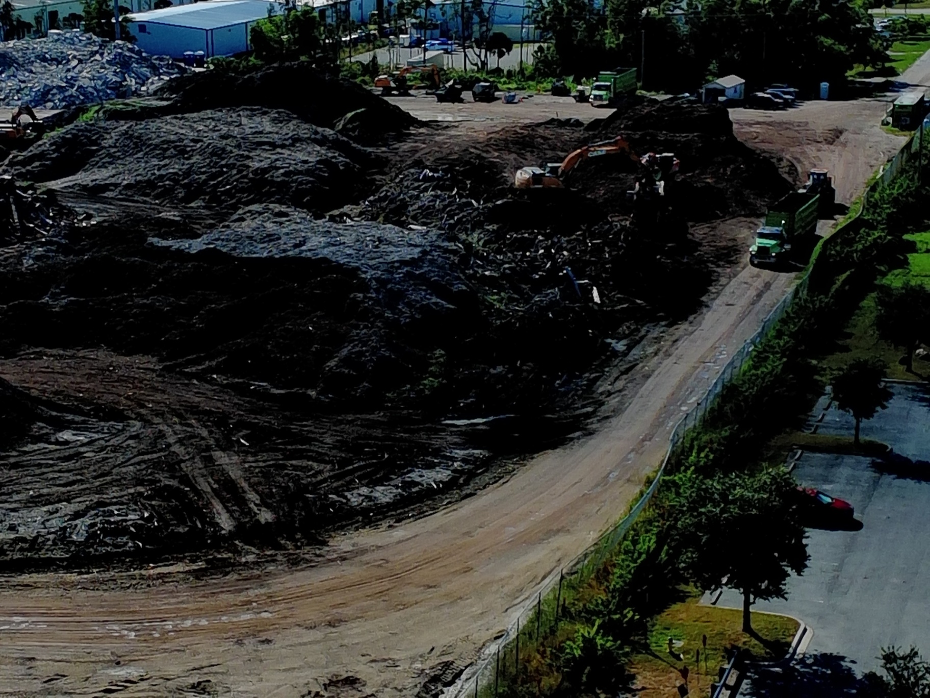
Construction Site Applications
Earthwork and grading verification: Orthomosaics generated from 48MP imagery provide clear ground texture and equipment placement: site managers can measure cut/fill volumes, verify grading progress, and document material stockpile locations with confidence.
Structural progress documentation: Exterior building details: framing members, MEP rough-ins, facade installation: remain legible in zoomed sections of the orthomosaic, enabling remote QA checks and reducing the need for repeat site visits.
As-built condition records: High-resolution aerial documentation captures the installed state of site improvements, utilities, and structures: creating a permanent visual record that supports facilities management, warranty claims, and future renovation planning.
Why the 1/2-Inch CMOS Sensor Matters
The EVO Lite 640T's visible camera pairs its 48MP resolution with a 1/2-inch CMOS sensor. Larger sensors generally improve dynamic range (the ability to capture detail in both bright and dark areas simultaneously) and low-light performance: important when flying near sunrise or sunset to avoid harsh shadows.
While not as large as full one-inch sensors found on some enterprise platforms, the 1/2-inch sensor combined with 48MP output delivers a practical balance: high pixel count for mapping detail, reasonable file sizes for field processing, and consistent image quality across varied lighting conditions common on Southwest Florida construction sites.
Video capability: The system also captures 4K video at 30 frames per second: useful for client presentations, marketing materials, and visual progress narratives that complement still-image deliverables.
ROI Advantage: When Hardware Specifications Translate to Project Outcomes
Sensor specifications matter because they determine deliverable quality: and deliverable quality determines whether drone data supports business decisions or sits unused in a project folder.
For property managers: Radiometric thermal data reduces the cost of roof and mechanical system triage. Instead of deploying contractors to investigate every suspect area, property teams review thermal reports, prioritize the highest-risk zones, and schedule targeted follow-up. One avoided emergency roof repair pays for multiple thermal surveys.
For construction teams: High-resolution orthomosaics and 3D models replace manual field measurements, reduce survey crew time, and provide objective documentation for progress billing and change order disputes. Accurate as-built records protect project timelines and reduce costly rework.
For facility and real estate operations: Combining thermal and visual data in a single flight eliminates the need for separate aerial photography and infrared inspection missions: reducing aircraft time, streamlining vendor coordination, and delivering faster turnaround on critical site assessments.
Final Context: Hardware Is the Foundation, Planning Is the Execution
The EVO Lite 640T's dual-camera system provides the raw capability: 640×512 radiometric thermal, 48MP visual resolution, and integrated data capture. But sensor specifications alone don't guarantee results.
Effective drone inspections and mapping projects require disciplined flight planning: altitude selection, overlap percentages, lighting conditions, ground control placement (when required), and environmental awareness. The hardware captures the data. Planning determines whether that data answers the client's question.
Cape UAV operates the EVO Lite 640T because it delivers the resolution, measurement capability, and dual-sensor integration that commercial roof, solar, and construction clients require. The platform supports the work; but mission execution drives outcomes.
For project-specific questions or to schedule a thermal inspection or mapping mission in Southwest Florida, contact Cape UAV at capeuav.com/contact.