Construction timelines in Southwest Florida compress every year. Permitting windows shrink, labor costs climb, and weather delays remain unpredictable. In 2026, general contractors and developers across Cape Coral, Fort Myers, and Naples are turning to drone mapping to eliminate documentation bottlenecks, reduce design iterations, and keep projects moving without adding field crews.
High-resolution aerial imaging delivers what traditional ground surveys and periodic site walks can't: complete site visibility on demand. Construction teams use GPS-guided orthomosaic mapping to document as-built conditions, coordinate trades, and provide stakeholders with real-time progress updates: all without pulling personnel off active tasks or waiting days for third-party documentation.
Why High-Resolution Mapping Changes Construction Workflows
Most project delays stem from incomplete information. Site conditions evolve daily: grading changes, material deliveries stack up, drainage patterns shift after rain events. Without current visual data, project managers make coordination decisions based on outdated plans or incomplete field reports.
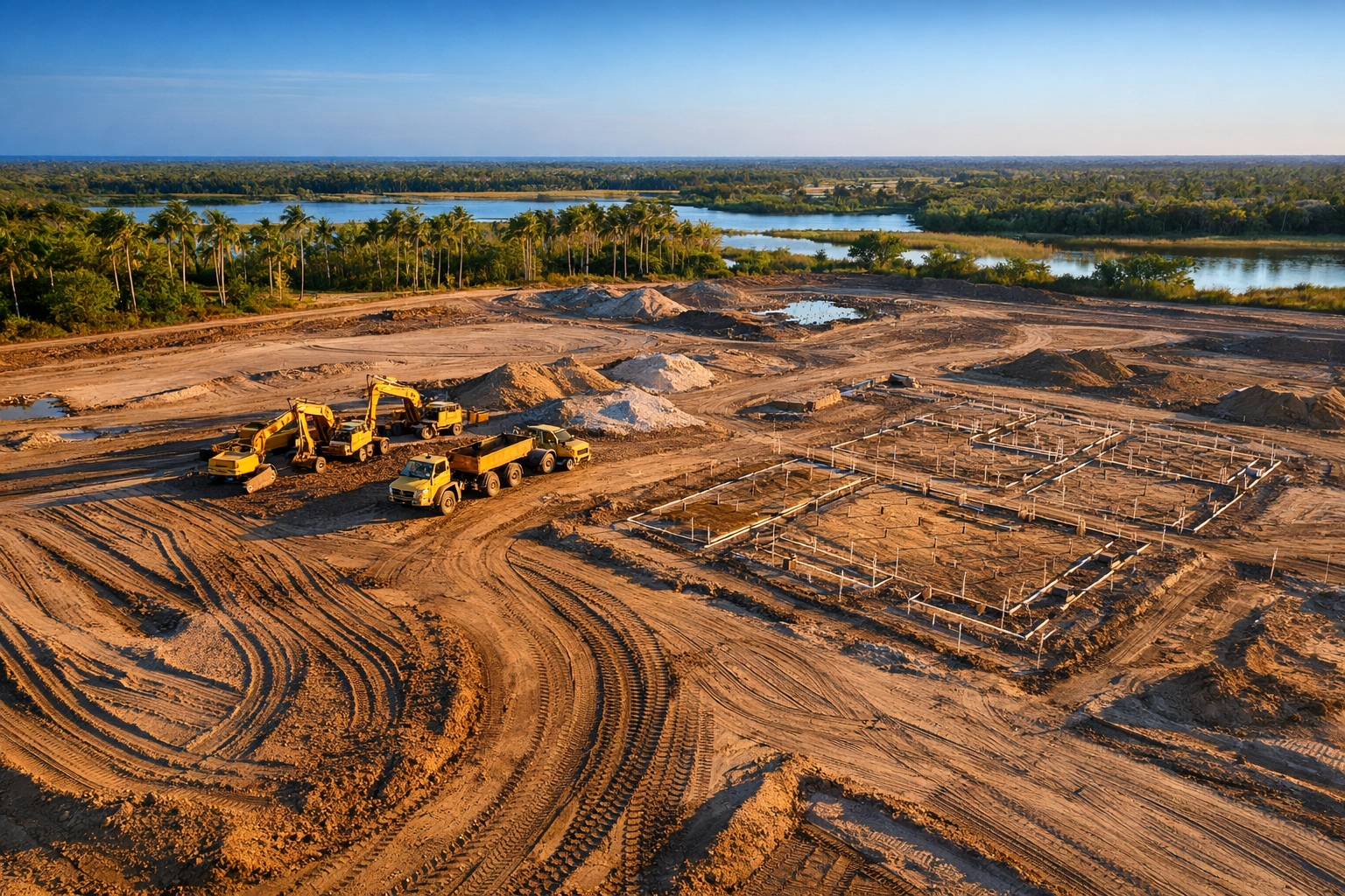
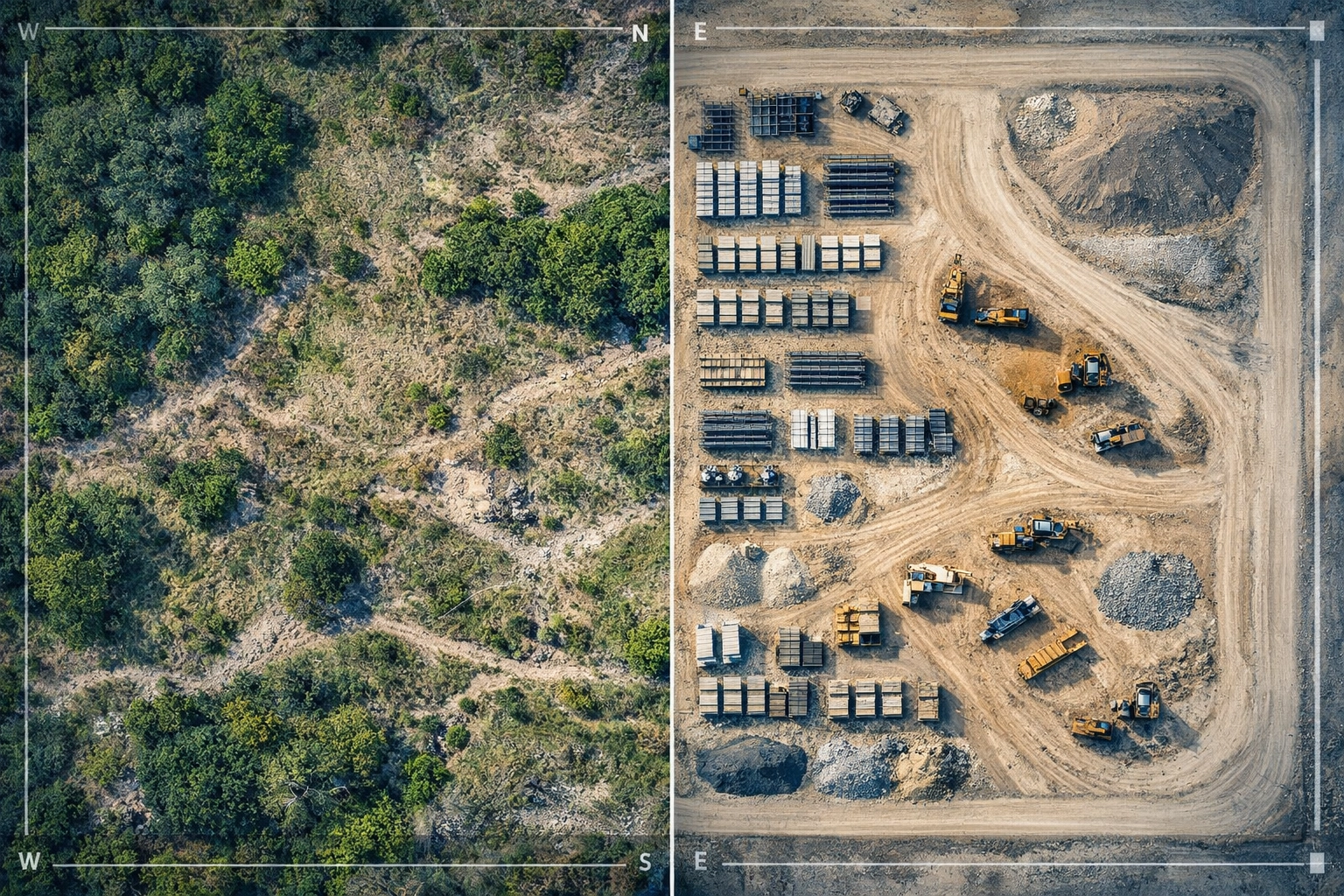
Drone-based orthomosaic mapping captures the entire site from above in a single flight, producing georeferenced imagery that integrates directly into project management software and design platforms. These high-resolution overviews show equipment locations, stockpile volumes, access road conditions, and grading progress: details that impact daily scheduling and weekly coordination meetings.
Key Applications in SWFL Construction Projects
Site Documentation for Planning and Compliance
Pre-construction baseline mapping establishes existing conditions before earthwork begins. Contractors use these initial overviews to document drainage patterns, identify existing utilities, and verify property boundaries match design intent. Throughout the project, periodic mapping tracks progress against design plans and provides visual evidence for permitting authorities and stormwater compliance reviews.
Southwest Florida's flat terrain makes stormwater management critical: even minor grading errors create runoff issues that trigger stop-work orders. High-resolution mapping helps construction teams verify that grading follows engineered drainage plans and provides documentation for Water Management District inspections.
Progress Tracking Without Field Disruption
Weekly or bi-weekly flights create a visual timeline of construction activity. Project managers compare sequential overviews to identify pace variations, equipment bottlenecks, and material staging issues. These time-stamped records serve multiple purposes:
- Verify contractor progress claims against payment schedules
- Document site conditions before and after weather events
- Provide visual proof of milestone completion for lenders and investors
- Support delay claims with timestamped evidence of site conditions
The ROI here is immediate: documentation flights take 15–20 minutes versus half-day site walks, freeing project managers to focus on coordination rather than record-keeping.
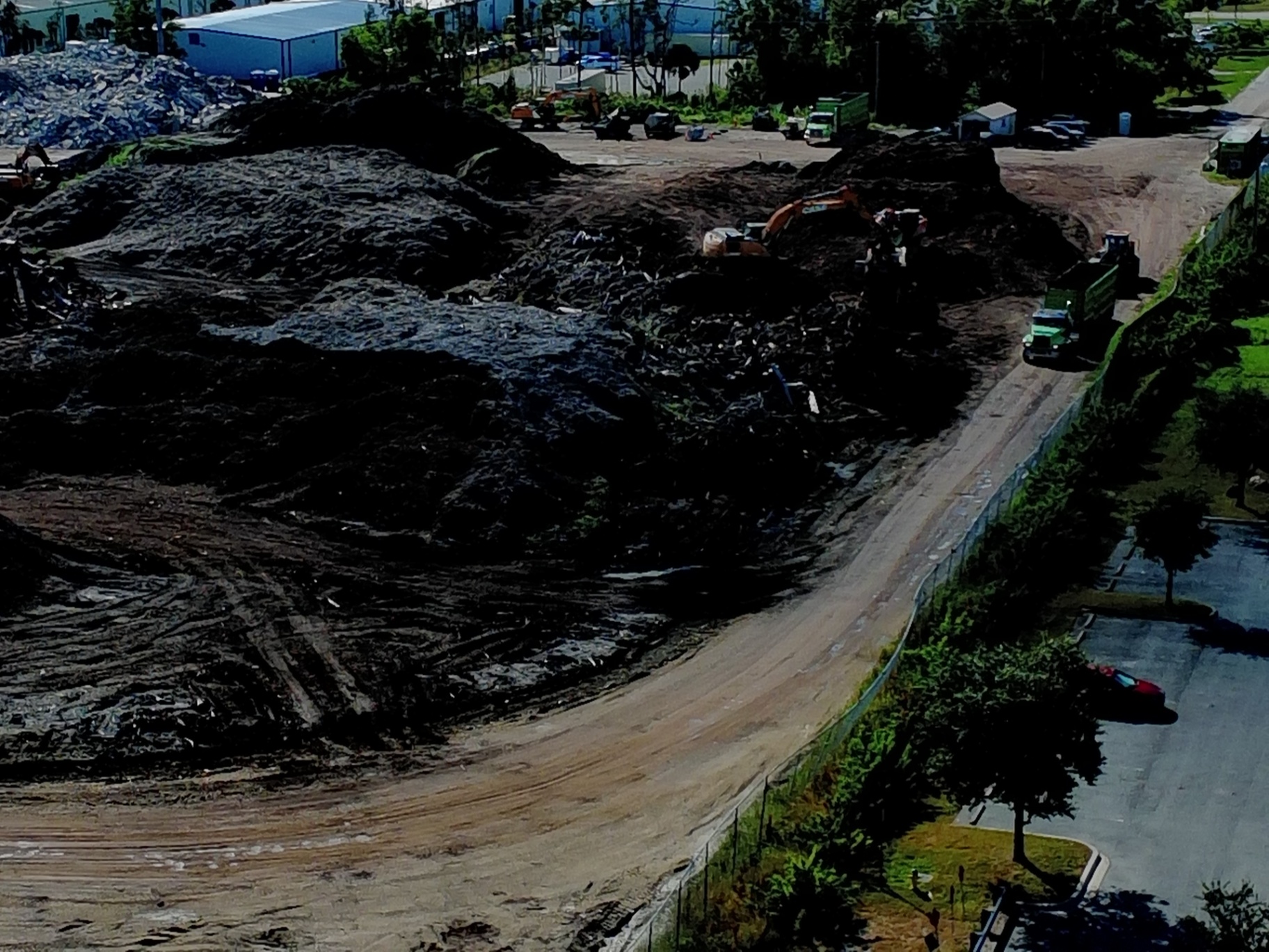
Material Volume Calculations
Earthwork estimates drive early project budgets, but ground-based volume calculations remain time-consuming and imprecise. Orthomosaic maps combined with digital surface models (DSMs) enable stockpile volume measurements that help contractors track material usage, verify delivery quantities, and adjust earthwork budgets before overages compound.
Excavation contractors use these measurements to:
- Calculate cut-and-fill volumes for progress billing
- Verify imported material quantities match delivery tickets
- Track topsoil and aggregate stockpiles across multi-phase developments
- Document material movement for environmental compliance reporting
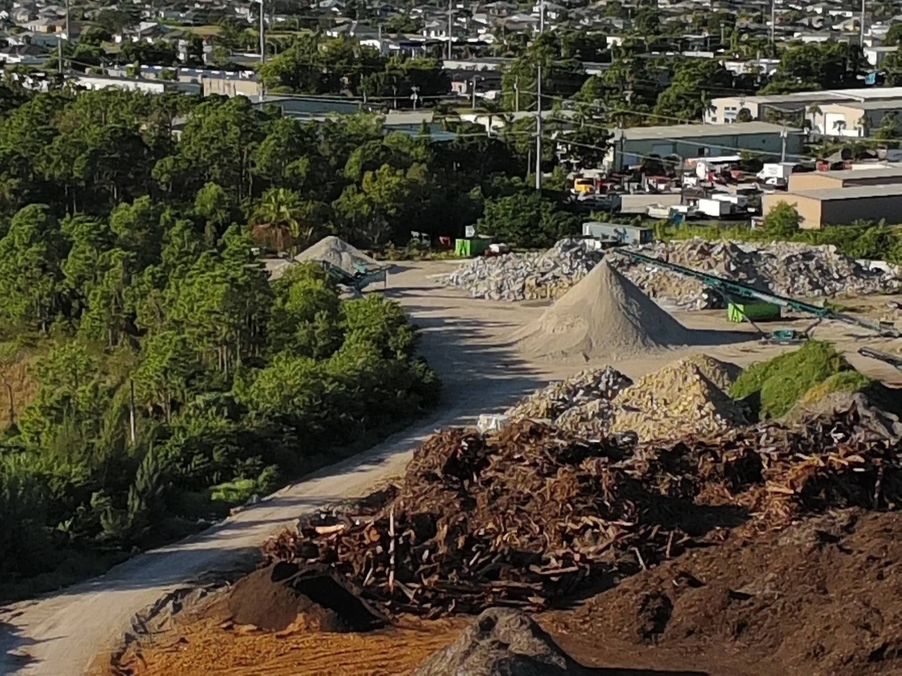
For large-scale developments moving tens of thousands of cubic yards, volume tracking prevents cost overruns and identifies material waste early.
Coordination Across Trades and Stakeholders
Multi-trade projects require constant communication between site superintendents, subcontractors, engineers, and owners. High-resolution site overviews provide a shared visual reference that eliminates miscommunication. When civil contractors, utility installers, and building trades review the same current site imagery, coordination meetings focus on solutions rather than clarifying what's actually on the ground.
Developers share these overviews with:
- Municipal inspectors reviewing permit compliance
- Engineers verifying as-built conditions match design intent
- Lenders and investors monitoring construction progress
- Marketing teams documenting development milestones
This transparency accelerates approvals and reduces back-and-forth requests for site condition updates.
Timeline Acceleration Through Early Problem Detection
Most construction delays result from discovering issues after they've already caused downstream impacts. Drainage problems appear after roadways are paved. Utility conflicts emerge when foundations are ready to pour. Access constraints become obvious when heavy equipment can't maneuver.
Construction drone services shift problem detection earlier in the timeline. High-resolution mapping reveals grading inconsistencies, drainage concerns, and access limitations before they escalate into schedule delays or change orders. Site superintendents identify these issues during weekly overviews rather than discovering them during inspections or punch-list reviews.
Why SWFL Contractors Prioritize Visual Documentation
Florida's regulatory environment demands proof. Stormwater permits, environmental compliance, and land development code requirements all hinge on demonstrating that construction follows approved plans. High-resolution aerial documentation provides that proof without manual field measurements or survey crews.
For projects disturbing more than one acre, NPDES permits require stormwater pollution prevention plans (SWPPPs) with ongoing compliance documentation. Periodic aerial mapping creates a visual record of erosion control measures, sediment barriers, and drainage infrastructure: evidence that satisfies inspectors and protects against violations.
Beyond compliance, this visual documentation protects contractors against unfounded delay claims and provides objective records when weather, site conditions, or scope changes impact timelines.
ROI: Faster Approvals, Fewer Redesigns, Reduced Coordination Time
The financial case for drone mapping in construction comes down to three factors: eliminating design rework, accelerating permit approvals, and reducing coordination overhead.
Design rework costs escalate quickly. When site conditions don't match assumptions in the design phase, engineers issue revised grading plans, drainage calculations change, and material orders shift. A single grading revision on a commercial site can delay timelines by weeks and add tens of thousands in engineering and material costs.
High-resolution baseline mapping: captured before design finalization: gives engineers accurate terrain data that reduces the likelihood of costly surprises during construction. For flat Southwest Florida sites where drainage calculations depend on subtle elevation changes, this upfront accuracy prevents expensive redesigns.
Permit approvals accelerate when submittals include current, high-resolution site documentation. Reviewing authorities spend less time requesting clarifications or scheduling site visits when visual evidence supports compliance claims. The time saved here: often measured in weeks: directly impacts project cash flow and occupancy timelines.
Coordination meetings that once consumed half-day site walks now happen in conference rooms with current aerial overviews displayed on screens. Project managers review site conditions, assign tasks, and resolve conflicts without pulling multiple trades off active work.
One general contractor in Cape Coral reported saving 8–12 hours per week on coordination and documentation tasks after integrating weekly drone overviews into project workflows: time redirected toward proactive problem-solving rather than reactive information gathering.

Technology Behind High-Resolution Construction Mapping
Cape UAV deploys the Autel Robotics EVO Lite 6T Enterprise (EVO Lite 640T), equipped with a 50MP visual camera and GPS-guided positioning. This enterprise platform captures the high-resolution imagery required for detailed site documentation and planning analysis.
The process converts hundreds of overlapping aerial images into georeferenced orthomosaic maps: visual records where every pixel corresponds to a real-world coordinate. These maps integrate directly into CAD software, project management platforms, and design tools, allowing engineers and project managers to measure distances, calculate areas, and overlay design plans without specialized GIS expertise.
Digital surface models (DSMs) complement orthomosaic maps by adding elevation data. Construction teams use DSMs to verify grading progress, calculate earthwork volumes, and identify drainage flow paths across the site.
Autel Robotics is a trademark of its respective owner; Cape UAV is not affiliated with or endorsed by Autel Robotics.
Important Disclaimer
Our data is for planning purposes and is not a substitute for a licensed land survey.
Looking Ahead: Documentation as a Competitive Advantage
Southwest Florida construction markets remain competitive. Contractors who deliver projects on schedule and within budget win repeat clients and larger opportunities. In 2026, the differentiator isn't just execution: it's information advantage.
High-resolution aerial documentation provides that advantage. Projects move faster when teams work from current, accurate visual data. Stakeholders approve decisions more quickly when they see evidence rather than descriptions. Problems get resolved earlier when site conditions are visible to everyone simultaneously.
For construction firms operating across Cape Coral, Fort Myers, Naples, and the broader SWFL region, drone mapping represents a shift from reactive documentation to proactive visibility: turning site overviews into strategic assets that compress timelines and reduce costly surprises.
Learn more about our construction drone services or explore how orthomosaic mapping fits into your next development project.
Important Disclaimer
Our data is for planning purposes and is not a substitute for a licensed land survey.