Rework consumes 5–15% of construction project costs: money that disappears when as-built conditions don't match design specifications. High-resolution drone mapping eliminates the guesswork by delivering centimeter-level visual documentation that catches discrepancies before they compound into expensive corrections. In Southwest Florida's active construction market, where land development projects move fast and coordination challenges multiply, weekly orthomosaic imagery creates a visual baseline that keeps crews aligned and superintendents informed.
The Rework Problem: What Traditional Documentation Misses
Construction rework stems from a simple reality: what gets built doesn't always match what was designed. Subcontractor interpretations vary. Site conditions change between planning and execution. Earthwork grades drift from specification. By the time these deviations surface through manual inspection or survey, subsequent trades have already built on top of the error.
The financial impact compounds quickly. A grading mistake caught after utilities are installed requires excavation, rework of the utilities, re-grading, and re-inspection: turning a $5,000 earthwork correction into a $40,000 delay. Traditional progress documentation: site photos, periodic surveys, superintendent walkthroughs: captures snapshots but misses the spatial relationships that reveal emerging problems.
How High-Resolution Orthomosaic Mapping Reduces Rework
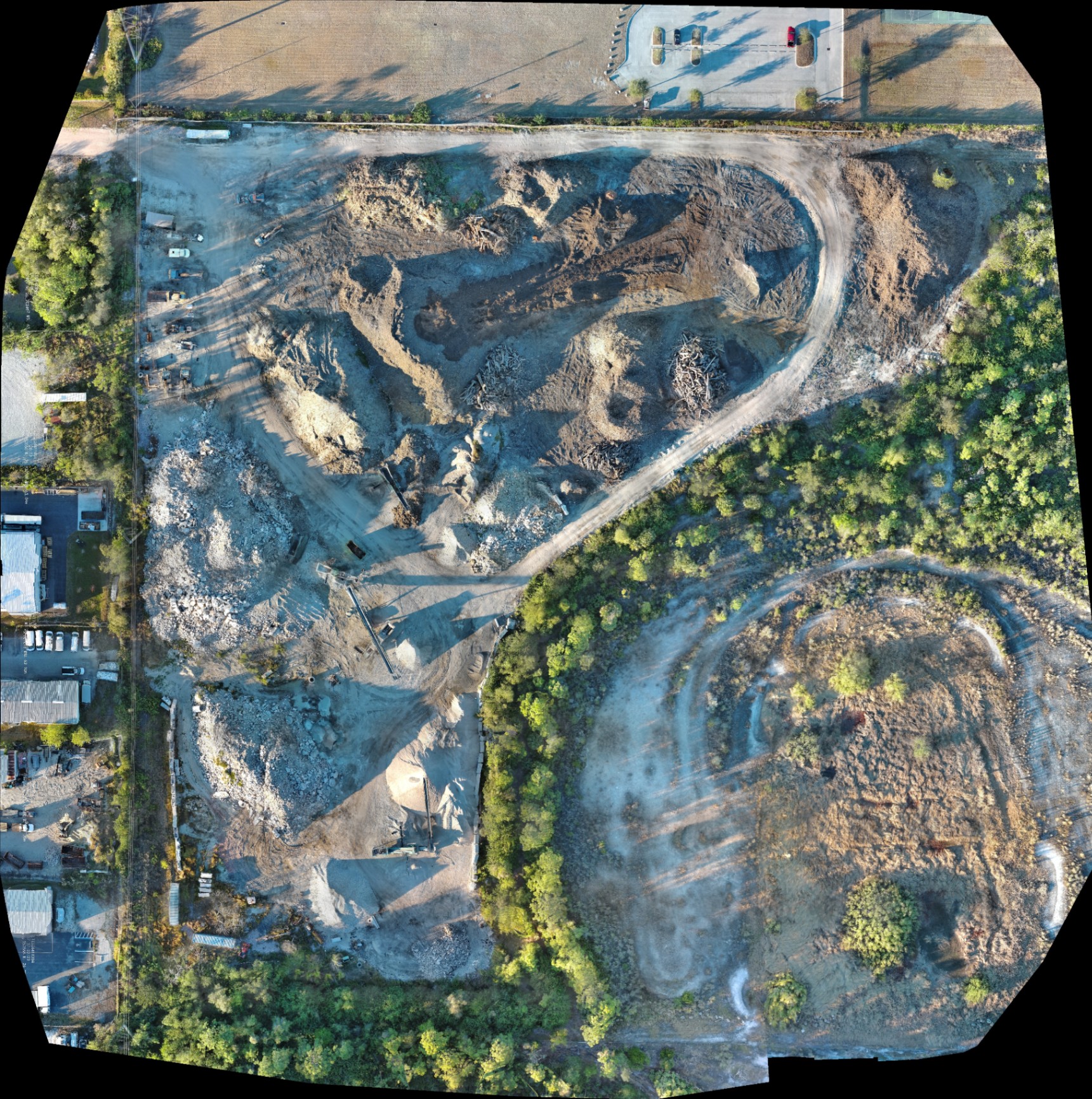
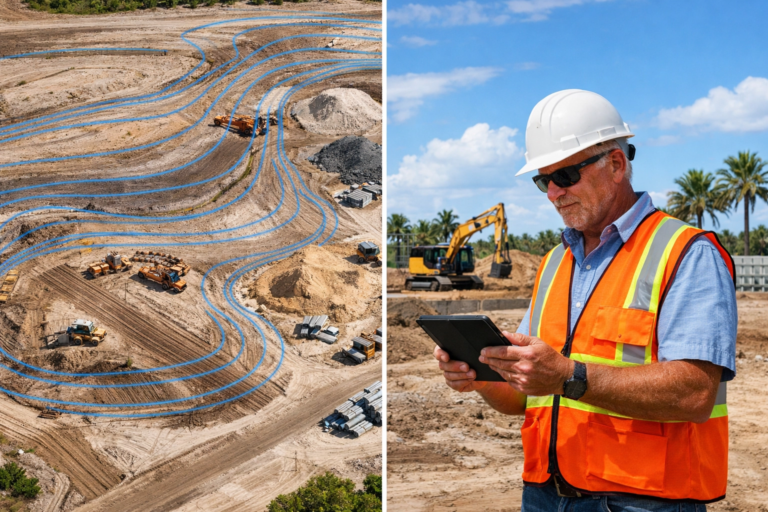
Orthomosaic mapping stitches hundreds of aerial images into a single, georeferenced visual record of the entire site. Unlike traditional site photography, orthomosaics eliminate perspective distortion: every pixel maintains consistent scale, enabling accurate overlay comparisons against design plans. This creates a feedback loop that identifies deviations early, when corrections cost hundreds instead of thousands.
Real-Time Progress Verification
Weekly orthomosaic flights document progress in a format that's immediately comparable. Superintendents overlay the current week's image against last week's baseline and the original grading plan: deviations appear instantly. A retention pond that's three feet short of spec becomes visible before the liner installation begins. A building pad that's rotated two degrees off-axis gets corrected before the foundation contractor mobilizes.
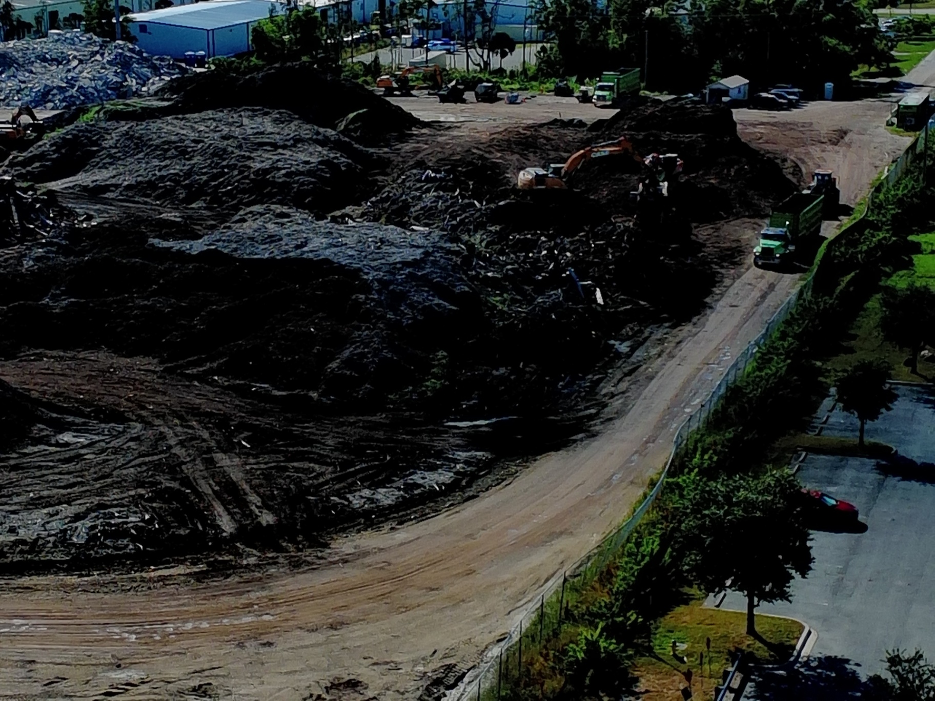
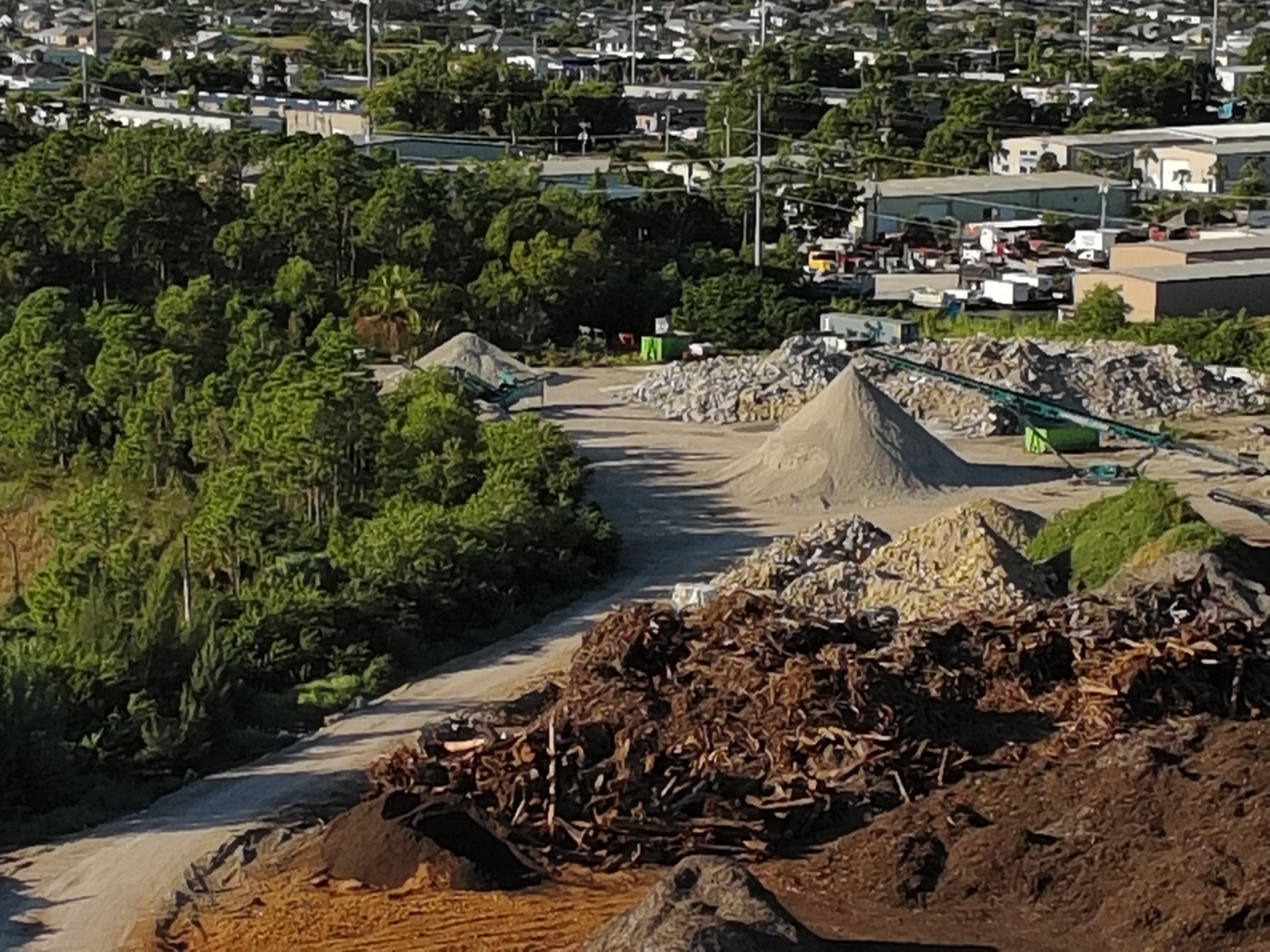
This visual verification extends beyond earthwork. Orthomosaics reveal stockpile placement that blocks future access routes, equipment staging that conflicts with utility corridors, and erosion control measures that have failed: all issues that lead to rework if left unaddressed.
Early Issue Identification Through Baseline Comparison
The power of orthomosaic documentation lies in its temporal precision. Each flight creates a time-stamped record that becomes the baseline for the next inspection cycle. When site conditions deviate from design, the comparison reveals it immediately: not weeks later when a surveyor spots the problem or months later when the next trade arrives and can't proceed.
Consider cut-and-fill operations in Cape Coral's variable soil conditions. A contractor's in-house GPS may show grade compliance, but an independent orthomosaic: overlaid with design contours: reveals low spots that will require additional fill. Catching this during earthwork costs the price of material and equipment time. Catching it after utilities and paving requires excavation, reinstallation, and schedule delays.
Coordination and Conflict Resolution
Construction sites operate through sequential dependencies: each trade builds on the previous trade's work. When Trade A's installation deviates from plan, Trade B either adapts (introducing its own deviation) or stops work (introducing delay). Orthomosaics eliminate the information gap that causes these cascading failures.
A weekly orthomosaic shared across all trades creates a common visual reference that reduces RFIs and coordination conflicts. The electrical contractor sees exactly where the plumbing rough-in was installed. The paving contractor confirms curb locations before mobilizing equipment. The landscaping crew validates drainage swales before ordering materials. Everyone works from the same accurate picture of current site conditions.
The 50MP Visual Camera Advantage: Resolution That Reveals Detail
Cape UAV's primary platform: the Autel EVO Lite 640T: pairs a 640×512 thermal sensor with a 50-megapixel visual camera that captures construction detail at a level traditional site documentation can't match. This resolution matters when identifying the small deviations that grow into large rework costs.
What 50MP Resolution Captures
At typical construction mapping altitudes, the EVO Lite 640T's 50MP camera delivers sub-centimeter ground sample distance: sufficient resolution to identify rebar spacing, formwork alignment, and material placement accuracy. Zooming into sections of the orthomosaic reveals bolt patterns, joint details, and surface finish quality without requiring additional flights or manual inspection.
This detail density supports multiple use cases from a single flight. The same orthomosaic used for progress verification also documents pre-existing conditions for dispute resolution, confirms material deliveries for payment applications, and provides marketing-quality imagery for stakeholder updates. One data capture serves site management, project controls, and client communication simultaneously.
Processing Speed and Data Quality
The 50MP sensor generates large image files: each photo contains significant detail: but modern photogrammetry software converts these datasets into orthomosaics within hours, not days. For active construction sites in Fort Myers and Cape Coral where conditions change rapidly, this processing speed maintains the value of the documentation. Data captured Monday becomes actionable intelligence Tuesday, when there's still time to adjust before the week's work is complete.
High-resolution imagery also improves the accuracy of derivative products. Volumetric calculations for stockpiles and excavations rely on surface models generated from the orthomosaic: more visual detail creates more accurate 3D reconstruction, which produces more reliable volume measurements. When material costs represent 40–50% of project budgets, accurate quantity tracking prevents over-ordering and reduces waste.
Southwest Florida Construction Considerations
Southwest Florida's construction environment introduces specific challenges that amplify the value of frequent orthomosaic documentation. Understanding these regional factors helps project teams anticipate where rework risks concentrate.
Wet Season Site Management
Cape Coral and Fort Myers experience significant rainfall from June through September: precipitation that transforms site conditions rapidly. A grading plan that provides adequate drainage in March may create ponding issues by July. Traditional monthly surveys capture these changes too slowly to prevent water-related damage to completed work.
Weekly orthomosaic flights during wet season document drainage performance in real-time. Superintendents identify pooling water, eroded swales, and failed sediment control before they compromise structural foundations or require rework of hardscape elements. The visual record also supports insurance claims and establishes accountability when weather impacts delay recovery or damage existing installations.
Rapid Development Pressure
Southwest Florida's development pace creates schedule compression: projects that would receive 12-month timelines in other markets get completed in 8–10 months here. This acceleration increases coordination complexity and raises rework risk when trades work in closer proximity or overlap traditional sequences.
High-resolution orthomosaics create the shared situational awareness that fast-track projects require. When multiple trades work simultaneously, the visual documentation confirms each crew's progress and position: reducing conflicts, preventing duplicate work, and eliminating the delays that occur when one trade blocks another's access or damages recently completed installations.
ROI Through Rework Reduction: The Financial Case
The cost of drone mapping services represents a fraction of potential rework expenses: typically 0.1–0.3% of total construction costs. The value emerges when that modest investment prevents even a single significant rework event.
Quantifying Rework Savings
Consider a 10-acre commercial development in Cape Coral with a $4 million construction budget. Weekly orthomosaic documentation costs approximately $2,000–$3,000 per month over a 10-month timeline: $20,000–$30,000 total. If that documentation prevents one major grading rework ($40,000), one utility relocation ($25,000), and three minor corrections ($5,000 each), the net savings exceed $50,000: a 2:1 return before accounting for schedule protection.
The ROI improves on larger projects or longer timelines. A 50-acre land development tracked over 18 months might invest $60,000 in orthomosaic documentation while preventing $200,000+ in rework costs. The documentation also supports faster payment approvals, reduces disputes with subcontractors, and provides liability protection when scope questions arise.
Beyond Direct Rework Costs
The financial benefits extend beyond avoided rework expenses. Orthomosaic documentation reduces schedule risk by identifying problems during weekly review cycles rather than through crisis discovery. Each week a problem goes undetected adds cost: labor stands idle, equipment sits unused, subsequent work proceeds incorrectly. Early detection through visual documentation compresses the problem-to-solution timeline, minimizing indirect costs.
The imagery also improves estimating accuracy for future phases or projects. Actual construction progress: documented through orthomosaics: reveals where estimates diverged from reality, supporting more accurate budgeting and reducing contingency requirements. Over multiple projects, this feedback loop compounds ROI by reducing overall project risk.
Implementation for Construction Teams
Integrating orthomosaic documentation into construction workflows requires minimal disruption: flights occur during non-working hours or coordinated around active operations. The data delivery happens through standard formats compatible with existing project management platforms.
Weekly Documentation Cycles
Most construction projects benefit from weekly orthomosaic flights scheduled for consistent days: typically Monday mornings before crews arrive. This rhythm creates comparable datasets (same day of week, same time) and minimizes site disruption. The resulting orthomosaic is processed and delivered within 24 hours, ready for Tuesday progress meetings.
For projects with critical sequences or accelerated schedules, mid-week supplemental flights document specific phases: foundation pours, major equipment installations, or utility rough-ins: providing additional verification points without waiting for the next weekly cycle.
Data Integration and Access
Orthomosaic deliverables integrate with common construction software platforms through standard georeferenced formats. Project teams access the imagery through cloud-based viewers that support overlay comparisons, measurement tools, and annotation capabilities. Superintendents, engineers, and subcontractors view the same data simultaneously: eliminating version control issues and ensuring everyone works from current information.
The visual nature of orthomosaic data reduces training requirements. Unlike complex survey deliverables that require specialized interpretation, orthomosaics communicate site conditions intuitively. A superintendent without GIS experience can overlay the current week's image against design plans and identify deviations: no specialized software knowledge required.
Important Disclaimer
Our data is for planning purposes and is not a substitute for a licensed land survey. Orthomosaic imagery and derived measurements support construction documentation and progress monitoring but do not establish legal boundaries or replace professional surveying for regulatory compliance.
Important Disclaimer: Our data is for planning purposes and is not a substitute for a licensed land survey.
High-resolution orthomosaic mapping transforms construction progress documentation from periodic snapshots into continuous visual verification: catching deviations early, supporting coordination across trades, and preventing the costly rework that erodes project margins. For Southwest Florida construction teams operating under development pressure and seasonal weather challenges, this documentation provides the clarity needed to keep projects on specification and on budget. Learn more about drone mapping services for construction applications.