In the competitive luxury real estate markets of Cape Coral, Fort Myers, and Sanibel, visual storytelling is no longer an optional upgrade: it is the baseline for high-end transactions. Premium properties demand premium perspectives that standard photography simply cannot deliver. At Cape UAV, we utilize the highest tier of enterprise technology to ensure every listing reflects its true value from the moment it hits the market.
High-resolution aerial imaging provides more than just a "bird's-eye view": it offers a comprehensive data set that influences buyer psychology and streamlines the closing process. By deploying the Autel EVO Lite 640T, we provide our clients with 50MP visual clarity that captures the fine details of Southwest Florida’s most prestigious estates. This technical edge translates directly into a measurable return on investment for homeowners and listing agents alike.
Capture the Unseen Details with 50MP Clarity
The difference between a standard consumer drone and an enterprise-grade platform is immediately visible in the final asset quality. Most consumer drones rely on smaller sensors that struggle with the high-contrast environments typical of Florida’s bright coastal landscapes. Our primary platform: the Autel EVO Lite 640T: features a 1/2-inch CMOS 50MP visual camera designed specifically for professional-grade marketing assets.
Why does 50MP resolution matter for luxury real estate? It allows for significant "digital zoom" and cropping without the loss of image integrity: meaning a single high-altitude shot can be repurposed into several detailed close-ups. From the intricate Mediterranean tile work on a roof in Sanibel to the custom pavers of a Cape Coral pool deck, every texture is rendered with absolute precision.
Accelerate the Sales Cycle and Reduce Days-on-Market
Time is the most expensive variable in any real estate transaction. Properties listed with professional aerial imagery sell 68% faster than those relying solely on ground-based photography: an essential statistic for agents managing high-value portfolios in Southwest Florida. By providing a clear sense of scale and location, high-resolution visuals eliminate the "visualization gap" that often stalls a buyer’s decision-making process.
The ROI of High-Resolution Visuals:
- Reduced Friction: Buyers can assess the property’s relationship to the waterfront, neighboring lots, and local amenities before the first showing.
- Increased Perceived Value: High-end visuals signal a high-end property: allowing for price premiums of up to 10% in some luxury segments.
- Global Reach: For out-of-state or international buyers looking at Fort Myers or Sanibel, 50MP imagery provides the confidence needed to make an offer sight-unseen.
Navigate the Southwest Florida Waterfront Market
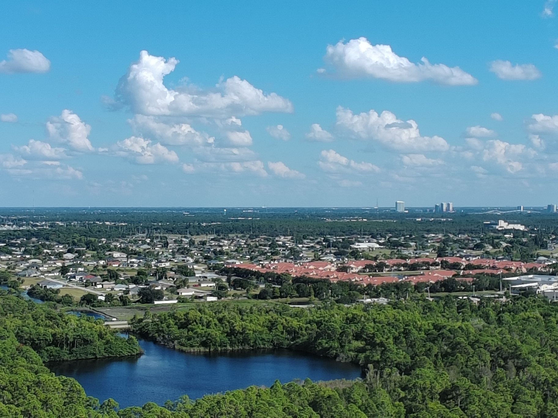
Southwest Florida is defined by its water. Whether it is the vast canal systems of Cape Coral or the Gulf-front estates of Sanibel, the property’s proximity to the water is its primary selling point. Standard photography often fails to capture the complexity of seawalls, boat lifts, and navigation paths that are critical to a luxury buyer’s checklist.
Our aerial imaging highlights these features with technical precision: mapping out the dockage capabilities and deep-water access that define the SWFL lifestyle. We capture the property in its full environmental context, showing the path from the backyard to the open water. This transparency builds trust with potential buyers, as they can clearly see the condition of the waterfront infrastructure.

Elevate Marketing with Professional-Grade Assets
Quality marketing is a game of pixels and lighting. To achieve the crisp, professional look required for luxury brochures and digital listings, we shoot in RAW format to retain the maximum amount of image data. This allows for sophisticated post-processing: including precise color correction, sky replacements for that perfect Florida sunset, and object removal to ensure the property looks its absolute best.
The technical specifications of our 50MP camera ensure that these assets remain sharp even when printed on large-format signage or high-gloss magazines. When you choose Cape UAV, you aren't just getting "photos": you are receiving a suite of high-fidelity visual data points designed to dominate the MLS and social media platforms.
| Feature | Standard Drone (12MP) | Cape UAV Enterprise (50MP) |
|---|---|---|
| Image Detail | Basic clarity; pixelation when zoomed | Crystalline detail; supports large prints |
| Sensor Size | 1/2.3-inch or smaller | 1/2-inch CMOS Enterprise Grade |
| Low Light Performance | Noisy images in shadows | Superior dynamic range and clarity |
| Post-Processing | Limited editing flexibility | Full RAW data for professional grading |
| Marketing Impact | Average engagement | High-impact, "Precision From Above" |
Strategic Planning for Land Development
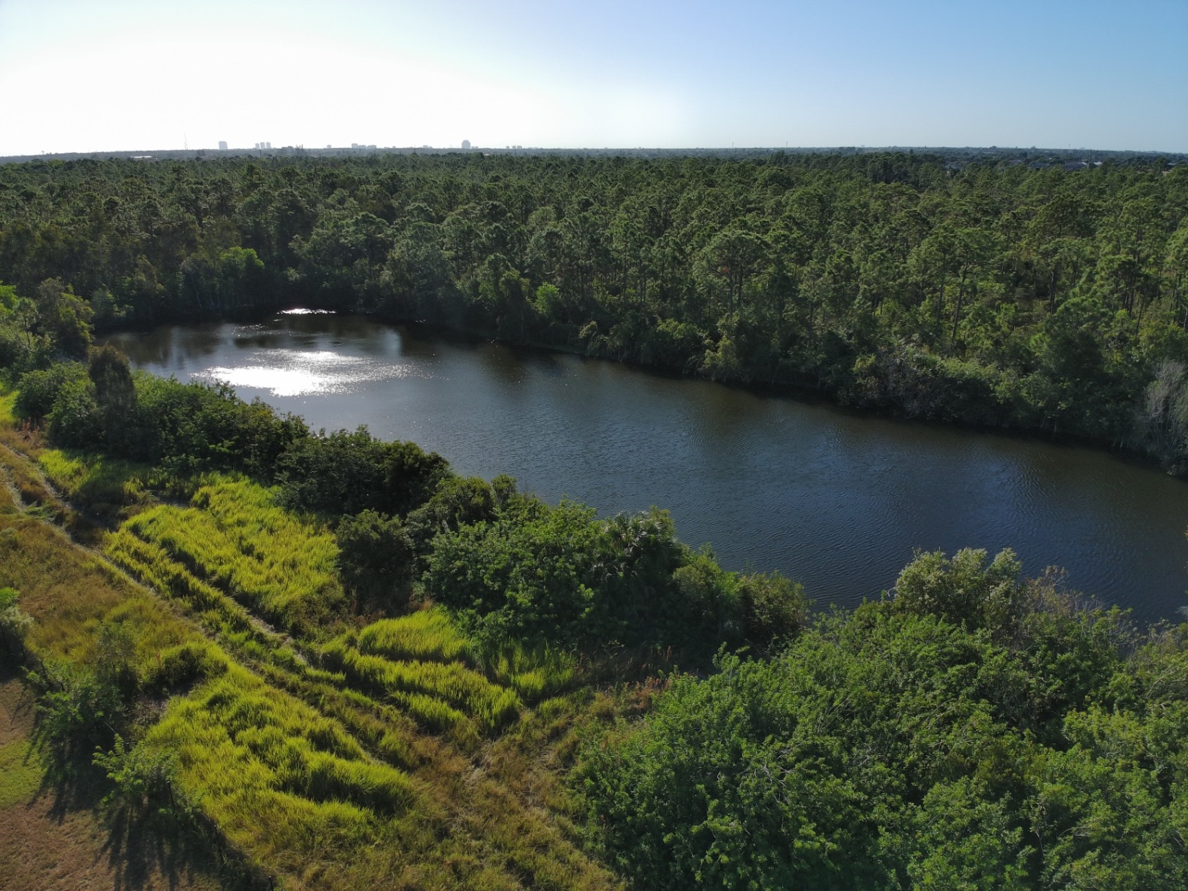
Beyond the immediate sale, high-resolution imaging is a vital tool for land development and estate planning in Southwest Florida. Large-acreage properties or new construction sites in the Fort Myers area benefit from our ability to document current site conditions with extreme clarity. While we provide these visuals for planning and documentation purposes, the level of detail captured by the 50MP sensor is unmatched for visualizing topography and vegetation.
This level of detail helps developers and owners identify the best buildable areas, plan for landscaping, and monitor construction progress without the need for frequent site visits. Our imaging provides a permanent, high-resolution record of the property at every stage of its lifecycle.
Precision From Above: The Cape UAV Advantage
At Cape UAV, we believe that luxury real estate deserves more than just a standard camera in the sky. Our approach combines technical expertise with a deep understanding of the local Southwest Florida market. We don't just fly; we strategically capture the angles and details that highlight the unique architectural and environmental features of every property we service.
Using enterprise-level equipment like the Autel EVO Lite 640T ensures that we deliver consistent, high-quality results regardless of the complexity of the project. This commitment to precision is what sets us apart and helps our clients close deals faster and with greater confidence.
Integrating Technical Excellence into Every Mission
The Autel Robotics EVO Lite 6T Enterprise (EVO Lite 640T) is more than just a camera platform: it is a dual-purpose tool. While this article focuses on the 50MP visual capabilities for real estate marketing, the same platform features a 640×512 thermal sensor. This allows us to offer additional value to luxury homeowners, such as identifying thermal anomalies in roofing or insulation during the inspection phase.
By leveraging enterprise hardware, we provide a level of data-depth that consumer-grade services simply cannot match. Whether it is for high-end marketing or preliminary property assessment, our technology delivers the clarity needed for informed decision-making.
Important Disclaimer
Our data is for planning purposes and is not a substitute for a licensed land survey. Thermal results indicate anomalies and are not a substitute for evaluation by a licensed professional.
Autel Robotics is a trademark of its respective owner; Cape UAV is not affiliated with or endorsed by Autel Robotics. Results depend on environmental conditions and specific property characteristics.
Why High-Resolution Visuals Are the New Standard
The luxury market in Southwest Florida is evolving. Buyers are more informed, more selective, and more reliant on digital discovery than ever before. To stand out, a listing must offer an immersive experience that conveys quality, luxury, and "Precision From Above."
By investing in 50MP aerial imaging, you are not just buying a service: you are investing in a high-speed sales tool. High-resolution visuals reduce time-on-market, increase buyer engagement, and provide the professional finish that Southwest Florida’s luxury market demands. Contact Cape UAV today to elevate your next listing with the technical precision it deserves.
Important Disclaimer
Our data is for planning purposes and is not a substitute for a licensed land survey. Thermal results indicate anomalies and are not a substitute for evaluation by a licensed professional.