In the luxury real estate market, first impressions are no longer made at the front door: they happen on a high-resolution screen. High-resolution aerial visuals have shifted from a "nice-to-have" add-on to a fundamental requirement for high-end listings. When dealing with multi-million dollar estates, standard ground-level photography fails to communicate the full scope of the investment.
At Cape UAV, we utilize enterprise-grade technology to bridge the gap between a simple listing and an immersive visual narrative. By leveraging 50MP visual sensors, we provide clarity that allows potential buyers to inspect the fine details of a property before they ever set foot on the grounds.
The Technical Edge: Why 50MP Resolution Matters
In luxury marketing, the difference between "good" and "exceptional" lies in the pixel count. Most consumer drones capture images that look acceptable on a smartphone but fall apart when displayed on large monitors or in high-quality print brochures.
We utilize the Autel Robotics EVO Lite 6T Enterprise (EVO Lite 640T), which features a 50MP visual camera. This high-resolution sensor captures granular detail: the texture of a slate roof, the precision of custom stonework, and the clarity of expansive landscaping: without the digital noise or blur found in lower-end equipment.
Why This Matters:
- Digital Zoom Capability: High-resolution files allow agents to crop into specific architectural features while maintaining crispness.
- Print Readiness: 50MP images provide the density required for large-format marketing materials and luxury lifestyle magazines.
- Perceived Value: High-fidelity visuals signal to the buyer that the property is a premium asset, justifying the asking price through professional presentation.
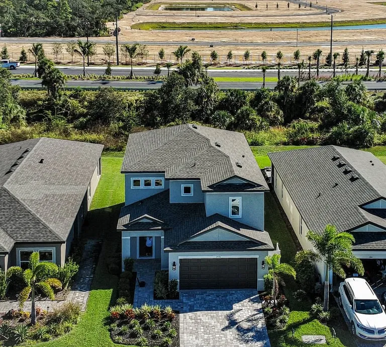
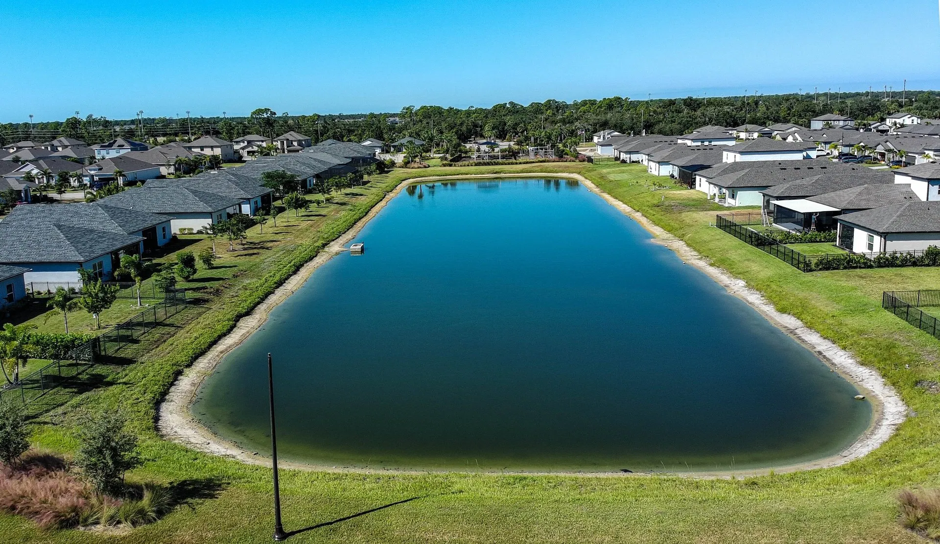
Defining Property Context and Scale
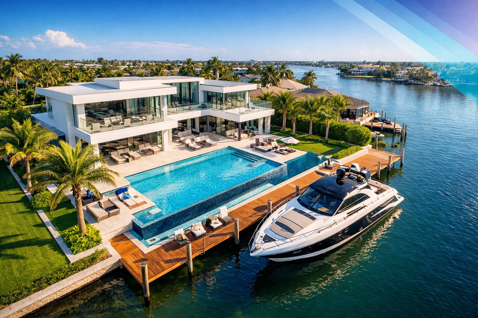
Luxury properties are defined as much by their surroundings as by the structures themselves. A ground-level photo of a backyard cannot capture the relationship between a custom infinity pool, the guest house, and the private waterfront access. Aerial visuals provide the necessary context that traditional photography lacks.
By providing a bird’s-eye perspective, we reveal the property's layout in its entirety. This includes highlighting lot boundaries, the proximity to local amenities (like golf courses or private docks), and the overall neighborhood aesthetic.
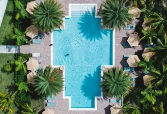
Visualizing Amenities
For properties featuring resort-style amenities, the overhead perspective is the only way to demonstrate the scale of the investment.
- Custom Landscaping: Showcases the geometric precision of manicured gardens.
- Outdoor Living Spaces: Captures the flow between indoor kitchens and outdoor entertainment areas.
- Water Features: Highlights the clarity and design of pools, ponds, and fountains.
Comparison: Traditional vs. High-Resolution Aerial Marketing
| Feature | Traditional Ground Photography | High-Resolution Aerial (50MP) |
|---|---|---|
| Perspective | Limited to eye-level or slightly elevated. | Unlimited angles, from 10ft to 400ft. |
| Context | Focuses on individual rooms/features. | Shows property relationship to the environment. |
| Detail | Variable; often limited by lens quality. | 50MP clarity for extreme detail retention. |
| Engagement | Standard; expected by all buyers. | High; captures attention in crowded feeds. |
| Information | Subjective feel of the home. | Objective view of roof, lot, and layout. |
Creating an Immersive Narrative for Out-of-State Buyers
The luxury market in Southwest Florida frequently attracts international and out-of-state investors. These buyers often make "shortlist" decisions based entirely on digital content. High-resolution real estate drone photography serves as a virtual site visit, providing the confidence needed to move forward with a purchase or schedule a flight for an in-person viewing.
Aerial videography further enhances this narrative by adding motion. Cinematic fly-overs create an emotional connection, guiding the viewer through the property as if they were walking the grounds themselves. This storytelling approach identifies opportunities for the buyer to visualize their lifestyle within the space: whether that involves launching a boat from a private lift or hosting events on an expansive terrace.
Safety, Compliance, and Technical Professionalism
Marketing a luxury asset requires a team that understands the importance of risk management. Using an uncertified neighbor or an uninsured hobbyist puts both the agent and the property owner at legal and financial risk.
At Cape UAV, all missions are handled by fully insured, FAA Part 107–certified Remote Pilots. This ensures that every flight is conducted within federal regulations, respecting privacy and safety protocols. Furthermore, our use of enterprise equipment like the EVO Lite 6T means we have the stability and redundancy needed to operate in the unique coastal conditions of Florida.
The Cape UAV Standard:
- FAA Compliance: All pilots are Part 107 certified for commercial operations.
- Insurance: Comprehensive liability coverage for every flight.
- Technical Redundancy: Enterprise-grade hardware ensures consistent performance.
- Data Privacy: Secure handling of all property visual data.
ROI Advantage: Why High-Resolution Visuals Pay for Themselves
The investment in professional drone services is directly tied to the speed and value of the sale. In a competitive market, listings that feature high-quality aerial content consistently outperform those without.
- Reduced Days on Market: Properties with aerial views typically see higher click-through rates on listing sites, leading to faster inquiries and showings.
- Higher Perceived Quality: High-resolution imagery supports a premium brand image for the listing agent, helping to attract future high-net-worth clients.
- Comprehensive Documentation: Beyond marketing, these visuals provide a high-resolution record of the property’s condition at the time of listing, which can be useful during the due diligence phase.
ROI Statement: By spending a fraction of the commission on elite visual assets, agents can identify opportunities to increase buyer competition, often resulting in higher final offer prices and a significantly shorter sales cycle.
Beyond Marketing: Technical Inspections for Luxury Estates
While the primary goal is marketing, our enterprise equipment also supports the technical side of property management. The Autel Robotics EVO Lite 6T includes a 640×512 thermal sensor, which can be used to identify anomalies that the naked eye might miss.
For property developers and managers, this technology is invaluable for identifying heat signatures that may suggest moisture intrusion or insulation gaps. While this is separate from the aesthetic marketing photos, it adds a layer of technical sophistication to the services we provide, ensuring that a luxury property is as sound as it is beautiful.
Important Disclaimer
Disclaimer: Thermal imaging and mapping data are for informational and inspection support purposes only. Cape UAV does not provide licensed land surveying or engineering services. Our data is for planning purposes and is not a substitute for a licensed land survey. Thermal results indicate anomalies and are not a substitute for evaluation by a licensed professional.
Elevate Your Listings with Cape UAV
In the world of luxury real estate, mediocre visuals are a liability. High-resolution 50MP aerial photography provides the clarity, context, and "wow factor" necessary to move high-value assets in today’s digital-first market.
Whether you are an agent looking to differentiate your brand or a developer documenting a new project, the technical precision of Cape UAV ensures your property is seen in the best possible light, literally.
For more information on how we can support your next project, visit our FAQ or contact us directly to discuss your specific needs.
Important Disclaimer
Disclaimer: Thermal imaging and mapping data are for informational and inspection support purposes only. Cape UAV does not provide licensed land surveying or engineering services. Our data is for planning purposes and is not a substitute for a licensed land survey. Thermal results indicate anomalies and are not a substitute for evaluation by a licensed professional.