Do You Really Need a Licensed Drone Pilot? The Risks of DIY Aerial Visuals
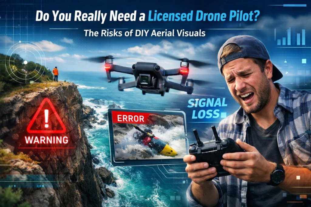
The Federal Aviation Administration (FAA) maintains a strict regulatory distinction between recreational drone use and commercial operations. For businesses in […]
The Federal Aviation Administration (FAA) maintains a strict regulatory distinction between recreational drone use and commercial operations. For businesses in […]
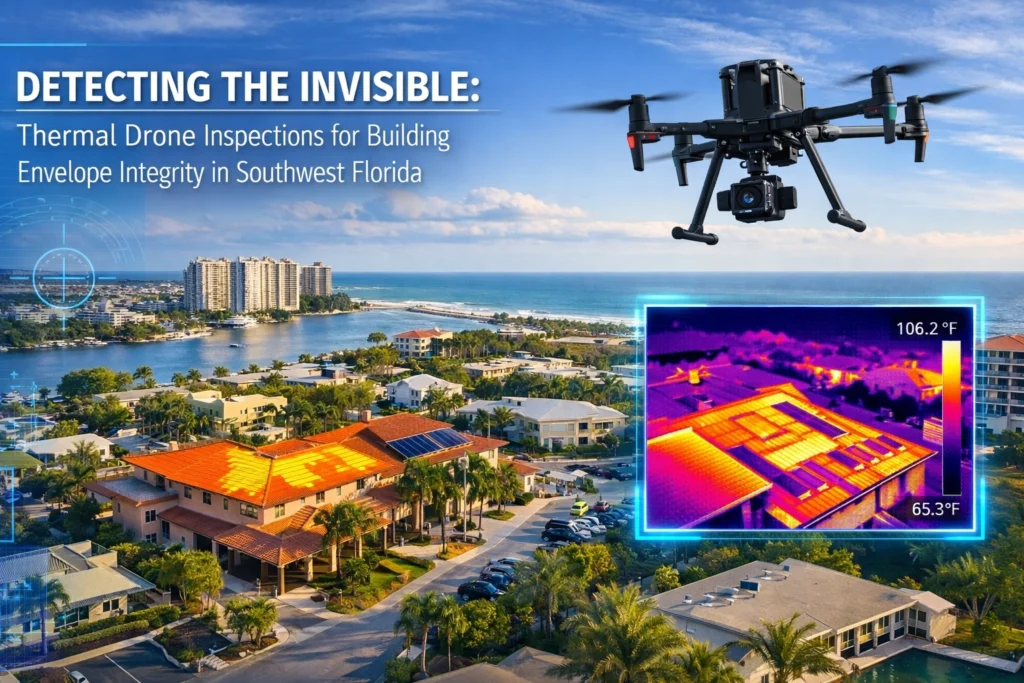
Thermal drone inspections use infrared cameras mounted on unmanned aircraft to detect temperature variations across building envelopes: revealing hidden moisture
Thermal imaging reveals what the naked eye cannot: subsurface moisture, electrical hot spots, and insulation gaps that compromise building integrity.
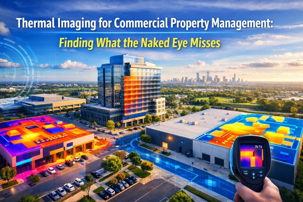
Commercial property management relies on the ability to identify risks before they manifest as catastrophic failures. Traditional visual inspections: relying
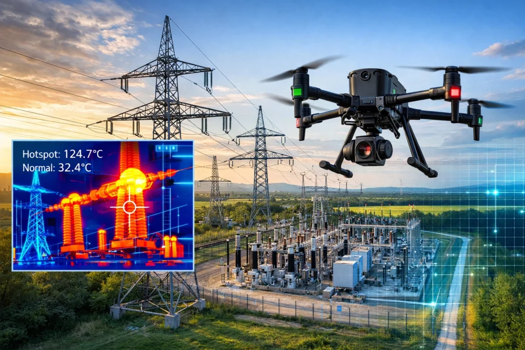
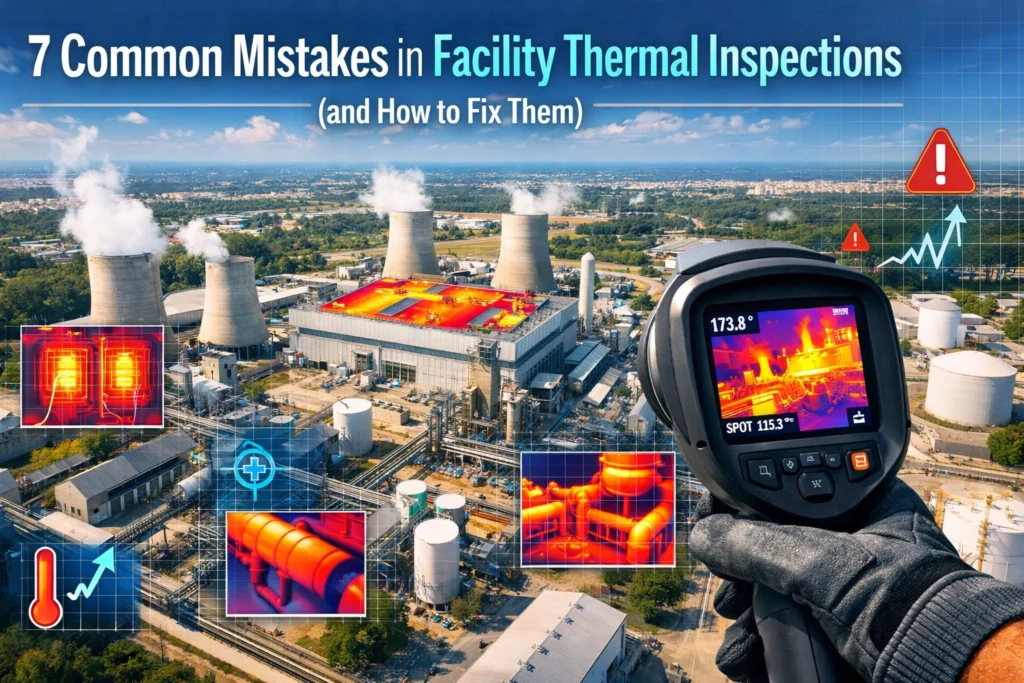
Thermal imaging represents the most critical advancement in utility maintenance since the introduction of the digital multimeter. By capturing the
Thermal imaging uses infrared technology to detect heat signatures invisible to the naked eye: revealing equipment problems, structural weaknesses, and
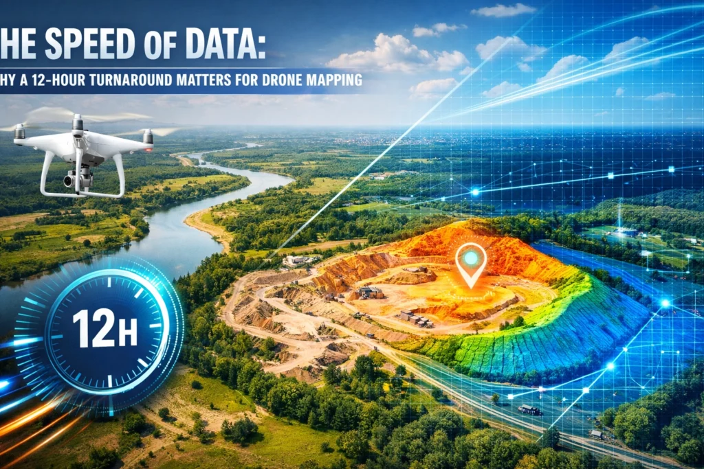
A 12-hour turnaround for drone mapping transforms site data from a documentation tool into an active decision-making resource. When a
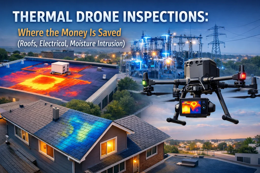
Most costly failures begin as invisible issues. Water penetration behind intact roofing membranes. Overheating electrical connections that haven't arced yet.
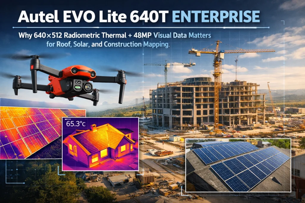
Commercial drone services live or die on image quality. When you're documenting a 200,000-square-foot roof membrane, mapping a 40-acre construction
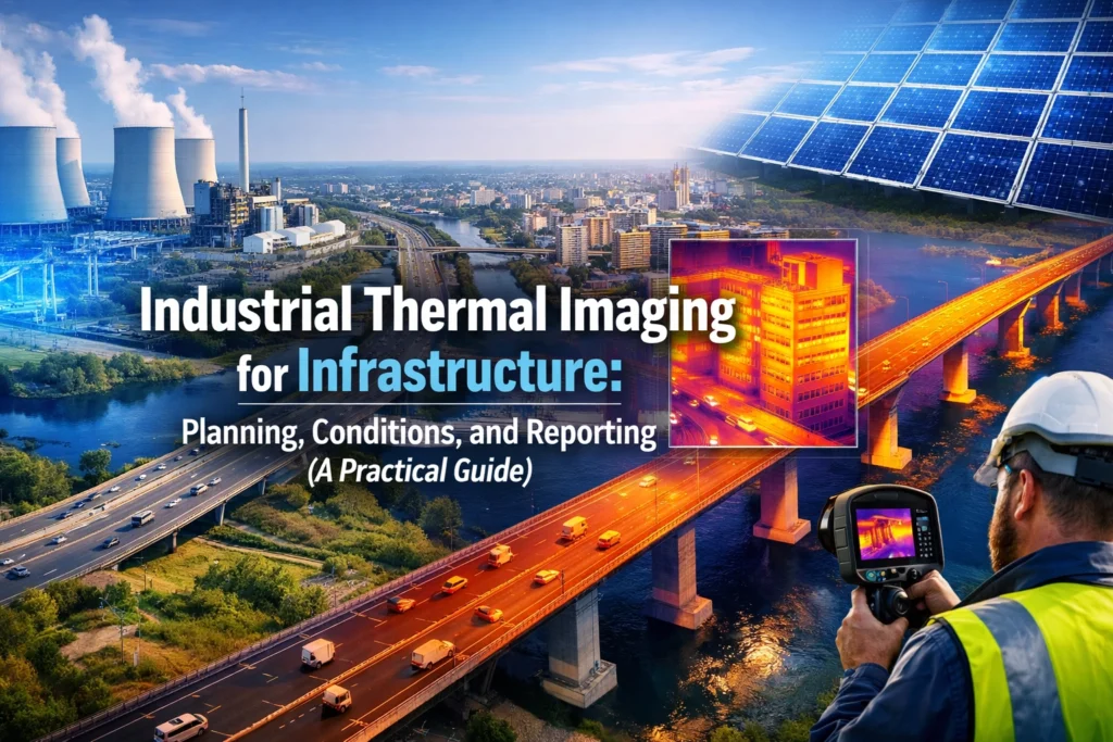
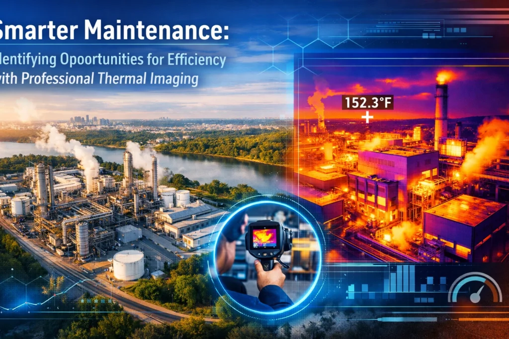
Industrial thermal imaging detects temperature anomalies before they become failures. Electrical faults, insulation breakdowns, moisture intrusion, and mechanical stress all