
If you are a property manager in Cape Coral or a construction site lead in Southwest Florida, you’ve likely seen drones buzzing around. You might even have a nephew with a high-end consumer drone who offered to "get some shots" for your next project. It’s a tempting offer: it’s fast, it’s cheap, and the photos look "fine."
But here is the reality of the situation: If you are using those images for any business purpose, you aren't just cutting corners: you are operating outside of federal law. In the eyes of the FAA, there is no "grey area" when it comes to commercial drone operations.
At Cape UAV, we believe in transparency. Whether you’re looking for high-resolution aerial photography for a luxury listing or a thermal inspection of a commercial roof, understanding the value of an FAA Part 107 certified pilot is the first step in protecting your investment and your liability.
The Legal Distinction: Work vs. Play
The FAA is very clear on this. If the flight is in any way connected to a business, a Remote Pilot Certificate (Part 107) is mandatory. This includes:
- Real estate photography for a listing.
- Inspecting a roof for a client.
- Creating a map for a construction site.
- Documenting progress for a developer.
Operating without a Part 107 certificate doesn't just put the pilot at risk; it puts the hiring company at risk. Fines from the FAA can reach tens of thousands of dollars per violation. More importantly, most commercial insurance policies will not cover damages or accidents if the operator was unlicensed.
The ROI Advantage: Compliance Equals Protection
Hiring a certified professional isn't just about following the rules: it’s about risk mitigation. A Part 107 pilot understands airspace restrictions around regional airports like RSW or APF and knows how to legally obtain LAANC (Low Altitude Authorization and Notification Capability) clearances to fly where others can't.

The Equipment Gap: Consumer vs. Enterprise
While most consumer drones are great for vacation photos, they lack the sensors required for professional-grade data. At Cape UAV, our primary technical platform is the Autel Robotics EVO Lite 6T Enterprise (also known as the EVO Lite 640T).
Why does the hardware matter? Because professional services require professional data. Our enterprise systems feature:
- Dual-Sensor Payloads: We can capture 50MP visual imagery and high-resolution thermal data simultaneously.
- 640×512 Thermal Resolution: Most consumer "thermal" drones use low-resolution sensors that offer little more than "heat blobs." Our sensors provide enough detail to identify individual moisture pockets or failing electrical components.
- Advanced Signal Stability: Enterprise drones are built to handle the RF interference often found on construction sites and industrial facilities.
Note: Autel Robotics is a trademark of its respective owner; Cape UAV is not affiliated with or endorsed by Autel Robotics.
Thermal Imaging: Beyond What the Eye Can See
For property managers and facility owners in Southwest Florida, thermal imaging is the ultimate proactive maintenance tool. We focus on "thermal-first" workflows because they offer the highest immediate ROI by detecting invisible issues before they become catastrophic failures.
The Power of 12um Pixel Pitch
Technical specs matter in thermal. Our equipment utilizes a 12um pixel pitch. In plain English, this means the sensor is incredibly sensitive to minute temperature variations.
Why This Matters to You:
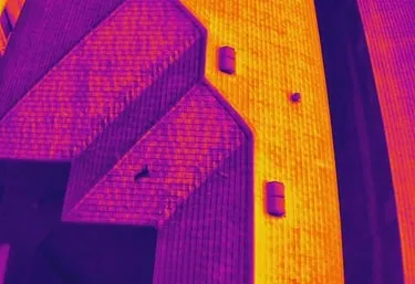
- Sub-Surface Moisture: On a flat commercial roof, we can identify trapped moisture that hasn't yet leaked into the building.
- Solar Array Efficiency: We can detect individual dead cells or bypass diode failures in large-scale solar installations.
- Electrical Hotspots: Identifying a transformer or breaker that is running hot before it blows can save a facility days of downtime.
ROI Advantage: Maintenance Savings
A thermal inspection that identifies a small area of moisture today can prevent a $100,000 full-roof replacement next year. It’s about moving from reactive repairs to proactive asset management.
Precision Mapping and 3D Modeling
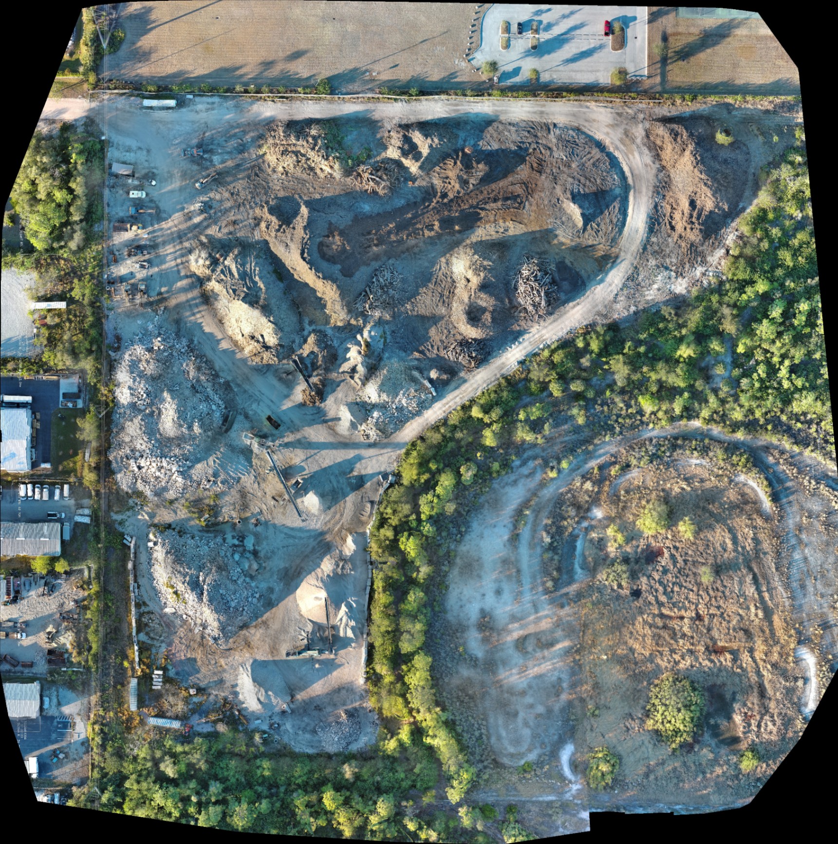
For land development and construction, "eyeballing it" is a recipe for budget overruns. Cape UAV provides high-resolution orthomosaic mapping and 3D modeling that allows project managers to see the entire site with incredible clarity.
Our mapping deliverables include:
- Orthomosaic Maps: Stitched-together images that provide a top-down, high-resolution view of the entire project area.
- 3D Point Clouds: Useful for visualizing terrain and structure heights.
- Digital Surface Models (DSM): Helping teams understand drainage and elevation trends.
Why Professional Mapping Matters:
- Site Planning: Use high-res maps for logistics and equipment staging.
- Stakeholder Communication: Provide visual proof of progress to investors and clients.
- Documentation: Maintain a permanent visual record of underground utility placement before they are buried.
Luxury Real Estate: The 50MP Difference
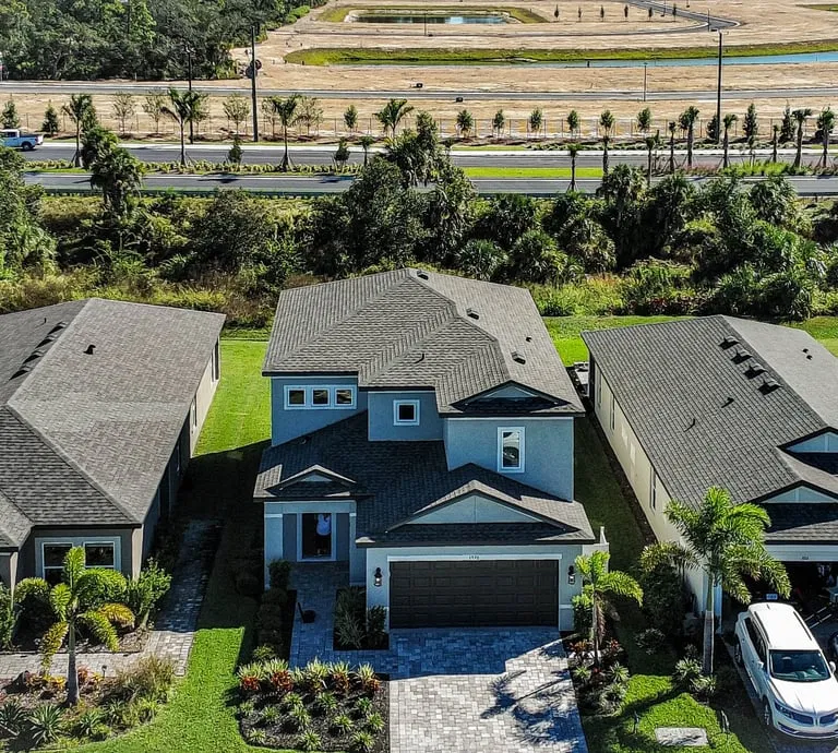
In a market like Cape Coral or Naples, "good enough" photography doesn't cut it. High-end listings require a perspective that captures the lifestyle: the proximity to the water, the layout of the amenities, and the scale of the estate.
Using the 50MP visual sensor on our enterprise platforms, we capture crisp, high-dynamic-range (HDR) imagery that makes properties stand out on the MLS. We don't just take a "top-down" shot; we use professional framing to highlight the flow of the property.
Professional vs. Amateur: The Comparison
| Feature | Amateur/Recreational | Cape UAV (Professional) |
|---|---|---|
| FAA Compliance | Illegal for business use | Fully Part 107 Certified |
| Insurance | Likely none/Limited | Professional Drone Liability |
| Thermal Sensor | Low-res or none | 640×512 with 12um pitch |
| Visual Resolution | 12MP – 20MP | Up to 50MP Enterprise grade |
| Airspace Mastery | Limited knowledge | LAANC authorized & compliant |
| Deliverables | Raw photos/videos | Maps, 3D models, Thermal reports |
Safety and Insurance: The Invisible Benefit
When you hire a Part 107 pilot, you are hiring someone who has been vetted by the TSA and tested by the FAA on emergency procedures, weather patterns, and aeronautical decision-making.
At Cape UAV, safety isn't a buzzword; it’s our operational foundation. We conduct pre-flight risk assessments for every mission. If the wind is too high or the airspace is restricted, we don't fly. That level of professional discipline is what separates a business service from a hobbyist.
Conclusion: Making the Right Choice
Do you really need an FAA Part 107 pilot? If you care about legal compliance, professional-grade data, and protecting your company from liability, the answer is a resounding yes.
The technical gap between a hobbyist and a professional service like Cape UAV is wide. From the 12um pixel pitch of our thermal sensors to the precise planning capabilities of our orthomosaic maps, we provide the technical edge that Southwest Florida businesses need to succeed.
Whether you're looking to identify heat loss in a commercial building or showcase a waterfront estate, don't leave your project to chance. Partner with a professional who brings the right tools and the right credentials to the job.
Important Disclaimer
Mapping Disclaimer: Our data is for planning purposes and is not a substitute for a licensed land survey.
Thermal Disclaimer: Thermal results indicate anomalies and are not a substitute for evaluation by a licensed professional.
Important Disclaimer
Mapping: Our data is for planning purposes and is not a substitute for a licensed land survey. Thermal: Thermal results indicate anomalies and are not a substitute for evaluation by a licensed professional.