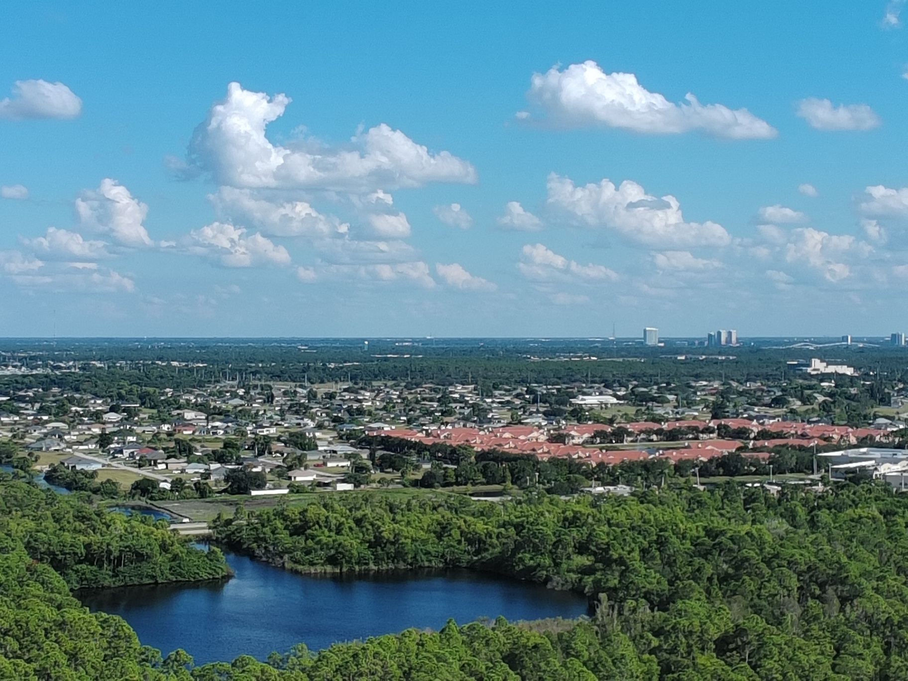
Property management in Southwest Florida operates on a different set of rules than most markets. Between hurricane season, coastal exposure, insurance scrutiny, and a competitive rental market stretching from Fort Myers to Marco Island, documentation isn't optional: it's operational infrastructure. High-resolution aerial imaging provides property managers with the visual evidence, site documentation, and marketing edge needed to manage risk, maintain properties, and secure occupancy in 2026.
Cape UAV delivers enterprise-grade aerial services across the SWFL region using FAA Part 107-certified pilots and professional-grade platforms, including the Autel Robotics EVO Lite 6T Enterprise (EVO Lite 640T) with up to 640×512 thermal resolution and up to 50MP visual imaging. Precision From Above. Insight Beyond Limits.
High-Resolution Aerials: Beyond Standard Property Photos
Property management requires documentation that holds up under insurance review, supports maintenance decisions, and provides defendable records when disputes arise. Standard ground-level photos miss roof conditions, drainage patterns, perimeter fencing, and landscaping compliance across multi-building portfolios.
High-resolution aerial imaging captures:
- Complete roof surface documentation showing shingle condition, ponding water, flashing integrity, and debris accumulation
- Perimeter and boundary verification for fencing, gate access, landscaping boundaries, and common area maintenance
- Parking lot and pavement condition revealing cracks, striping wear, drainage issues, and ADA compliance
- Pool, amenity, and hardscape conditions providing visual records of maintenance status before and after contractor work
- Landscaping and irrigation coverage documenting turf health, tree canopy, and ground coverage across large properties

Each aerial shoot delivers next-day edited imagery in high-resolution formats suitable for insurance submissions, owner reporting, contractor coordination, and legal documentation. Instead of walking properties with a smartphone, property managers receive complete overhead views showing exactly what's happening across every building, amenity, and common area.
Why It Matters
Properties that look well-maintained from the street often hide problems visible only from above. Roof ponding leads to leaks. Drainage failures create erosion. Fencing gaps become liability risks. Aerial documentation catches these issues before they escalate into expensive repairs, insurance claims, or tenant complaints.
Storm Damage Assessment: Post-Hurricane Documentation for SWFL
Southwest Florida property managers operate under constant hurricane exposure. After storm events: whether direct hits or glancing impacts: accurate damage assessment determines insurance claims, repair priorities, and tenant safety decisions. Ground-level inspections miss roof damage, structural shifts, and site-wide debris patterns that inform recovery planning.
Aerial imaging provides complete post-storm documentation within hours of safe flight clearance:
- Roof damage mapping showing missing shingles, lifted flashing, punctures, and standing water
- Structural displacement detection revealing shifted units, compromised supports, or foundation movement
- Debris field documentation capturing fallen trees, scattered materials, and blocked access routes
- Drainage and flooding evidence showing standing water, erosion patterns, and storm surge impact
- Perimeter and fencing damage documenting compromised barriers, gate failures, and security exposures
Property managers submit this visual evidence to insurers immediately, supporting claims with timestamped, high-resolution proof of damage extent. The same imagery guides contractor scoping, helping prioritize repairs based on safety risk and occupancy impact.
ROI Advantage
Insurance adjusters work from documentation. Properties with comprehensive aerial damage records settle claims faster and more completely than those relying on ground photos and written descriptions. One successful claim recovery pays for years of aerial documentation services.
Proactive Maintenance and HOA Enforcement
Property managers enforce covenants, maintain common areas, and coordinate contractor work across dozens: sometimes hundreds: of units. Aerial imaging creates unbiased, timestamped records that document compliance issues, track maintenance completion, and reduce disputes with contractors, owners, and tenants.
Applications include:
- Bylaw and covenant enforcement showing unapproved structures, landscaping violations, or storage infractions
- Contractor completion verification documenting roof replacements, paving work, or landscaping installations before final payment
- Common area maintenance tracking providing before-and-after records of pond cleaning, tree trimming, or irrigation repairs
- Seasonal monitoring capturing property conditions across multiple shoots to track deterioration or improvement trends
Instead of responding to complaints with ground-level photos that miss context, property managers present aerial views showing exactly what exists, where violations occur, and how conditions compare to previous inspections. This documentation reduces arguments and creates defensible enforcement records.
Why This Matters
Disputes cost time. Contractors claim work is complete when it isn't. Owners contest violation notices. Tenants complain about maintenance delays. Aerial documentation removes subjectivity: the image shows what exists, without interpretation or debate.
Marketing Edge: High-Resolution Visuals That Secure Tenants
Vacancy costs property managers revenue and reputation. In competitive SWFL markets: especially seasonal rental markets in Naples, Marco Island, and coastal Fort Myers: properties need visual differentiation. Aerial photography provides prospective tenants with comprehensive views that ground-level shots cannot deliver.
High-resolution aerials showcase:
- Property scale and layout showing building proximity to amenities, water features, and green space
- Neighborhood context revealing nearby beaches, marinas, shopping, and recreational facilities
- Amenity positioning highlighting pools, clubhouses, fitness centers, and outdoor gathering areas
- Landscaping and curb appeal presenting mature trees, manicured grounds, and attractive hardscaping
Properties marketed with professional aerial imagery attract higher-quality inquiries and reduce time-to-lease. Prospective tenants make leasing decisions based on visual appeal and perceived value: aerial shots communicate both immediately.

ROI Advantage
Reducing vacancy by even a few days across a multi-unit property generates revenue that exceeds the cost of professional aerial marketing imagery. Faster leasing, higher rents, and reduced turnover compound annually.
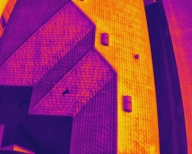
Thermal Imaging for Hidden Issues
Property managers inherit deferred maintenance. Roofs leak without visible damage. HVAC systems fail prematurely. Electrical panels overheat silently. Thermal imaging reveals temperature anomalies invisible to standard inspections, allowing proactive repairs before failures occur.
Thermal inspections detect:
- Roof moisture intrusion showing hidden leaks and insulation failures
- HVAC inefficiency revealing ductwork leaks and equipment malfunctions
- Electrical hotspots identifying overloaded circuits and failing components
- Building envelope deficiencies exposing air leaks and insulation gaps
Advanced Radiometric Reporting Add-On
For properties requiring detailed temperature analysis beyond visual heat maps, Cape UAV offers Advanced Radiometric Reporting: delivering quantitative temperature data extracted directly from high-resolution thermal imagery.
Deliverables include:
- Spot Temperature Measurements: Precise readings at specific points of interest
- Area Analysis: Minimum, maximum, and average temperatures within defined boundaries
- Anomaly Detection: Data-backed identification of thermal variances supporting maintenance planning
Note: Radiometric reporting is an optional deliverable and must be specified in the client's Statement of Work (SOW) prior to flight. All temperature data is captured using enterprise-grade sensors with up to 640×512 thermal resolution.
Important Disclaimer:
Thermal imagery shows surface temperature differences and may indicate anomalies; results vary by site conditions and it is not a substitute for evaluation by a licensed professional. Cape UAV is not affiliated with, sponsored by, or endorsed by Autel Robotics.
Why It Matters
Most property failures begin as invisible issues. By the time leaks, electrical failures, or HVAC breakdowns become obvious, damage has already occurred. Thermal imaging shifts property management from reactive repairs to proactive maintenance, reducing emergency costs and tenant disruption.
Enterprise-Grade Operations Across SWFL
Cape UAV operates across the entire Southwest Florida region: Fort Myers, Cape Coral, Naples, Bonita Springs, Estero, and Marco Island: with FAA Part 107-certified pilots and $1M liability insurance. Flights are conducted using professional-grade platforms that deliver consistent, high-resolution imagery suitable for insurance, legal, and operational purposes.
Operational advantages include:
- Next-day delivery on edited high-resolution imagery for time-sensitive assessments
- Consistent documentation using backend organization systems to track historical shoots and monitor property changes over time
- Regulatory compliance with federal aviation standards and airspace authorization where required
Property managers receive professional imagery they can submit to insurers, present to ownership groups, share with contractors, and use in marketing: without concerns about quality, legality, or liability.
The 2026 Season: Documentation Is Infrastructure
Southwest Florida property management in 2026 requires more than reactive maintenance and standard marketing. Accurate documentation, proactive inspections, and visual differentiation separate properties that thrive from those that struggle with vacancies, insurance disputes, and deferred maintenance crises.
High-resolution aerial imaging provides property managers with the visual infrastructure needed to manage risk, enforce standards, market effectively, and maintain properties year-round. Whether documenting storm damage, verifying contractor work, enforcing covenants, or marketing units, aerial services deliver clarity, confidence, and control.
Cape UAV brings Precision From Above. Insight Beyond Limits. to Southwest Florida property management: combining enterprise-grade platforms, FAA-certified operations, and professional-grade imagery that supports every aspect of property oversight. Learn more about our drone services or contact us to discuss your property management needs.