7 Mistakes You’re Making with Aerial Data (And How to Ensure Precision From Above)
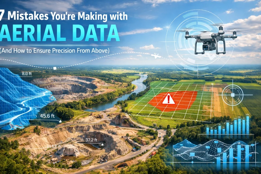
Aerial data precision is defined by the mathematical alignment of digital pixels to real-world coordinates. For construction, land development, and […]
Aerial data precision is defined by the mathematical alignment of digital pixels to real-world coordinates. For construction, land development, and […]
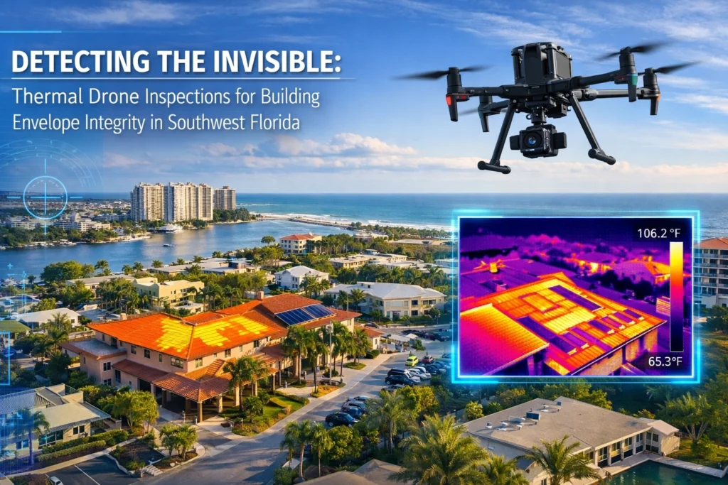
If you manage a commercial facility in Southwest Florida, you know the drill. A tenant calls about a ceiling stain,

Commercial drone operations in the United States are governed by the Federal Aviation Administration (FAA) under Title 14 of the

Construction projects in Southwest Florida are high-stakes environments where even a minor oversight can spiral into a six-figure delay. Whether
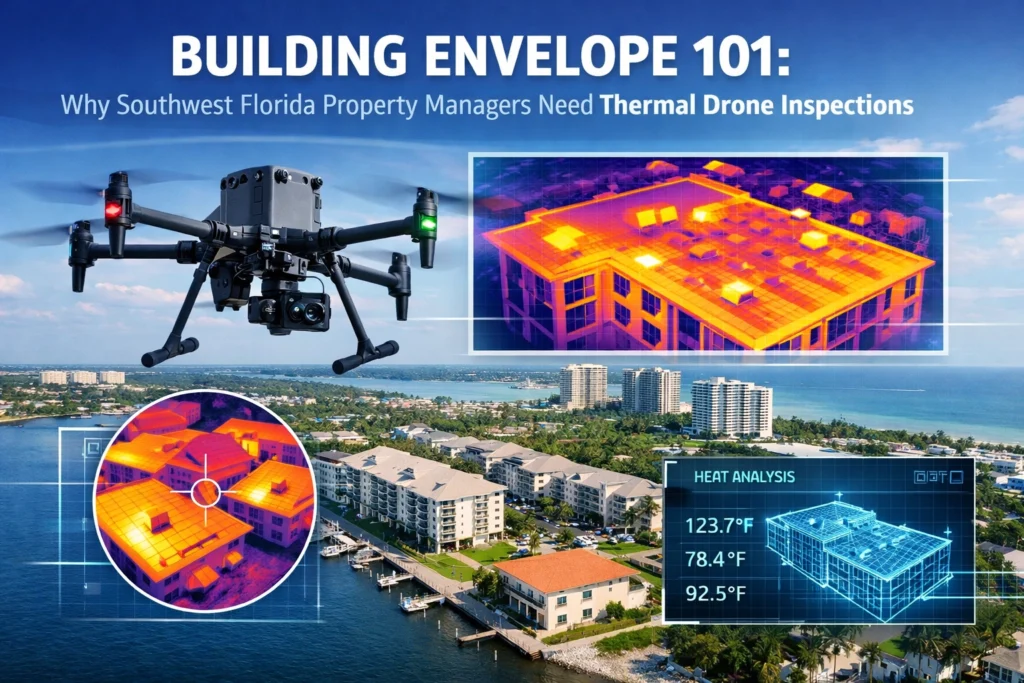
For property managers in Southwest Florida, the building envelope is the first and most critical line of defense against an

The Federal Aviation Administration (FAA) maintains a strict regulatory distinction between recreational drone use and commercial operations. For businesses in
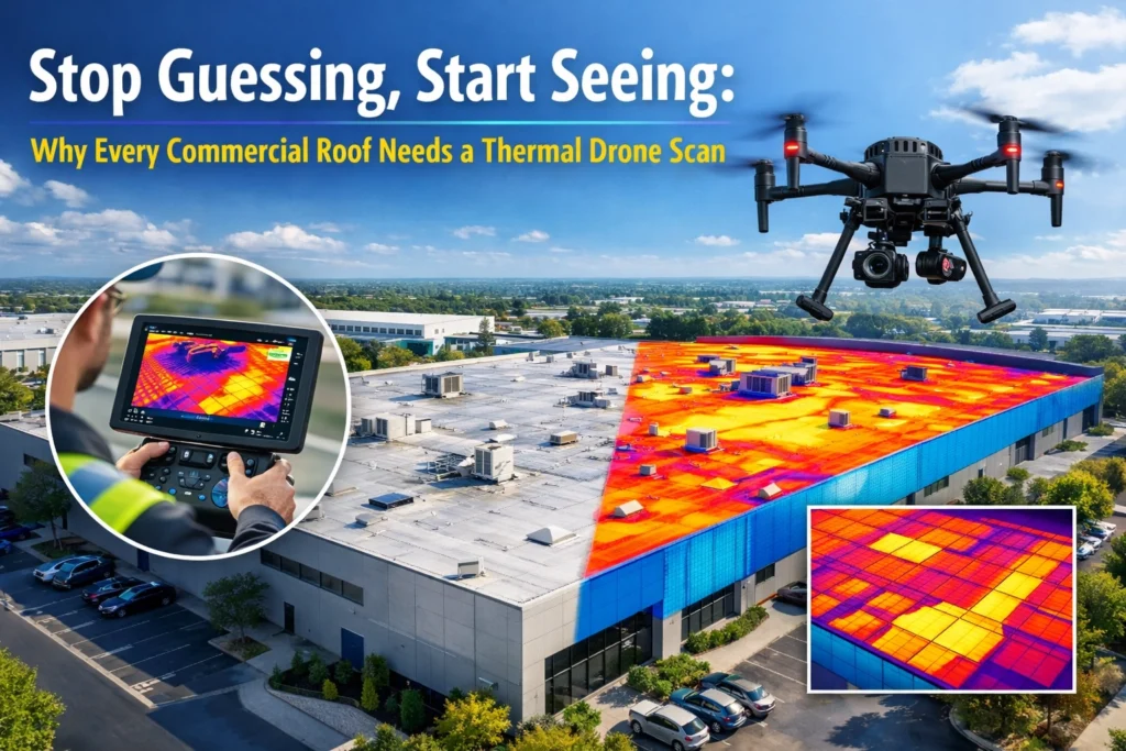
Thermal drone inspections use infrared cameras mounted on unmanned aircraft to detect temperature variations across building envelopes: revealing hidden moisture
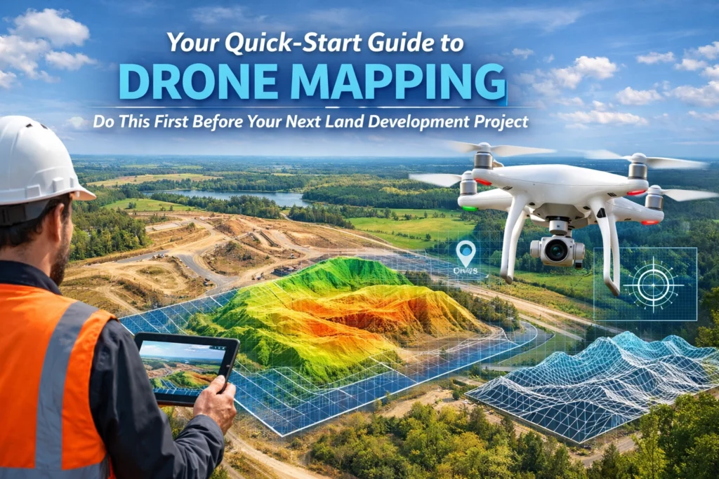
Drone mapping is the process of using high-resolution aerial imagery to create accurate, digital representations of land: delivering essential data

Thermal imaging reveals what the naked eye cannot: subsurface moisture, electrical hot spots, and insulation gaps that compromise building integrity.

When you hire a drone service provider for your luxury real estate listing, construction site, or industrial facility in Southwest