A 12-hour turnaround for drone mapping transforms site data from a documentation tool into an active decision-making resource. When a construction site changes daily, earth moved, materials delivered, grades adjusted, waiting three days for updated maps means making decisions based on outdated information. A 12-hour cycle delivers current conditions while the work that created them is still in motion.
This speed isn't about convenience. It's about preventing delays, avoiding rework, and maintaining project momentum when every day on schedule protects your budget.
The Problem with Slow Data
Traditional surveying methods require scheduling crews, mobilizing equipment, collecting field data, then processing results back at the office. The timeline stretches across days or weeks. By the time the deliverables arrive, the job site has evolved beyond what the data represents.
Decisions made on stale data compound risk. Earthwork calculations based on last week's topography don't account for yesterday's grading. Progress documentation that lags behind actual conditions can't validate schedules or catch discrepancies before they cascade into change orders.
Construction projects move fast. Documentation methods that don't keep pace create blind spots exactly when visibility matters most.
What a 12-Hour Turnaround Delivers
Drone mapping services operating on a 12-hour cycle capture site conditions in the morning and return processed orthomosaic maps, elevation models, and volumetric data by end of day, or reverse the sequence to deliver overnight for morning meetings.
Here's what that timeline enables:
- Same-day actionability , Project managers review updated topography and make decisions the afternoon following a morning flight
- Current condition awareness , Teams work with data that reflects today's site, not last week's configuration
- Rapid verification , Identify grade discrepancies, missing materials, or unexpected site changes before the crew moves to the next phase
- Flexible corrections , If data is unclear or coverage is incomplete, re-fly the next day without remobilizing a full survey crew
The technical process matters less than the operational result: high-resolution mapping for planning and documentation that stays synchronized with project pace.
Why Speed Prevents Costly Delays
Job site momentum depends on continuous forward motion. When teams wait days for survey data before proceeding, labor sits idle, equipment remains underutilized, and schedules slip.
Financial impact compounds quickly:
- A five-person crew waiting two days for verification data burns $4,000–$8,000 in direct labor costs alone
- Equipment rental continues regardless of whether machines are productive
- Weather windows close, a delay that pushes work from dry conditions into rain creates cascading rework
- Subcontractor schedules conflict when preceding tasks extend beyond planned completion
These aren't hypothetical scenarios. Many construction projects have avoided six-figure change orders by identifying discrepancies early through rapid drone documentation. When updated maps reveal that delivered fill material doesn't match specified volumes, or that grading hasn't achieved design elevation, immediate detection allows immediate correction, before concrete gets poured or structures get built on compromised foundations.
Situational awareness delivered in hours rather than days protects hundreds of thousands of dollars in potential overruns.

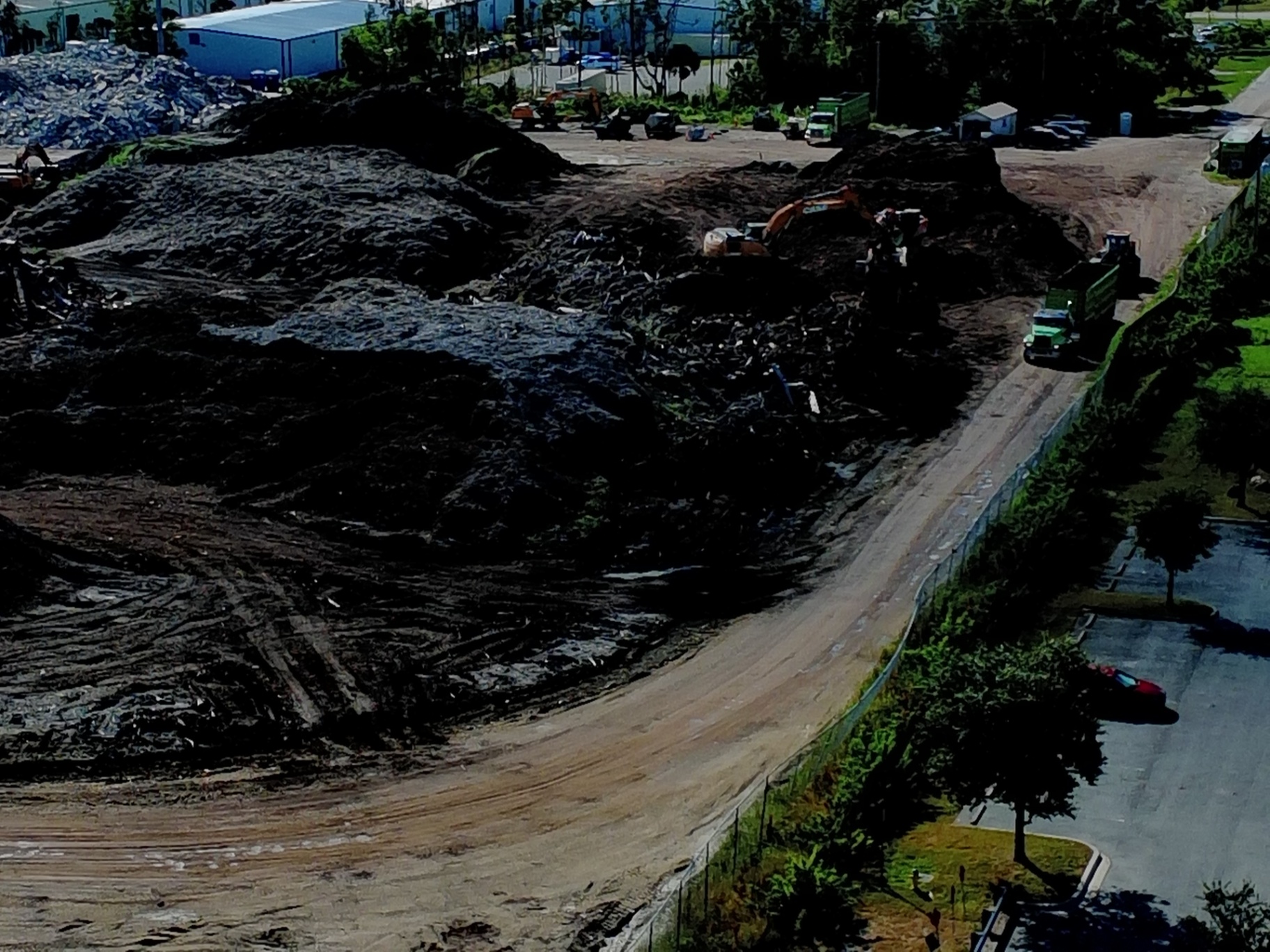
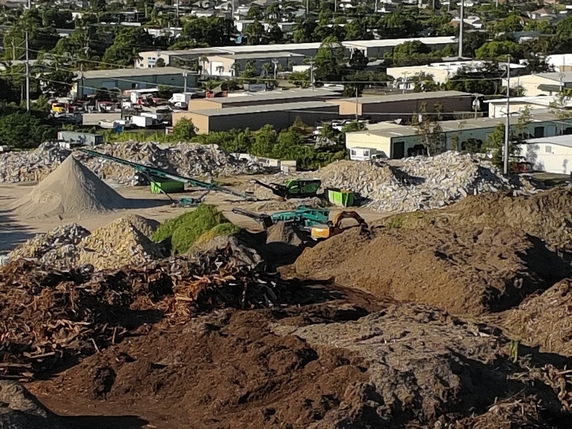
Continuous Monitoring Without Disruption
Traditional surveying requires mobilization, coordinating crew schedules, transporting equipment, establishing control points, and executing field work. The overhead makes frequent monitoring impractical. Most projects settle for periodic snapshots: initial survey, mid-project check, final as-built.
Drone mapping with a 12-hour turnaround inverts this model. Flying a site weekly, or more frequently during critical phases, becomes operationally feasible. Processing completes overnight. By morning, teams compare this week's orthomosaic against last week's to verify progress, validate schedules, and document any delays or impacts.
This frequency creates a visual timeline that traditional methods can't match:
- Track earthwork progress week to week with precise volumetric calculations
- Document material delivery and staging area changes
- Verify contractor claims against actual site conditions
- Identify emerging drainage or erosion issues before they affect foundations
- Create defensible documentation if disputes arise over schedule impacts
The capability to re-fly quickly matters as much as the speed of processing. When weather, access issues, or unclear deliverables require a second flight, a next-day option keeps projects moving. Compare that to remobilizing a survey crew, schedule availability might push the correction out another week.

Technical Delivery That Supports Decision-Making
Speed means nothing if deliverables don't support the decisions they're meant to inform. A 12-hour turnaround delivers processed orthomosaic maps, Digital Surface Models (DSM), Digital Elevation Models (DEM), and volumetric reports, not raw imagery that requires additional interpretation.
Cape UAV processes data through enterprise photogrammetry software using the Autel Robotics EVO Lite 6T Enterprise platform with a 50MP visual camera that captures the resolution needed for accurate orthomosaic generation. The resulting deliverables integrate directly into CAD systems, project management platforms, and stakeholder dashboards.
Cloud-based delivery means project teams, engineers, and owners access the same current data simultaneously, no emailing files or coordinating physical media. When everyone works from identical information updated on the same timeline, coordination improves and miscommunication decreases.
ROI Advantage: When Fast Data Pays for Itself
The cost of drone mapping services appears as a line item. The cost of delayed decisions, rework, and change orders doesn't, it hides in schedule extensions, labor overruns, and disputed invoices.
Consider the math:
A typical site mapping flight with 12-hour processing costs $1,500–$3,000 depending on acreage and deliverable complexity. If that data prevents a single day of delay, whether by catching a grade error before concrete placement, verifying material quantities before ordering additional fill, or documenting conditions that support a legitimate schedule extension, the savings typically exceed the mapping cost by 5x to 20x.
Projects that integrate weekly mapping throughout active construction phases often see return on investment within one to three avoided issues. The documentation also protects against disputes, time-stamped aerial evidence of site conditions proves invaluable when contractors, engineers, and owners debate responsibility for delays or changes.
Fast turnaround doesn't just deliver data. It delivers defensibility, clarity, and the confidence to make decisions that keep projects moving forward.
When Projects Need Current Information
Certain construction phases demand current data more than others:
- Earthwork and grading operations , Verify cut/fill quantities match specifications before transitioning to the next phase
- Material delivery and staging , Document inventory, calculate volumes, and validate invoices against actual delivered quantities
- Erosion control and drainage , Identify standing water, sediment movement, or compromised BMPs before inspections or weather events
- Progress documentation for lenders or owners , Provide visual proof that project milestones align with draw requests
- Dispute documentation , Create time-stamped records of conditions when schedule impacts occur
These scenarios share a common requirement: the information must reflect current reality, not conditions from last week or last month.
A 12-hour turnaround treats mapping as an active tool that supports project execution rather than a passive record created after decisions have already been made. When data arrives fast enough to influence the work it documents, it becomes operationally valuable instead of merely archival.
Moving at Project Speed
Construction projects don't wait for documentation to catch up. Crews move forward based on the best information available, and if that information is days old, the decisions made on it carry unnecessary risk.
Drone mapping services with 12-hour turnaround align documentation speed with project pace. When site conditions change daily, the data that informs decisions must keep pace. When verification needs to happen before the next phase begins, waiting days for results isn't an option. When disputes require defensible documentation, current imagery matters more than historical records.
The technology enables this speed. Processing workflows convert raw aerial imagery into deliverable orthomosaics, elevation models, and volumetric reports within hours rather than days. Cloud delivery makes the data accessible immediately to everyone who needs it.
What matters most: your team makes decisions based on what the site looks like today, not what it looked like last week. That difference prevents delays, protects budgets, and keeps projects moving at the speed construction demands.
Important Disclaimer: Cape UAV drone mapping services are for planning and documentation purposes only. We are not licensed land surveyors. For legal property boundaries or construction-grade staking, please consult a licensed professional surveyor.