Commercial property management relies on the ability to identify risks before they manifest as catastrophic failures. Traditional visual inspections: relying on the human eye or standard photography: only capture surface-level conditions. They miss the subsurface moisture, the overheating electrical component, and the silent energy leaks that drive up operational costs.
Thermal imaging, or infrared thermography, changes the inspection paradigm. By capturing the heat signatures of building envelopes, roofing systems, and electrical infrastructure, property managers gain a data-driven view of asset health. At Cape UAV, we utilize enterprise-grade technology to reveal these invisible anomalies, providing a proactive roadmap for facility maintenance.
The Technical Edge: Autel Robotics EVO Lite 6T Enterprise
Effective thermal inspection requires more than just a camera in the air; it requires high-resolution radiometric data. Our primary platform for commercial inspections is the Autel Robotics EVO Lite 6T Enterprise (EVO Lite 640T). This aircraft is specifically designed for industrial applications where precision is non-negotiable.
Key Technical Specifications:
- Thermal Sensor: 640×512 resolution, providing the density of data points necessary to distinguish subtle temperature gradients.
- Visual Camera: 50MP sensor for high-resolution RGB overlays, allowing for "picture-in-picture" or blended views to pinpoint the exact location of a thermal anomaly.
- Radiometric Data: Every pixel in the image contains temperature information, allowing for post-flight analysis and detailed reporting.
Note: Autel Robotics is a trademark of its respective owner; Cape UAV is not affiliated with or endorsed by Autel Robotics. Results depend on environmental conditions and site-specific variables.
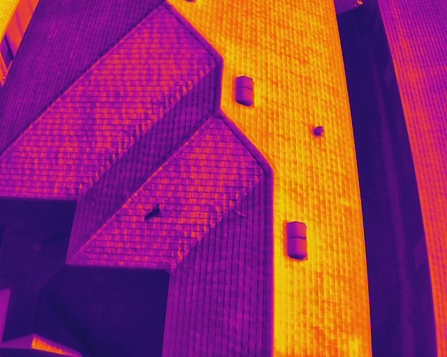
Detecting Subsurface Moisture and Roof Leaks
Roofing is one of the most significant capital expenses for any commercial property. In Southwest Florida, the combination of intense solar loading and heavy seasonal rain makes roof decks particularly vulnerable. Visual inspections often fail to identify leaks until water has already reached the interior ceiling, leading to mold and structural decay.
Thermal imaging identifies moisture by leveraging the principle of thermal capacitance. During the day, the sun heats the entire roof. At night, dry materials cool down rapidly. However, wet insulation trapped beneath the membrane retains heat longer.
Why This Matters
- Early Intervention: Detect leaks months or years before they become visible inside the building.
- Targeted Repairs: Instead of replacing an entire 50,000-square-foot roof, property managers can identify the specific 200-square-foot area where moisture is trapped.
- Documentation: Aerial thermal maps provide objective evidence for insurance claims or warranty disputes.
ROI Advantage
Early detection of moisture intrusion can extend the life of a commercial roof by 25% or more: avoiding premature replacement costs that often reach six figures.
Identifying Electrical Hotspots and Mechanical Failures
Electrical systems in commercial facilities are under constant load. Over time, connections loosen, components wear out, and circuits become overloaded. These issues generate heat long before they cause a fire or a system-wide blackout.
Aerial thermal imaging allows for the inspection of exterior electrical infrastructure: such as transformers, rooftop HVAC disconnects, and solar arrays: without requiring a technician to climb a ladder or enter a high-risk zone.
Common Electrical Issues Detected:
- Imbalanced Loads: Identifying phases that are drawing excessive current.
- Loose Connections: High-resistance connections that appear as "hotspots" on the thermal map.
- Failing Bearings: In mechanical systems like HVAC fans or cooling towers, heat signatures often indicate friction and imminent mechanical failure.

Energy Efficiency and Building Envelope Analysis
Heating and cooling account for a massive portion of commercial operating budgets. In the humid climate of Cape Coral and Southwest Florida, maintaining the integrity of the building envelope is critical for climate control.
Thermal imaging reveals exactly where a building is losing its conditioned air. By scanning the facade and roof, we identify gaps in insulation, failed window seals, and "thermal bridges" where heat is transferring directly into the structure.
Why This Matters
- Reduced Utility Costs: Identifying specific areas of heat gain allows for targeted insulation improvements that support overall building efficiency.
- HVAC Longevity: When a building envelope is tight, HVAC systems don't have to work as hard, reducing wear and tear and extending the service life of expensive equipment.
- Tenant Comfort: Eliminating hot spots and drafts improves the tenant experience and retention rates.
ROI Advantage
A building with a high-performing envelope is more attractive to premium tenants and costs significantly less to operate year-over-year.
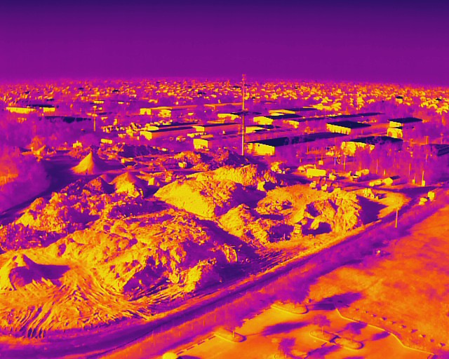
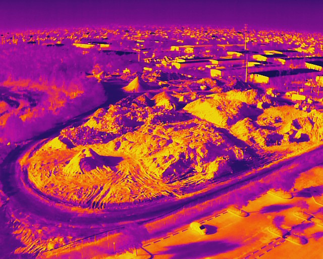
The Drone Advantage: Efficiency and Safety
Traditionally, thermal inspections were performed with handheld cameras. This approach is limited by the "angle of incidence": the angle at which the camera views the surface. For large commercial roofs or high-rise facades, a handheld camera cannot achieve the perpendicular angle necessary for accurate data.
Drones eliminate these limitations. A Part 107-certified pilot can position the Autel EVO Lite 6T directly above a structure, capturing a comprehensive, top-down view that a ground-based technician simply cannot replicate.
| Feature | Traditional Inspection | Cape UAV Drone Inspection |
|---|---|---|
| Speed | Days of manual walking | Hours of flight time |
| Safety | High (ladders, roof edges) | Minimal (ground-based operation) |
| Perspective | Limited/Oblique | Complete/Planar |
| Data Quality | Subjective photos | Radiometric orthomosaics |
| Cost | High labor hours | Efficient, streamlined workflow |
Integrating Thermal Data into Maintenance Workflows
Data is only valuable if it is actionable. Cape UAV provides property managers with more than just images; we provide a comprehensive visual record of the site. By combining thermal data with high-resolution orthomosaic mapping, managers can see exactly where a problem is located on a map of their entire property.
This integrated approach is particularly useful for:
- Preventative Maintenance Schedules: Prioritizing repairs based on the severity of the thermal anomaly.
- Budgeting: Providing hard data to justify capital expenditure requests to owners or boards.
- Vendor Accountability: Verifying that repairs were completed correctly by performing a follow-up thermal scan.
For more information on the different types of deliverables available, read our guide on Orthomosaic vs. 3D Model vs. 2D Map.
Strategic Value for Southwest Florida Property Managers
The unique environmental challenges of Southwest Florida: high humidity, salt air, and extreme heat: accelerate the degradation of commercial building materials. Property managers in Cape Coral, Fort Myers, and Naples must be more vigilant than those in milder climates.
Whether you are managing an industrial park, a retail center, or a multi-family residential complex, thermal imaging provides the clarity needed to protect your investment. Our missions are handled by fully insured, FAA Part 107–certified Remote Pilots, ensuring that every flight is conducted with the highest standards of safety and regulatory compliance.
Important Disclaimer
Thermal results indicate anomalies and are not a substitute for evaluation by a licensed professional.
Ready to see what the naked eye is missing?
Proactive property management starts with better data. Contact Cape UAV today to schedule a thermal inspection for your commercial assets and identify hidden risks before they become expensive liabilities.
Contact Cape UAV for a Consultation | Explore Our Drone Services | Learn More About Thermal Imaging
Disclaimer: Thermal imaging and mapping data are for informational and inspection support purposes only. Cape UAV does not provide licensed land surveying or engineering services. Our data is for planning purposes and is not a substitute for a licensed land survey. Thermal results indicate anomalies and are not a substitute for evaluation by a licensed professional. All operations are conducted by FAA Part 107–certified pilots.