Site logistics in Southwest Florida demand a level of oversight that traditional ground-level inspections simply cannot provide. From the sprawling developments in Cape Coral to high-density commercial projects in Fort Myers, managing the movement of materials, equipment, and personnel requires a comprehensive, top-down perspective.
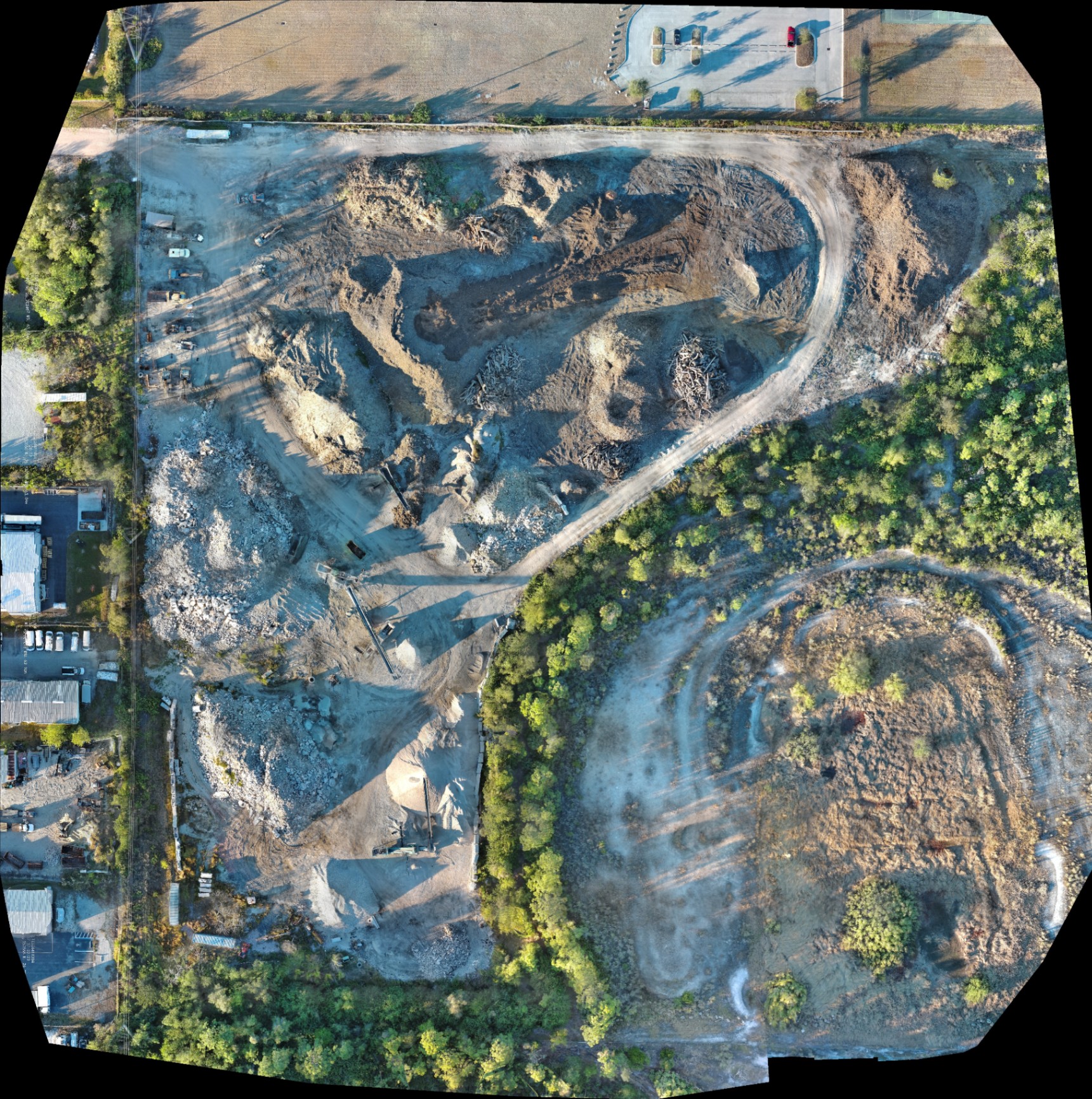
High-resolution orthomosaic mapping has emerged as the definitive tool for construction project managers seeking to eliminate guesswork. By combining hundreds of individual aerial images into a single, geometrically corrected 2D map, teams gain an undistorted view of their entire site: enabling smarter decision-making and more efficient workflows.
At Cape UAV, we utilize enterprise-grade technology to deliver these visual insights. Our primary platform: the Autel Robotics EVO Lite 640T: features a 50MP visual sensor that captures the granular details necessary to identify opportunities for efficiency that remain invisible from the trailer or the ground.
The Technical Edge: 50MP Visual Precision
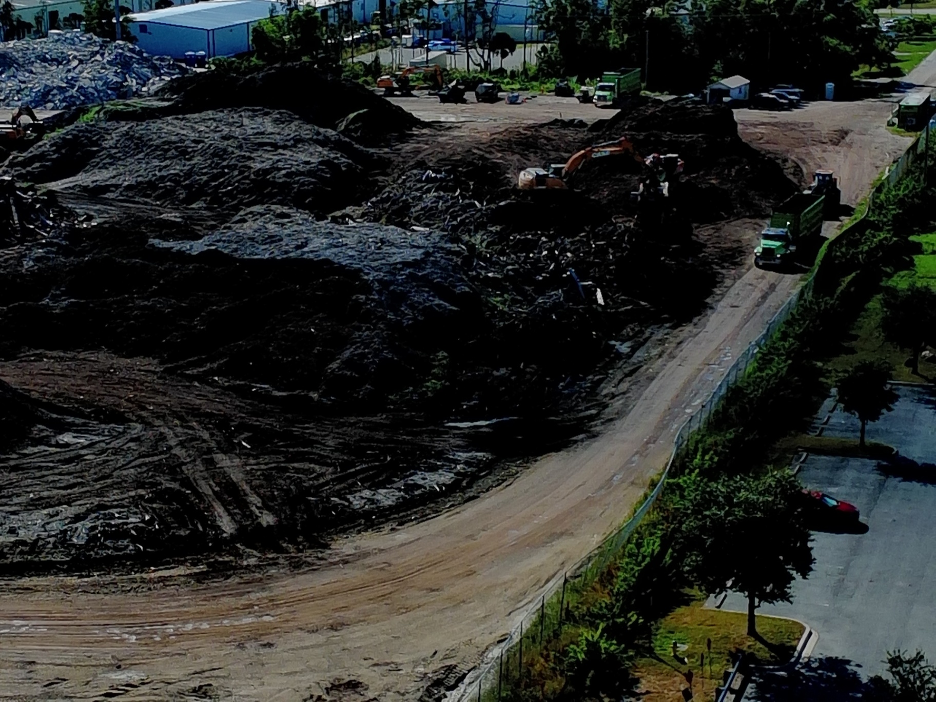
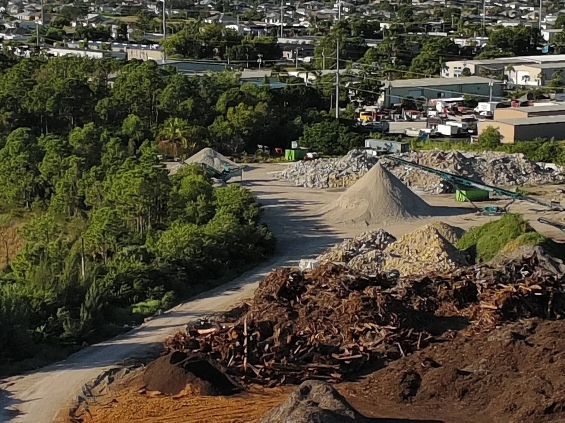
The quality of an orthomosaic map is entirely dependent on the resolution of the source data. While consumer drones often struggle with motion blur or low pixel density, the Autel EVO Lite 640T delivers 50MP high-resolution imagery: ensuring that every pixel represents a tangible part of the site.
This level of detail allows project managers to zoom into specific areas of a massive map without losing clarity. Whether you are checking the serial number on a piece of equipment or inspecting the integrity of a silt fence: the visual precision remains constant across the entire dataset.
Why This Matters:
- Enhanced Detail: Capture fine-grain site conditions that lower-resolution sensors miss.
- Orthorectification: Our processing adjusts for lens distortion and terrain variation: creating a map with a uniform scale across the entire image.
- Documentation Integrity: High-resolution files provide a clear, indisputable record of site conditions at a specific point in time.
Optimizing Site Logistics and Material Staging
Effective site logistics is the art of moving as little as possible. When materials like fill dirt, lumber, or drainage pipe are staged in the wrong location, the resulting "double handling" eats into profit margins: adding unnecessary labor and fuel costs to the project.
High-resolution orthomosaic mapping allows developers to visualize the entire site layout in a single view. This perspective is vital for planning haul roads, identifying optimal staging areas, and ensuring that equipment has enough clearance to operate safely and efficiently.
Identifying Opportunities for Efficiency:
By viewing a high-resolution 2D orthomosaic map, managers can spot bottlenecks in real-time. If a delivery of materials is blocking a primary access route, or if a stockpile has grown to impede visibility: these issues can be resolved before they cause a site-wide delay.
Streamlining Construction Progress Monitoring
Consistent documentation is the backbone of successful project management. Weekly or bi-weekly orthomosaic flights provide a chronological record of progress: allowing stakeholders to compare current conditions against the original site plan or previous weeks of work.
This visual timeline is more than just a progress report; it is a communication tool. Project managers can share these maps with subcontractors and owners to provide a clear, objective status update: reducing the need for frequent, time-consuming site visits.
Reducing Rework Through Early Detection:
Errors in site prep or material placement are far less expensive to fix on day one than on day thirty. Orthomosaic maps allow teams to verify that work aligns with the project schedule: identifying deviations early before they escalate into costly rework.
ROI Advantage: The Financial Case for Drone Mapping
The return on investment for drone-based mapping is realized through time savings and risk mitigation. For large-scale developments in Fort Myers and Cape Coral, the cost of a single major rework event often exceeds the annual cost of a recurring drone mapping program.
| Traditional Monitoring | High-Resolution Drone Mapping |
|---|---|
| Ground-level inspections take hours or days | Site-wide data capture in minutes |
| Subjective reports based on memory | Objective, high-resolution visual data |
| High risk of missing "big picture" issues | Comprehensive 2D map of the entire site |
| Difficult to share with remote stakeholders | Digital deliverables accessible anywhere |
Reducing Site Rework:
By identifying where a foundation was poured or where a trench was dug in relation to the overall site plan, project managers can catch errors in real-time. This proactive approach ensures that the project remains on schedule and within budget: protecting the bottom line of the developer.
Enhancing Stakeholder Communication
Construction projects involve a complex web of stakeholders: including developers, architects, subcontractors, and municipal inspectors. Miscommunication is one of the leading causes of project friction and delays.
An orthomosaic map serves as a single source of truth. When everyone is looking at the same high-resolution image, there is less room for interpretation or disagreement: improving coordination between various trades and ensuring everyone is aligned on the current state of the project.
Improved Accountability:
Consistent documentation creates a culture of accountability. Subcontractors can see their progress (or lack thereof) reflected in the weekly maps: motivating teams to hit their milestones and providing managers with the evidence needed to handle disputes.
Navigating Southwest Florida's Unique Challenges
Developing land in Southwest Florida presents specific logistical hurdles: from managing water runoff to navigating the environmental regulations of Lee County. Our high-resolution mapping services are tailored to the local landscape, helping managers monitor sensitive areas and ensure compliance with site-specific permits.
Whether you are managing a residential build in a Cape Coral canal neighborhood or a massive commercial development off I-75, our drone services provide the clarity needed to navigate these complexities. We deliver data that empowers you to manage your site with precision: regardless of the project size.
For more information on choosing the right map for your project, explore our guide on orthomosaic vs. 3D models.
Final Insights: Precision Leads to Profitability
In the competitive Southwest Florida construction market, the difference between a profitable project and a loss often comes down to the details. High-resolution orthomosaic mapping provides the "visual precision" necessary to master site logistics and maintain tight control over progress.
By leveraging the 50MP sensor of the Autel EVO Lite 640T, Cape UAV delivers more than just pictures: we deliver actionable intelligence. We help you identify opportunities for efficiency, reduce the risk of rework, and keep your stakeholders informed every step of the way.
Important Disclaimer:
Our data is for planning purposes and is not a substitute for a licensed land survey.
Important Disclaimer
Our data is for planning purposes and is not a substitute for a licensed land survey. Thermal results indicate anomalies and are not a substitute for evaluation by a licensed professional.
Ready to improve your site logistics? Contact Cape UAV today to schedule your first high-resolution mapping flight.