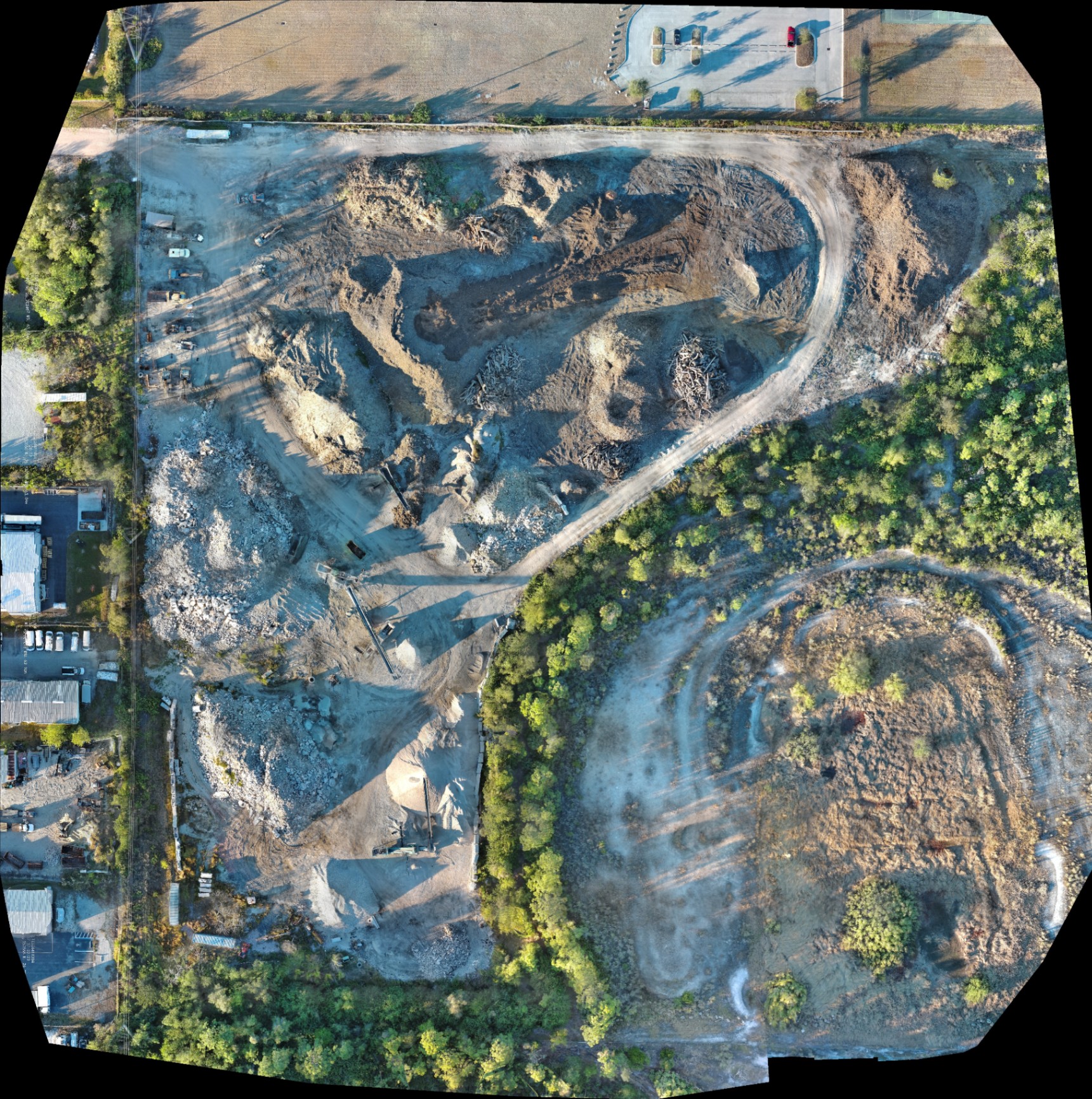
An orthomosaic is a geometrically corrected aerial image map: processed from hundreds or thousands of individual drone photos: that delivers a distortion-free, top-down view of a construction site with uniform scale. Unlike a standard aerial photograph, which suffers from perspective tilt and lens distortion, an orthomosaic allows project managers to identify site conditions across the entire project area with centimeter-level detail. For construction firms in Southwest Florida, this technology transitions site monitoring from a reactive, ground-based task to a proactive, data-driven strategy.
High-resolution mapping provides the clarity needed to verify site layouts, track earthwork, and communicate with stakeholders without requiring constant physical presence on-site. By utilizing enterprise-grade platforms like the Autel Robotics EVO Lite 6T Enterprise, Cape UAV captures high-fidelity data that serves as a single source of truth for the project lifecycle.
The Technical Foundation: How Orthomosaics Are Built
The process begins with an FAA Part 107-certified pilot executing an automated flight path. The drone captures images at precise intervals with significant overlap: typically 70% to 80%: ensuring every feature of the terrain is documented from multiple angles.
We utilize the Autel Robotics EVO Lite 6T Enterprise (also known as the EVO Lite 640T) for these missions. This platform is equipped with a 50MP visual camera that captures the granular detail required for high-resolution mapping. The high pixel count ensures that even when zooming into the map, features like rebar placement, utility conduits, and site boundaries remain sharp and identifiable.
Why This Matters:
- Uniform Scale: Every pixel represents a specific, consistent distance on the ground.
- Geo-Rectification: Each image is tagged with GPS coordinates, allowing the final map to be overlaid onto CAD files or site plans.
- Resolution: A 50MP sensor provides a Ground Sample Distance (GSD) that far exceeds satellite imagery or standard drone photos.
From Photos to Actionable Data
Traditional site photos provide a "vibe" of the progress, but orthomosaics provide data. When these high-resolution maps are generated, they enable the construction team to perform various checks and balances for planning purposes.
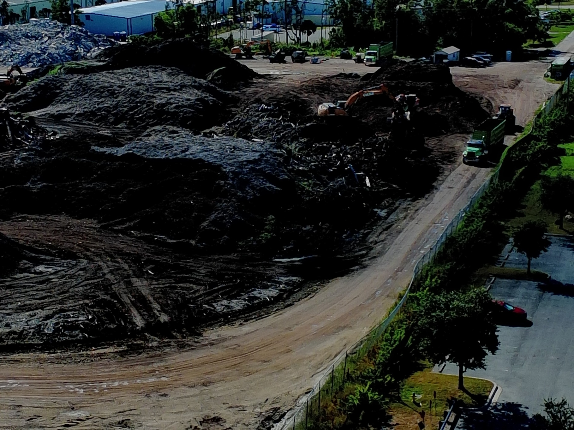
Volumetric Analysis and Earthwork
One of the most immediate benefits of drone mapping in Southwest Florida land development is tracking material movement. Instead of sending a crew to manually measure stockpiles: a process that is both time-consuming and potentially hazardous: a drone can capture the data in minutes. While not a substitute for a licensed land survey, these orthomosaics and the resulting digital surface models (DSMs) allow project managers to estimate cut-and-fill volumes across large grading areas.
Subgrade and Utility Verification
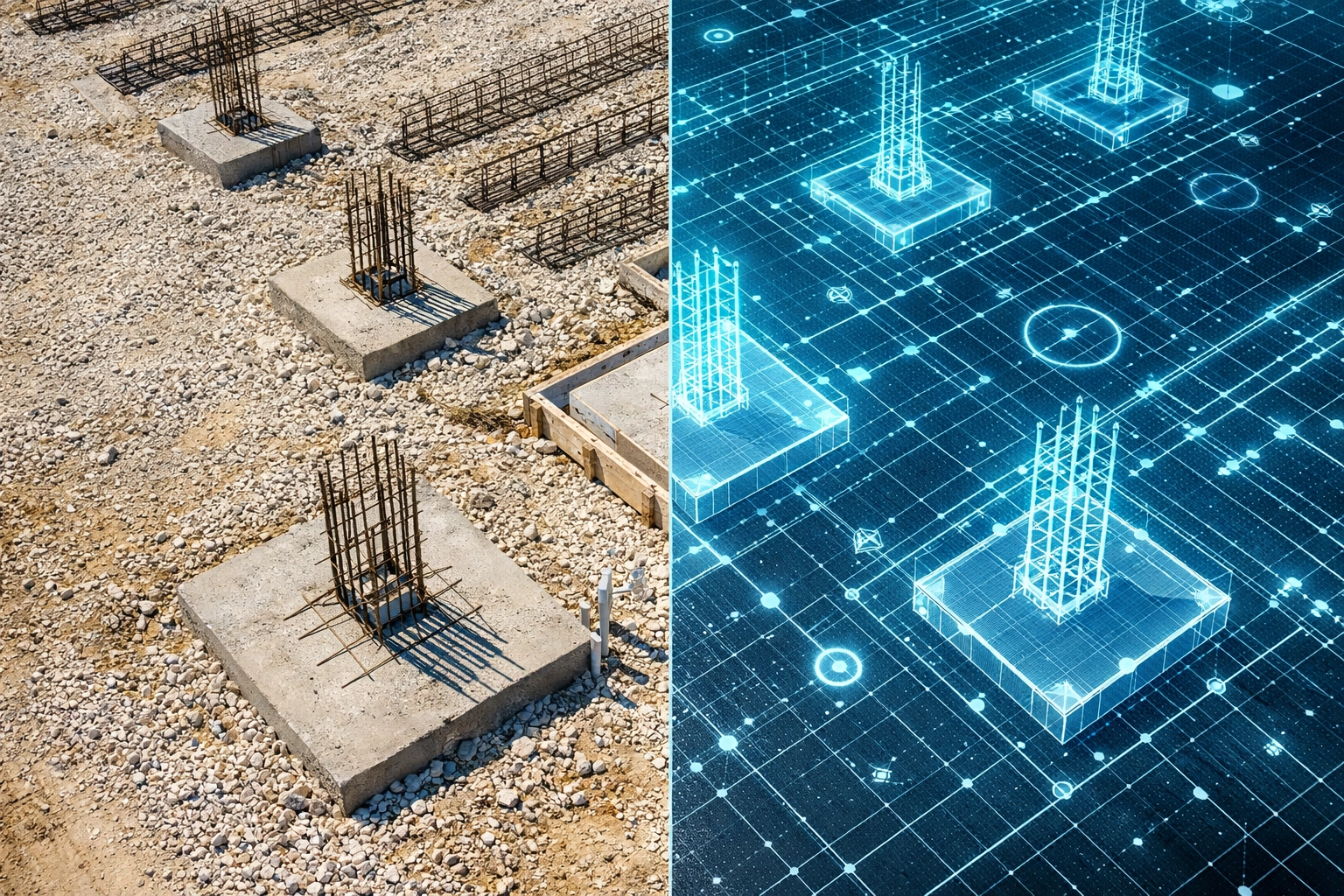
Before the concrete is poured or trenches are backfilled, an orthomosaic provides a permanent visual record of what lies beneath. Capturing the site at the "gray stage" ensures that the location of every pipe, conduit, and footing is documented. If a utility line is hit six months later, the team can refer back to the historical orthomosaic to pinpoint the exact location of the underground infrastructure.
Site Plan Overlays
By importing a high-resolution orthomosaic into BIM or CAD software, engineers can overlay the original design plans directly onto the current site conditions. This reveals deviations early: before they become costly rework. Whether it is a foundation that is slightly out of alignment or a drainage pond that isn't meeting the designed footprint, the orthomosaic highlights the discrepancy in clear, visual terms.
Comparison: Traditional Site Tracking vs. High-Resolution Orthomosaics
| Feature | Traditional Ground Methods | Drone Orthomosaic Mapping |
|---|---|---|
| Perspective | Limited, eye-level views | Comprehensive, top-down view |
| Scale | Distorted; impossible to measure | Uniform; allows for distance/area planning |
| Data Density | Point-based or fragmented | Continuous, site-wide documentation |
| Speed | 4–8 hours for large sites | 15–30 minutes of flight time |
| Documentation | Paper logs and random photos | Digital, geo-tagged, and time-stamped |
| Safety | High (boots on ground in active zones) | Low (aerial capture from a distance) |
Streamlining Workflows and Stakeholder Communication
Construction projects involve a complex web of stakeholders: owners, developers, subcontractors, and municipal inspectors. Keeping everyone on the same page is often the most significant hurdle to meeting deadlines.
Remote Site Inspections
High-resolution orthomosaics enable remote inspections, which can cut travel costs and time by up to 75%. Project managers can navigate the site virtually from their office in Cape Coral or Fort Myers, identifying defects or checking progress without stepping foot on a ladder or navigating heavy machinery.
Historical Timelines
By flying the same flight path at weekly or bi-weekly intervals, we create a chronological record of the build. This timeline feature allows teams to navigate backward through the site’s history with a single click. This level of accountability is invaluable during disputes or for insurance documentation, providing undeniable proof of when specific milestones were reached.
Improved Safety and Compliance
Reducing the number of personnel required to walk active construction sites naturally decreases the risk of onsite accidents. Drone mapping keeps crews away from hazardous slopes, heavy equipment, and unstable terrain while still providing the data necessary for site management.
The ROI Advantage of Precision Mapping
The investment in high-resolution mapping often pays for itself within the first few months of a project. The primary driver of ROI is the prevention of rework. In the construction industry, fixing a mistake after a slab is poured can cost ten times more than identifying the error during the layout phase.
ROI Highlights:
- Reduced Site Visits: Save hundreds of man-hours by conducting virtual site walkthroughs.
- Early Detection: Identify grading errors or utility misplacements before they escalate.
- Enhanced Reporting: Provide investors and owners with professional, high-fidelity visual updates that build trust and transparency.
- Inventory Management: Track the usage of onsite materials (sand, gravel, fill dirt) more accurately for procurement planning.
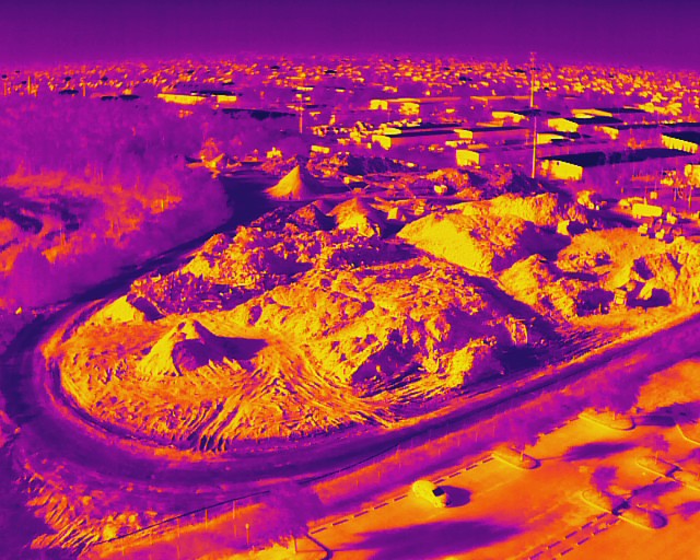
Thermal Integration for Site Management
While visual orthomosaics are the standard for progress tracking, the use of thermal imaging adds another layer of depth to site maintenance and facility management. Our equipment, the Autel Robotics EVO Lite 6T Enterprise, features a 640×512 thermal sensor with a 12um pixel pitch.
For construction and property management, this allows us to detect anomalies that are invisible to the naked eye. This includes identifying moisture intrusion in newly installed roofing, detecting heat loss in building envelopes, or monitoring electrical components in industrial sites for overheating. Integrating thermal data with visual mapping provides a comprehensive "health check" of the asset.
Conclusion: Data-Driven Construction
High-resolution orthomosaics are no longer a luxury for large-scale infrastructure projects; they are a necessary tool for any modern construction firm looking to maintain a competitive edge in Southwest Florida. By providing clarity, confidence, and a permanent digital record, drone mapping eliminates the guesswork from site management.
At Cape UAV, we combine enterprise-grade technology with FAA Part 107-certified expertise to deliver the visual data you need to keep your project on track and under budget. Whether you are managing a luxury residential build or a large-scale industrial development, our mapping services provide the oversight required for success.
Important Disclaimer
Mapping Disclaimer: Our data is for planning purposes and is not a substitute for a licensed land survey.
Thermal Disclaimer: Thermal results indicate anomalies and are not a substitute for evaluation by a licensed professional.
Explore more about our technical deliverables:
- Learn about the difference between mapping types: Orthomosaic vs. 3D Model vs. 2D Map
- See our specialized services for Land Development and Drone Mapping
- Review our Industrial Inspection Capabilities
Important Disclaimer
Our data is for planning purposes and is not a substitute for a licensed land survey. Thermal results indicate anomalies and are not a substitute for evaluation by a licensed professional. Autel Robotics is a trademark of its respective owner; Cape UAV is not affiliated with or endorsed by Autel Robotics.