
Precision drone mapping is the process of capturing high-resolution aerial imagery and converting it into georeferenced 2D orthomosaics and 3D digital twins. In the fast-paced world of Southwest Florida construction and land development, traditional site tracking is no longer sufficient. Relying on ground-level photos and manual walk-throughs creates data silos: leaving project managers to make decisions based on incomplete or outdated information.
At Cape UAV, we utilize the Autel Robotics EVO Lite 6T Enterprise (also known as the EVO Lite 640T) to bridge this gap. With a 50MP visual camera and a 640×512 thermal sensor, this platform provides the technical foundation for comprehensive site documentation. This is not just "taking pictures"; it is the systematic collection of spatial data that empowers stakeholders to see their projects with unprecedented clarity.
The Inefficiency of Traditional Monitoring
Traditional site inspections rely heavily on manual labor. A superintendent or project manager walks the site with a clipboard and a handheld camera, snapping photos of specific milestones. This method is inherently flawed: it is subjective, slow, and impossible to scale across large industrial or residential developments.
The Problem with Legacy Methods:
- Documentation Gaps: Ground photos fail to capture the context of the entire site, leading to "blind spots" in progress reports.
- Safety Risks: Manual inspections often require personnel to navigate active excavation areas or climb structures.
- Subjective Reporting: Two different inspectors may interpret progress differently, leading to inconsistent data.
- Delayed Detection: Issues are often discovered days or weeks after they occur, resulting in expensive rework.
Drone mapping eliminates these variables. By capturing a site from a top-down perspective with high-resolution sensors, we create a definitive spatial record that leaves no room for interpretation.

The Technical Advantage: Precision Imaging
The quality of a drone map is only as good as the sensor capturing the data. Our primary platform, the Autel Robotics EVO Lite 6T Enterprise, features a 1/1.28" CMOS sensor capable of 50MP visuals. This allows for extreme detail even when flying at altitudes that cover dozens of acres in a single flight.
Why Sensor Specs Matter:
- 50MP Visual Camera: Provides the resolution necessary to identify specific materials, equipment, and structural details without pixelation.
- 640×512 Thermal Sensor: Essential for identifying anomalies in sub-surfaces or utility installations before they are covered.
- Enterprise Stability: Ensures consistent data capture even in the variable wind conditions common in Cape Coral and the surrounding coastal areas.
Note: Autel Robotics is a trademark of its respective owner; Cape UAV is not affiliated with or endorsed by Autel Robotics.
High-Resolution Deliverables That Drive Decisions
Precision drone mapping is more than a single image; it is a suite of deliverables tailored to specific phases of the construction lifecycle. For developers in Southwest Florida, these tools are becoming the standard for drone mapping and site management.
1. High-Resolution Orthomosaics
An orthomosaic is a large, map-quality image composed of hundreds of individual aerial photos stitched together. It is corrected for lens distortion and camera tilt to ensure a uniform scale across the entire site.
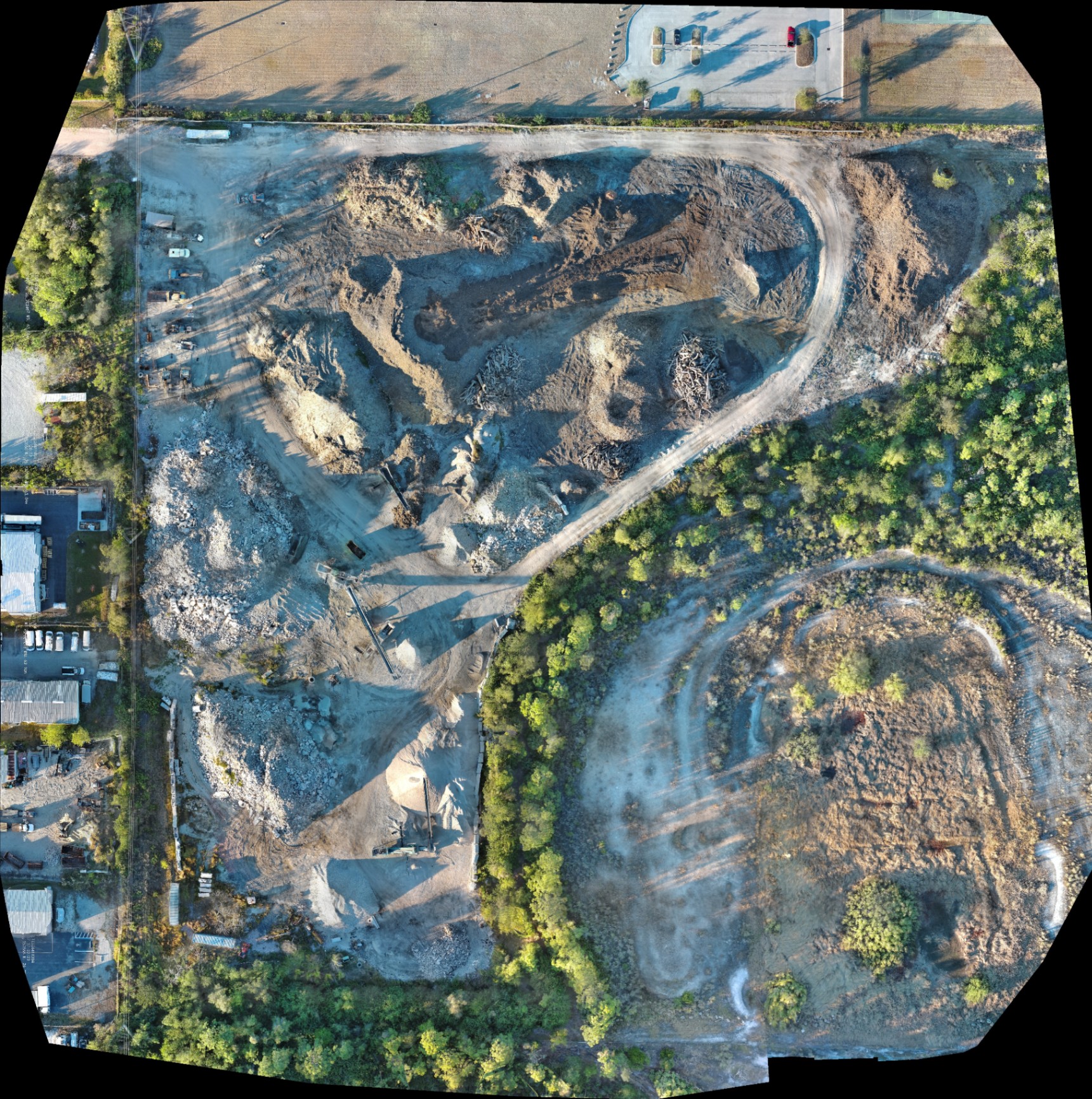
Why It Matters:
- Provides a bird’s-eye view of the entire project footprint.
- Allows for remote site visits, saving time for out-of-state stakeholders.
- Acts as a visual timeline of progress when captured at regular intervals.
2. Digital Surface Models (DSM) and Topography
By using photogrammetry, we generate 3D models that represent the elevations of the site. This includes buildings, stockpiles, and equipment.
Why This Matters:
- Drainage Analysis: Identify potential water pooling areas before landscaping begins.
- Site Planning: Visualize how structures will interact with the existing terrain.
- Early Problem Detection: Catch grading errors before they impact the foundation pour.
3. Volumetric Analysis
For excavation and land clearing, knowing exactly how much material has been moved is critical for budget management. Precision mapping allows for the calculation of stockpile volumes and cut/fill requirements.
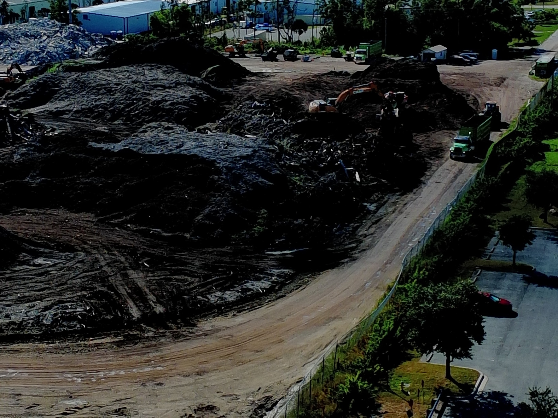
ROI Advantage:
- Verify Subcontractor Invoices: Ensure you are paying for the exact amount of dirt moved, not an estimate.
- Inventory Management: Track gravel, fill dirt, and mulch levels with high frequency.
- Efficiency: Reduce the need for manual topographic checks that slow down heavy machinery.
Comparing Traditional vs. Precision Drone Mapping
| Feature | Traditional Manual Tracking | Precision Drone Mapping |
|---|---|---|
| Data Collection Speed | Hours or days of walking | 20–40 minutes of flight |
| Data Accuracy | Subjective/Visual only | Objective/Spatial records |
| Site Coverage | Limited/Fragmented | 100% Comprehensive |
| Reporting Frequency | Monthly or Bi-weekly | Weekly or Daily |
| Safety Risk | High (personnel on site) | Low (remote operation) |
| Historical Record | Disjointed photos | Sequential 2D/3D maps |
The Integration of Thermal Imaging
In industrial and large-scale commercial construction, thermal imaging adds an extra layer of "invisible" data. Using the 12um pixel pitch sensor on our enterprise hardware, we can detect thermal anomalies that indicate moisture intrusion, electrical overheating, or curing issues in concrete.
Why This Matters:
- Facility Maintenance: Detect heat signatures of failing HVAC components or roof leaks on new builds.
- Infrastructure: Identify anomalies in underground utilities before final paving.
- Quality Control: Ensure thermal consistency during critical phases of construction.

ROI: The Financial Case for Drone Mapping
The primary question for any owner or developer is: Does this save money? The answer is found in the reduction of rework and the acceleration of the schedule.
1. Eliminating Rework
Rework is the single largest drain on construction profits. Precision mapping allows you to overlay design plans with actual site conditions. If a foundation is poured two feet off-center or a trench is dug in the wrong location, it is detected immediately: not after the concrete has cured.
2. Stakeholder Transparency
Miscommunication between owners, architects, and contractors leads to delays. By providing a shared, high-resolution visual record, everyone stays on the same page. This transparency reduces disputes and speeds up the approval process for change orders.
3. Safety and Insurance
By keeping personnel away from hazardous areas like steep stockpiles or active machinery zones, you reduce the risk of on-site accidents. Fewer accidents lead to lower insurance premiums and fewer work stoppages.
Operational Excellence in Southwest Florida
Operating a drone for professional mapping requires more than just owning the hardware. At Cape UAV, all missions are conducted by FAA Part 107 certified pilots. We understand the unique airspace challenges in Cape Coral and the technical requirements of industrial site documentation.
Our workflow is designed for speed and reliability. Data is captured, processed, and delivered in formats that integrate with your existing project management tools. Whether you are managing a luxury real estate development or a massive industrial facility, our mapping services provide the clarity, confidence, and control you need to see the project through to completion.
Important Disclaimer
Mapping Disclaimer: Our data is for planning purposes and is not a substitute for a licensed land survey.
Thermal Disclaimer: Thermal results indicate anomalies and are not a substitute for evaluation by a licensed professional.
Summary of Value
Precision drone mapping is not a luxury: it is a competitive necessity. It transforms the way you interact with your site, turning a physical location into a digital asset that can be analyzed, measured, and shared globally.
- Speed: Capture entire sites in a fraction of the time.
- Detail: High-resolution 50MP visuals for every square inch.
- Insight: Thermal and volumetric data that traditional photos miss.
- Protection: A permanent historical record for legal and compliance needs.
To learn more about how we can support your next project, visit our drone services page or contact us directly to discuss your specific site requirements.
Important Disclaimer
Our data is for planning purposes and is not a substitute for a licensed land survey. Thermal results indicate anomalies and are not a substitute for evaluation by a licensed professional.