Drone mapping is the process of using high-resolution aerial imagery to create accurate, digital representations of land: delivering essential data for planning and documentation before a single piece of heavy equipment arrives on site. In the fast-moving land development landscape of Southwest Florida, the traditional "wait and see" approach to site conditions is a liability.
Before you break ground on your next project in Cape Coral or Fort Myers, the first step isn't hiring a crew; it’s capturing a comprehensive digital twin of the terrain.
Define Your Mission and Deliverables First
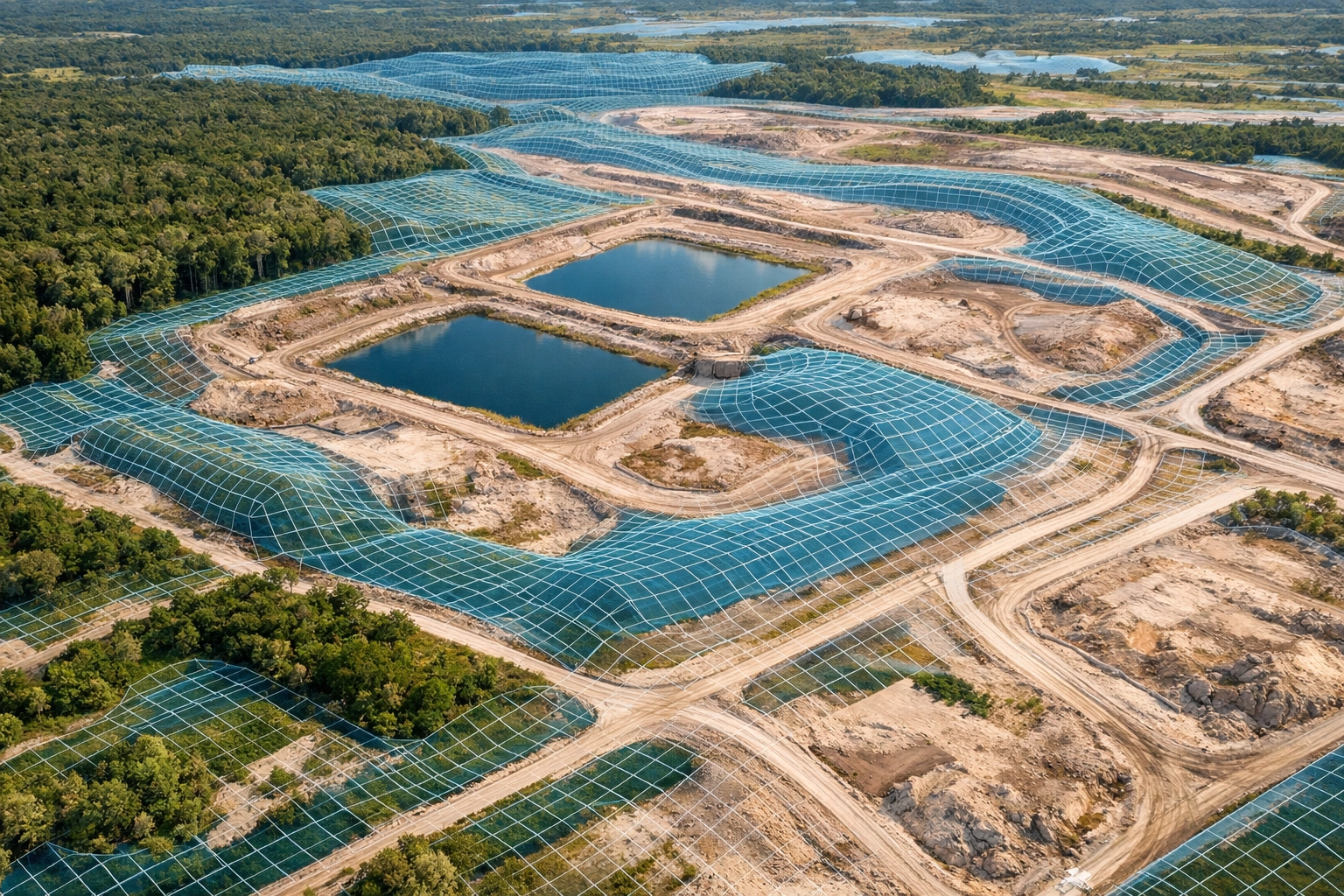
Successful drone mapping begins with comprehensive project planning and mission definition. This is the foundation that determines success before any drone takes flight. You must identify the specific area of interest and determine which high-resolution deliverables your team needs to streamline the development process.
Why This Matters
Without a clear mission definition, you risk capturing data that lacks the detail required for precision planning. Identifying your needs early: whether it’s volumetric analysis of stockpiles or a 2D orthomosaic for site layout: ensures the flight parameters are optimized for those outcomes.
| Deliverable Type | Primary Use Case | Key Value |
|---|---|---|
| High-Res Orthomosaic | Site layout & planning | A "God's eye view" with no perspective distortion. |
| 3D Mesh Model | Stakeholder presentations | Realistic visualization of site topography. |
| Digital Surface Model (DSM) | Drainage & runoff analysis | Identifies elevation highs and lows across the site. |
| Point Cloud | CAD Integration | Raw data for architectural and engineering software. |
Choose Enterprise-Grade Hardware
For land development mapping, the quality of your data is directly tied to the sensor capturing it. At Cape UAV, we utilize the Autel Robotics EVO Lite 6T Enterprise (also known as the EVO Lite 640T). This platform is equipped with a 50MP visual camera, which provides the high pixel count necessary for granular detail in large-scale maps.
While the 640×512 thermal sensor is industry-leading for solar and facility inspections, the 50MP visual sensor is the workhorse for land development. It allows for high-altitude flights that maintain a tight Ground Sampling Distance (GSD): ensuring every rock, boundary, and elevation change is documented.
ROI Advantage
Using enterprise-grade sensors like the 50MP Autel visual camera reduces the number of photos needed while increasing the clarity of each. This leads to faster processing times and more reliable digital reconstructions: saving thousands in potential project delays caused by poor data.
Verify Airspace and Compliance
Southwest Florida features complex airspace, particularly near Page Field and Southwest Florida International Airport (RSW). Before any mapping mission, verifying airspace restrictions and obtaining necessary FAA authorizations is mandatory.
All Cape UAV missions are conducted by FAA Part 107 certified pilots. This certification ensures that your land development data is captured legally, safely, and in full compliance with federal regulations: protecting your project from liability and regulatory fines.
Optimize Flight Parameters for Precision
Planning flight parameters is a technical exercise in balancing coverage and resolution. To ensure a high-quality photogrammetric reconstruction, the drone must capture images with significant overlap.
- Front Overlap: 70%
- Side Overlap: 60%
- Altitude: Determined by the required resolution and terrain complexity.
Why This Matters
High overlap allows photogrammetry software to "see" the same point on the ground from multiple angles. This creates the depth and detail needed for 3D modeling. If overlap is too low, the resulting map will have "holes" or distorted sections, rendering it useless for site planning.
Establish Ground Control Points (GCPs)
To anchor aerial data to real-world coordinates, we establish a minimum of five ground control points. These are physical markers placed on the ground with precisely known coordinates. For sites with significant elevation changes, GCPs are spaced closer together to account for terrain variance.
Why This Matters
GCPs ensure that your drone map aligns perfectly with other geospatial datasets, such as existing CAD files or property boundaries. This alignment is critical when using maps for project planning and permitting: preventing costly errors in site layout.
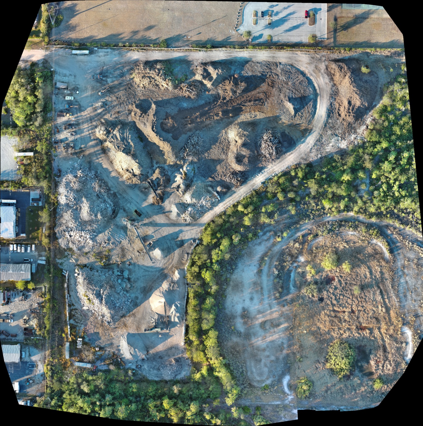
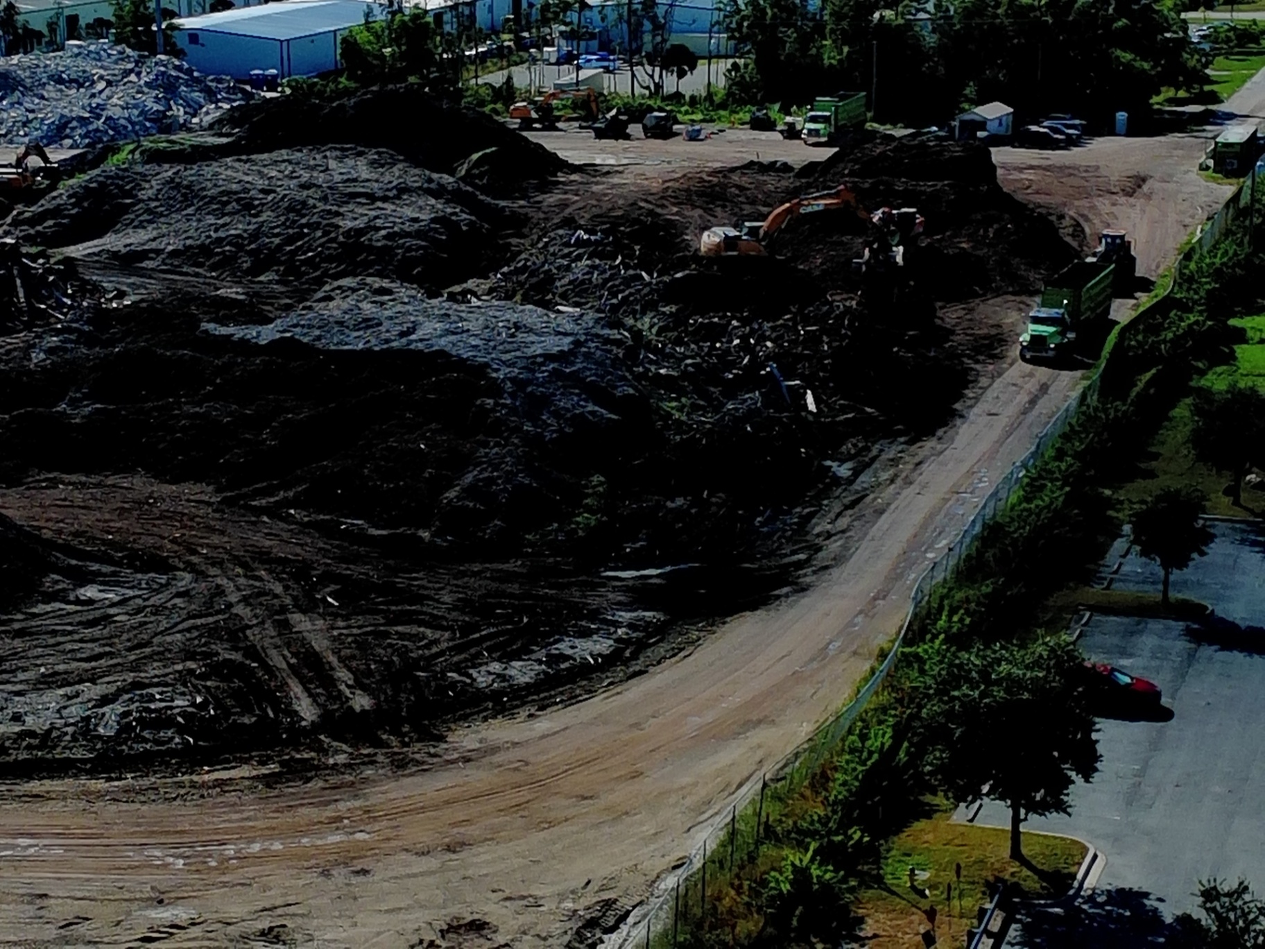
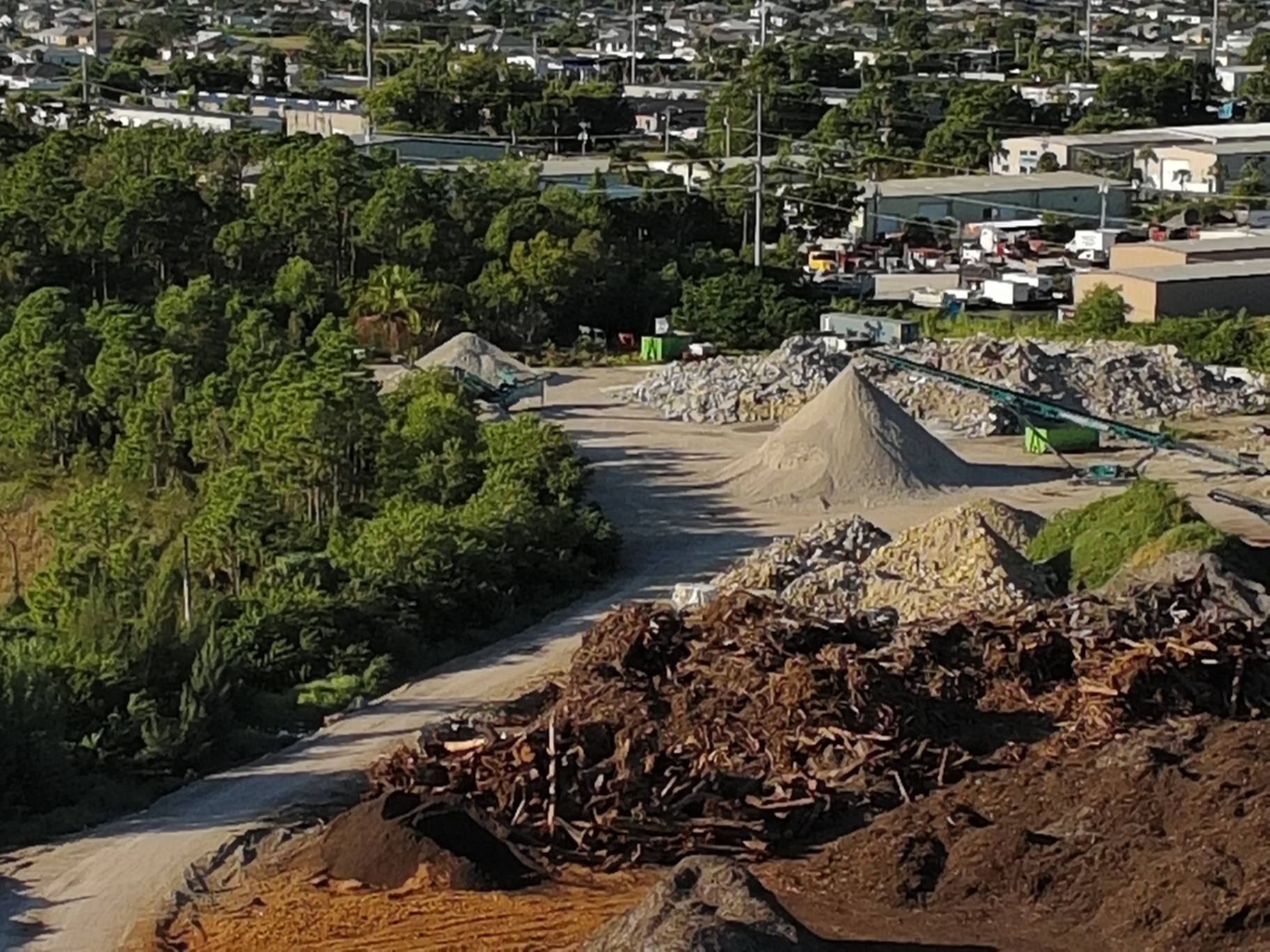
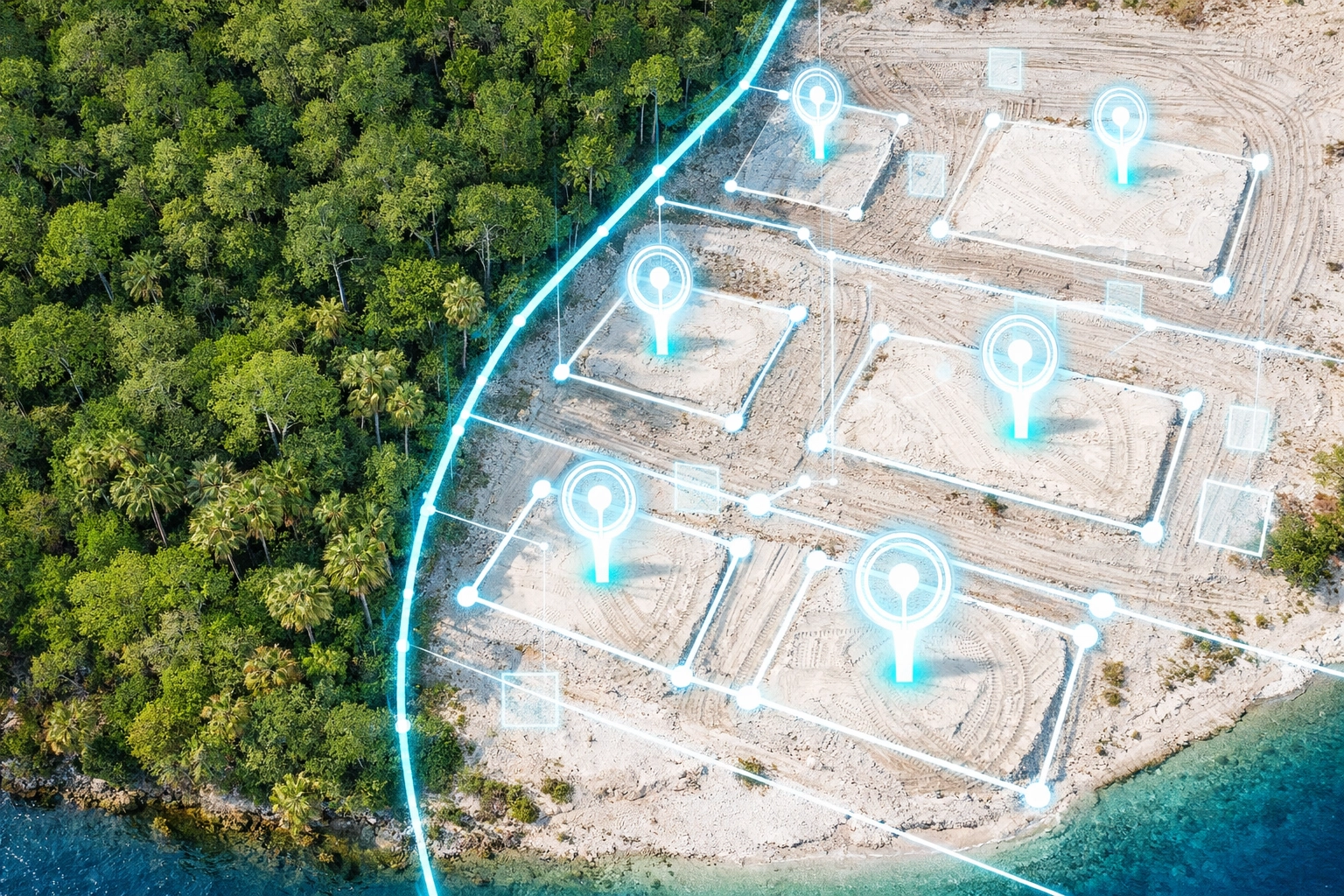
Inventory and Material Tracking
One of the most immediate benefits of drone mapping for land development is the ability to track materials. High-resolution orthomosaics allow for the visual inspection of equipment, dirt roads, and vegetation.
Furthermore, detailed imagery of an industrial site: like the one shown above: can be used for volumetric analysis. By mapping stockpiles of earth, gravel, or debris, developers can calculate exactly how much material has been moved or how much is needed, facilitating better inventory management and progress tracking.
ROI Advantage
Manual inventory of material piles can take days; drone mapping completes the task in minutes. This real-time data allows for more accurate billing and faster decision-making on the job site.
Avoid the "Survey-Grade" Trap
It is essential for developers to understand the distinction between drone mapping and licensed land surveying. While drone data provides incredible detail and spatial context, it is used for planning and documentation.
In the state of Florida, official boundary determinations and legal surveys must be performed by a licensed professional land surveyor. Drone mapping serves as a powerful supplement to these surveys, providing the visual and topographic context that a traditional survey often lacks.
Final Pre-Flight Equipment Check
Before the propellers spin, a final checklist ensures mission success:
- Firmware Verification: Ensure all drone and sensor software is up to date.
- Calibration: Calibrate the compass and IMU to ensure flight stability.
- Battery Management: Verify all flight batteries and controllers are at 100% capacity.
- Weather Analysis: Confirm wind speeds and visibility meet safe operating minimums.
The ROI of Early Mapping
Investing in drone mapping at the start of a land development project creates a digital baseline. This baseline allows you to:
- Identify drainage issues before they become construction hurdles.
- Document site conditions for insurance and liability protection.
- Coordinate subcontractors with a shared, high-resolution visual reference.
- Communicate progress to stakeholders with clear, data-driven visuals.
By capturing this data first, you eliminate the guesswork that leads to expensive rework and missed deadlines.
Important Disclaimer
Our data is for planning purposes and is not a substitute for a licensed land survey. Thermal results indicate anomalies and are not a substitute for evaluation by a licensed professional.
Ready to Map Your Next Project?
If you are planning a land development project in Southwest Florida, high-resolution aerial data is your most valuable asset. Contact Cape UAV today to discuss how our drone mapping services can streamline your workflow and provide the clarity you need to build with confidence.
Learn more about our industrial solutions or explore our full list of drone services.
Important Disclaimer: Our data is for planning purposes and is not a substitute for a licensed land survey. Thermal results indicate anomalies and are not a substitute for evaluation by a licensed professional. Autel Robotics is a trademark of its respective owner; Cape UAV is not affiliated with or endorsed by Autel Robotics. Results depend on environmental and site conditions.