
Construction site monitoring is evolving. If you’re still relying on manual walk-throughs, handheld cameras, and "best-guess" estimates for stockpile volumes, you’re likely leaking profit. In a fast-paced environment like Southwest Florida, where weather and supply chains can shift in an afternoon, having delayed or inaccurate data isn't just an inconvenience: it’s a liability.
At Cape UAV, we see the same challenges across job sites in Cape Coral and the surrounding region. Project managers are stretched thin, stakeholders are demanding more transparency, and site safety remains a top priority. The solution isn't more people on the ground; it’s better data from above. High-resolution drone mapping and thermal imaging provide a level of oversight that traditional methods simply cannot match.
Here are the seven most common mistakes being made in construction site monitoring today and how enterprise-grade drone technology fixes them.
1. Relying Solely on "Boots on the Ground" Perspectives
The most common mistake is assuming that a ground-level walk-through provides a complete picture of the site. While site supervisors are essential, their perspective is limited by physical barriers, equipment height, and the sheer scale of modern land development.
How Drone Mapping Fixes It:
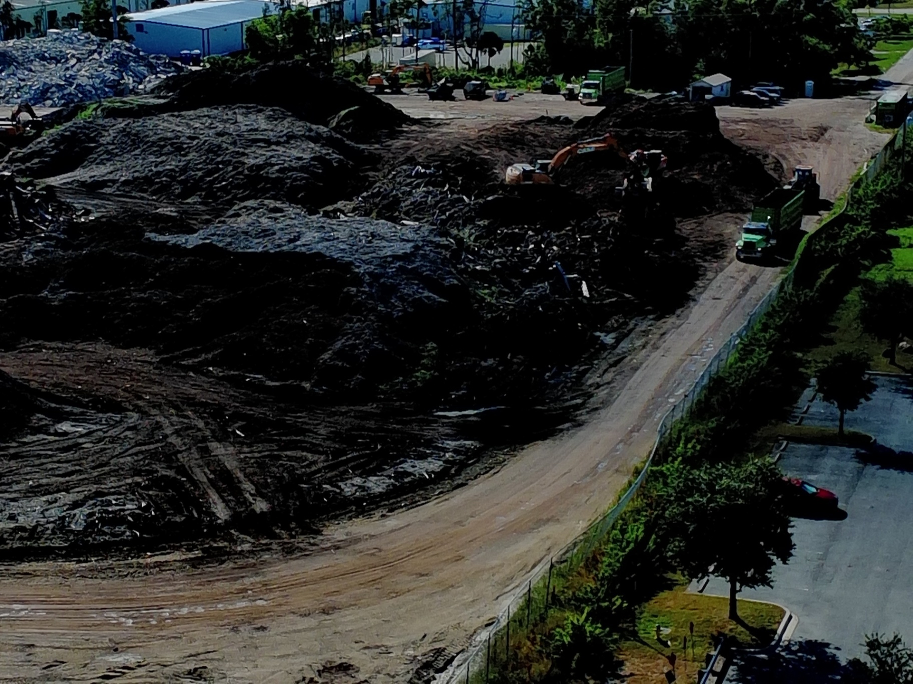
An aerial perspective provides a comprehensive view of the entire project footprint in a single session. Using the Autel Robotics EVO Lite 6T Enterprise, we capture 50MP visual data that allows you to zoom in on specific details: like rebar placement or utility trenching: while maintaining the context of the entire site.
Why It Matters:
- Eliminates "blind spots" caused by large machinery or material piles.
- Provides a bird’s-eye view of site logistics and traffic flow.
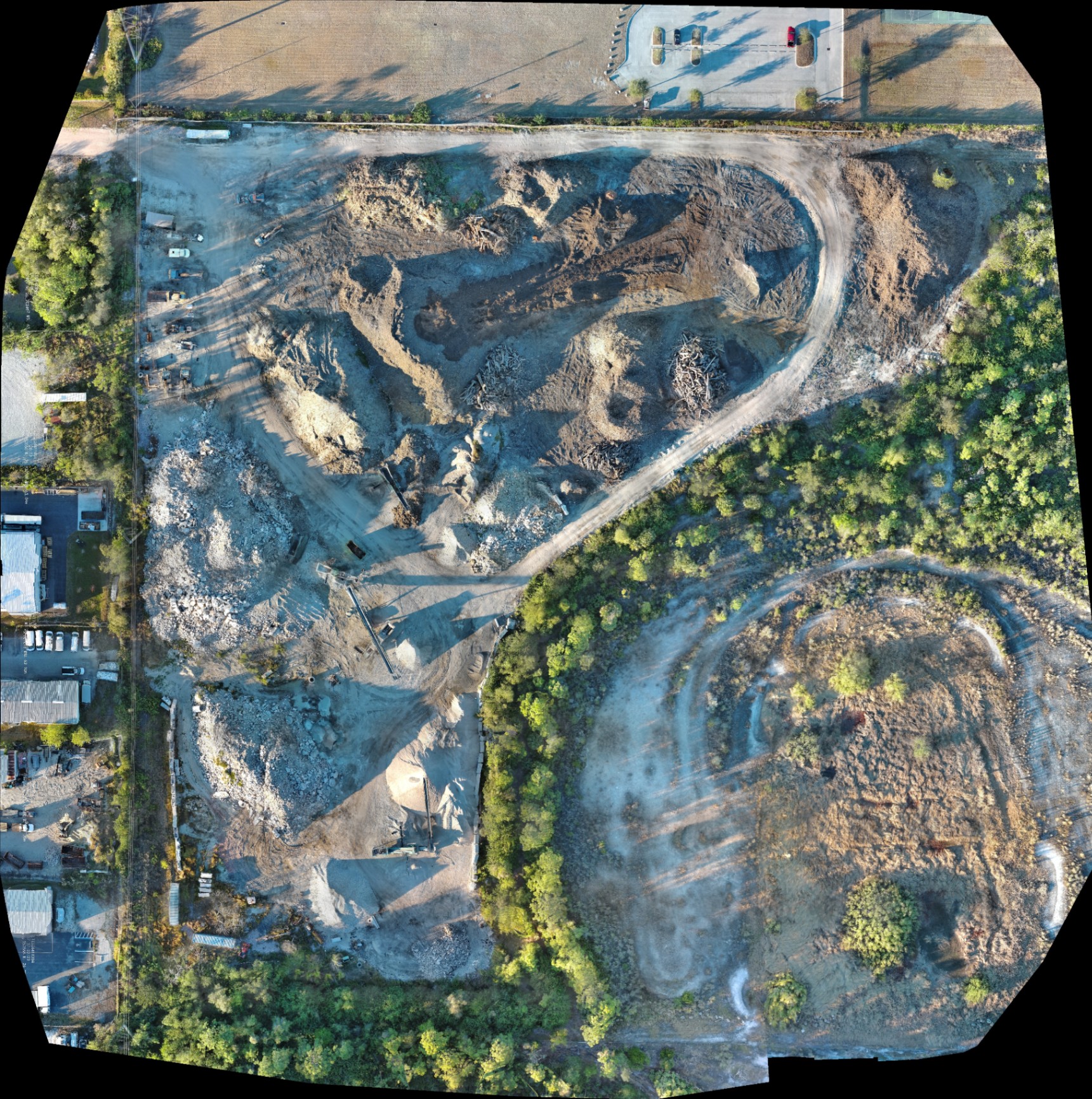
- Captures high-resolution orthomosaic maps that document the site exactly as it exists at that moment.
2. Using Inconsistent or Infrequent Reporting Intervals
Many projects only document progress at major milestones. If a mistake is made during the foundational phase but isn't caught until the framing begins, the cost to remediate is astronomical. Stale data leads to reactive management rather than proactive planning.
How Drone Mapping Fixes It:
Drone missions can be automated and repeated with precision. By flying the same flight path every week or even every day, you create a time-lapse record of progress. This consistency allows for "side-by-side" comparisons that highlight exactly what has changed over time.
ROI Advantage:
Regularly scheduled drone services catch deviations from the site plan early. Detecting a grading error a week after it happens is significantly cheaper than finding it a month later when the concrete has already been poured.
3. Eyeballing Stockpiles and Material Inventories
Estimating the volume of dirt, gravel, or debris piles by eye or with basic GPS sticks is notoriously inaccurate. These errors lead to poor budgeting for haul-away costs or unexpected shortages of fill material, both of which stall production.
How Drone Mapping Fixes It:
By generating 3D models and digital surface models (DSM), drones can calculate volumes with high precision. While this data is for planning purposes and not a substitute for a licensed land survey, it provides project managers with the actionable data needed to manage logistics efficiently.
Why This Matters:
- Predictability: Know exactly how much fill you have on-site.
- Cost Control: Avoid overpaying for material transport.
- Efficiency: Inventory checks that used to take hours now take minutes of flight time.
4. Communication Silos Between Field and Office
Miscommunication is the primary driver of construction delays. When the office team is looking at 2D blueprints and the field team is looking at real-world conditions, things get lost in translation. Static photos sent via text or email lack the context required for high-level decision-making.
How Drone Mapping Fixes It:
High-resolution orthomosaics can be shared via cloud platforms, allowing every stakeholder: from the owner to the sub-contractors: to view the same digital twin of the site. This creates a "single source of truth."
Technical Edge:
Our primary platform, the EVO Lite 640T, allows us to deliver ultra-detailed visuals. When everyone is looking at the same high-res map, "I thought you meant the other corner" ceases to be a valid excuse.
5. Ignoring Thermal Anomalies and Hidden Issues
Construction isn't just about what you can see with the naked eye. Moisture intrusion, electrical hotspots in temporary site power, or insulation gaps in newly enclosed structures can go unnoticed until they cause a failure.
How Drone Mapping Fixes It:
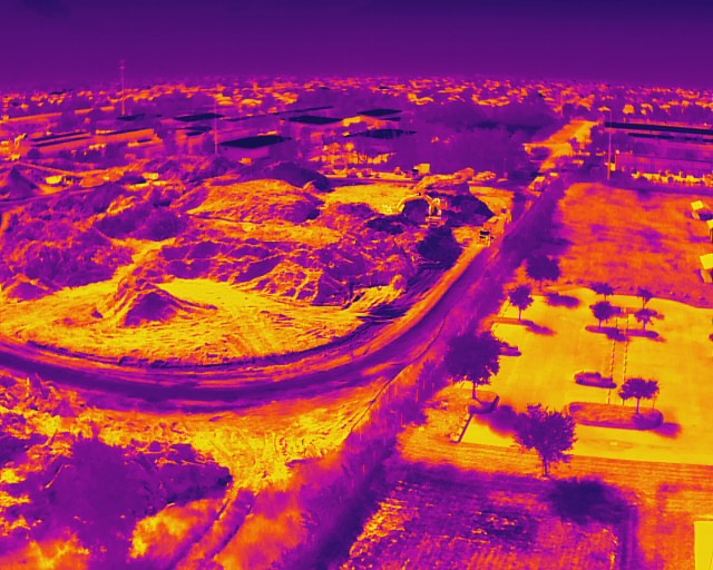
This is where thermal imaging becomes a game-changer. Our enterprise drones feature a 640×512 thermal sensor with a 12um pixel pitch. This allows us to detect temperature variations that indicate potential problems beneath the surface.
Why It Matters:
- Identifies moisture trapped under roofing membranes before the interior is finished.
- Locates overheating electrical components in heavy machinery or site infrastructure.
- Supports facility maintenance by identifying energy inefficiencies early.
6. Manual Tracking of Heavy Equipment and Assets
On large-scale industrial or land development sites, keeping track of where every bulldozer, excavator, and generator is located can be a headache. Manual tracking is time-consuming and prone to human error, leading to underutilized equipment and wasted fuel.
How Drone Mapping Fixes It:
A single 15-minute flight provides a total inventory of all assets on the site. By integrating this with your industrial site management workflow, you can optimize equipment placement and ensure that high-value assets are exactly where they need to be.
The ROI of Visibility:
Reducing the "search time" for equipment or identifying underutilized machinery can save thousands in rental and labor costs over the life of a project.
7. Inadequate Safety and Liability Documentation
If an accident occurs or a neighboring property owner claims damage, "he-said-she-said" is a dangerous legal position. Most sites lack the comprehensive, time-stamped documentation needed to defend against liability claims or verify safety compliance.
How Drone Mapping Fixes It:
Aerial site audits provide an indisputable record of site conditions. You can verify that silt fences are installed correctly, PPE is being worn in high-risk areas, and that the site was secured at the end of the day.
Technical Fact:
Operating under FAA Part 107 certification, Cape UAV ensures that all missions are flown safely and legally, providing professional-grade documentation that holds up under scrutiny.
The ROI of Professional Drone Mapping
Switching from traditional monitoring to a drone-first approach isn't just about having "cool photos." It’s about a measurable return on investment. For construction firms in Southwest Florida, the benefits are clear:
| Feature | Traditional Method | Drone Mapping Solution |
|---|---|---|
| Site Overview | Limited ground photos | 50MP Visual Orthomosaic |
| Stockpile Analysis | Manual estimation | 3D Volumetric Planning Data |
| Inspection Speed | Hours/Days of walking | Minutes of flight time |
| Data Accuracy | Subjective | High-resolution technical specs |
| Safety | High-risk manual climbing | Remote aerial inspection |
By identifying errors before they are buried in concrete or hidden behind drywall, drone mapping pays for itself many times over in avoided rework and reduced delays.
Important Disclaimer
Mapping Disclaimer: Our data is for planning purposes and is not a substitute for a licensed land survey.
Thermal Disclaimer: Thermal results indicate anomalies and are not a substitute for evaluation by a licensed professional.
Ready to bring high-resolution clarity to your next project?
Whether you’re managing a luxury residential build or a massive industrial development, Cape UAV provides the technical expertise and enterprise-grade equipment to keep your project on track.
Contact Michael Sischo at Cape UAV today to discuss how our thermal imaging and precision mapping can support your Southwest Florida construction site.
Important Disclaimer
Our data is for planning purposes and is not a substitute for a licensed land survey. Thermal results indicate anomalies and are not a substitute for evaluation by a licensed professional. Autel Robotics is a trademark of its respective owner; Cape UAV is not affiliated with or endorsed by Autel Robotics.