
For construction project managers and land developers in Southwest Florida, visual documentation is no longer a luxury: it is a requirement. However, not all aerial imagery is created equal. When you are looking at a drone-captured view of your site, you are likely seeing one of two things: a standard aerial photograph or a high-resolution orthomosaic map.
While a standard photo looks great in a progress report, it lacks the technical depth required for high-level site management. Orthomosaic maps, on the other hand, transform raw visual data into a powerful planning tool. Understanding the technical differences between these two assets is the first step toward optimizing your drone services strategy and protecting your bottom line.
The Visual Standard vs. Technical Data
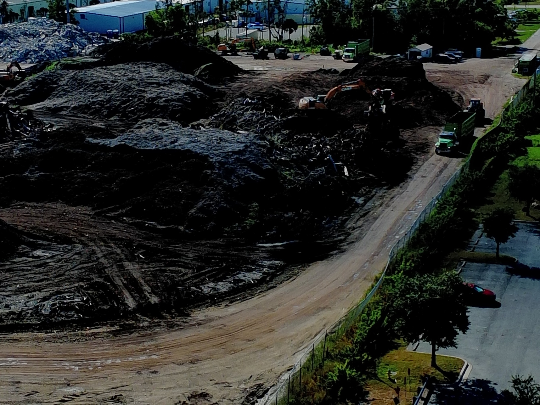
Standard aerial photos are exactly what they sound like: high-quality snapshots taken from the air. At Cape UAV, we utilize the Autel Robotics EVO Lite 6T Enterprise, equipped with a 50MP visual camera, to capture these images. They are excellent for marketing, showcasing a completed project, or giving a general sense of site activity.
But standard photos have a major flaw for construction: perspective distortion. Because the camera lens is a single point of capture, objects farther from the center of the frame appear tilted or warped. This "fisheye" effect makes it impossible to rely on these photos for site planning or precise documentation.
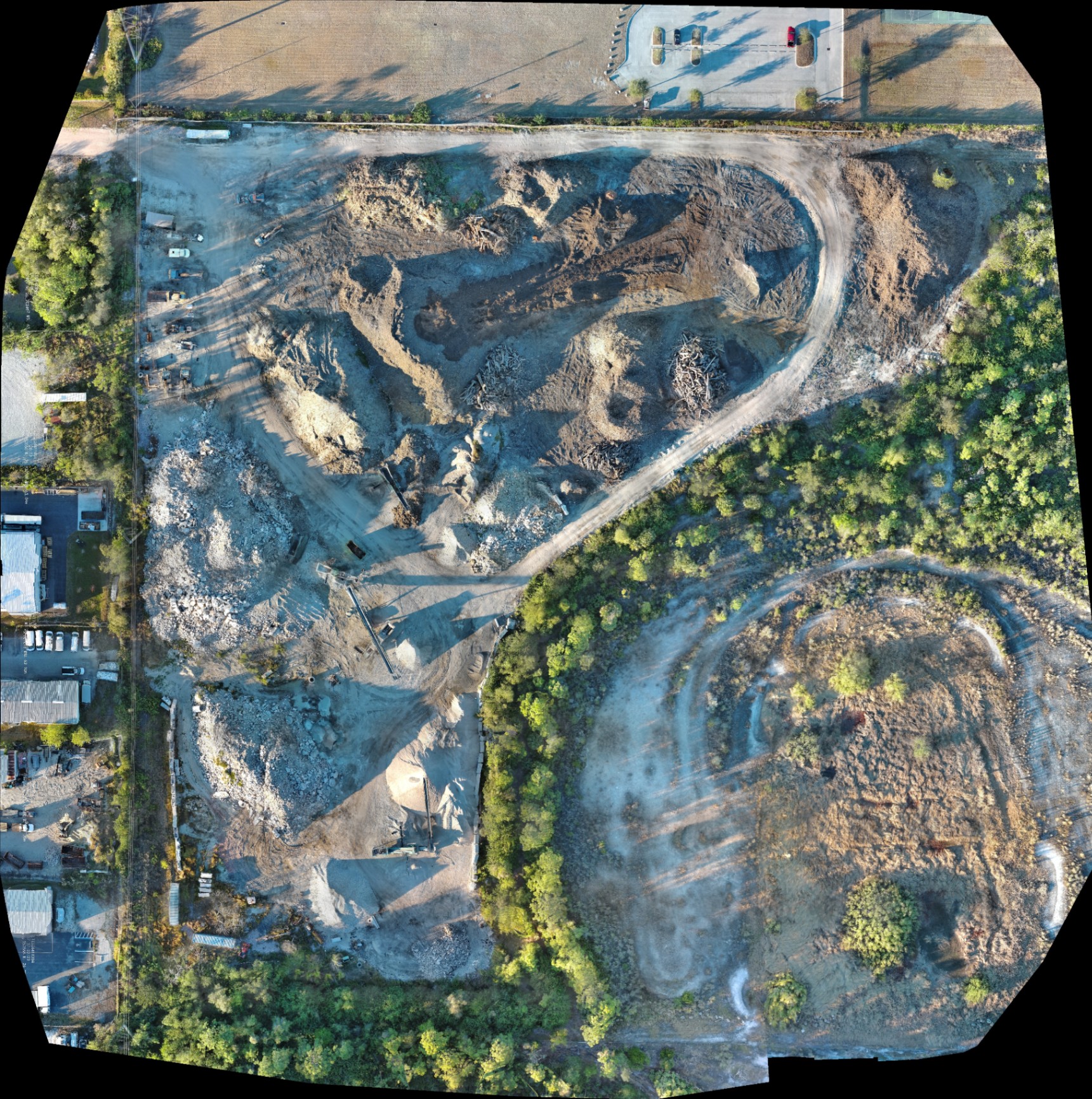
Orthomosaic maps solve this problem. An orthomosaic is a large, map-quality image composed of hundreds or even thousands of individual photos stitched together. Each photo is "orthorectified," a process that removes perspective distortion and corrects for the earth’s topography. The result is a perfectly top-down, uniform view where every pixel is geometrically corrected.
Why Orthorectification Matters
When you look at a standard photo of a tall building, you can see the sides of the structure. In an orthomosaic map, you only see the roof. This is because the software aligns every image to ensure the camera is effectively "looking down" at every single square inch of the site simultaneously.
The Problem with Perspective
- Lens Distortion: Standard lenses curve the edges of an image, making straight lines appear bent.
- Camera Tilt: If the drone isn't perfectly level, the scale of the ground changes across the photo.
- Topographic Relief: Changes in elevation: like large stockpiles or trenches: warp the perceived distance between objects in a regular photo.
By eliminating these variables, orthomosaic maps provide a consistent scale across the entire site. This allows project managers to overlay CAD drawings or site plans directly onto the drone data to ensure that reality matches the design. This level of precision is critical for drone mapping in Southwest Florida, where land development moves at a rapid pace.
Key Advantages for Construction Sites
For most construction workflows, the orthomosaic map is the superior choice. It offers a level of utility that a standard photo simply cannot match.
1. Superior Progress Tracking
Standard photos capture moments; orthomosaics capture progress. By flying the same automated path every week, we can generate a series of maps that align perfectly. This allows you to toggle between different dates and see exactly how much dirt has been moved or how much foundation has been poured.
2. Precise Site Planning and Logistics
Managing a busy job site requires a clear understanding of space. With a high-resolution orthomosaic, you can identify the best locations for material staging, crane placement, and temporary access roads. Because the map is to scale, you can visualize whether a piece of equipment will fit through a specific corridor before it even arrives on-site.
3. Volumetric Analysis (Stockpiles)
One of the most valuable uses for orthomosaic data is calculating the volume of material piles. By using the technical data embedded in the map, project managers can estimate the volume of soil, gravel, or debris. This helps in managing haul-away costs and ensuring you have enough material for fill operations.
Orthomosaic vs. Standard Photo: A Quick Comparison
| Feature | Standard Aerial Photo | Orthomosaic Map |
|---|---|---|
| Primary Use | Marketing & Basic Progress | Planning, Analysis & Documentation |
| Perspective | Perspective / Tilted | Perfectly Top-Down (Nadir) |
| Distortion | High (Edges are warped) | Eliminated (Orthorectified) |
| Scalability | Variable (Cannot be scaled) | Uniform (True-to-scale) |
| Utility | Visual context only | CAD/GIS Integration |
| Data Size | Small (Single JPG) | Large (GeoTIFF / Layered Data) |
The Integration of Thermal Data
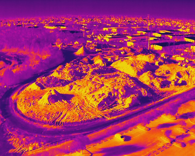
In addition to visual mapping, the next generation of construction documentation involves thermal imaging. Our enterprise platforms, including the EVO Lite 640T, feature a 640×512 thermal sensor with a 12um pixel pitch. This high-sensitivity sensor allows us to create thermal orthomosaics.
For construction sites, a thermal map can reveal invisible issues that a standard visual photo would miss entirely. This includes identifying subsurface moisture on a new roof, detecting heat anomalies in electrical infrastructure, or monitoring the curing process of large concrete pours.
Thermal results indicate anomalies and are not a substitute for evaluation by a licensed professional, but they provide the early warning signs needed to prevent costly rework.
ROI Advantage: Saving Time and Reducing Rework
The cost of an orthomosaic map is higher than a set of standard photos, but the ROI is significantly greater. In the construction industry, the most expensive problems are the ones discovered too late.
- Communication: Sharing a single, high-resolution map with subcontractors ensures everyone is looking at the same "source of truth."
- Transparency: Stakeholders and investors can view the site from anywhere in the world with a level of detail that feels like they are standing on the ground.
- Documentation: Having a permanent, geometrically accurate record of the site at various stages provides invaluable protection against future insurance claims or structural disputes.
By utilizing Cape UAV's industrial services, firms in Cape Coral and the surrounding areas can transition from "seeing" their site to "analyzing" it.
Which One Should You Choose?
The answer depends on your goals for the specific project phase.
Choose Standard Photos if:
- You need marketing material for a real estate listing.
- You want a quick visual update for a weekly email.
- You are capturing aesthetic "hero shots" of a completed building.
Choose Orthomosaic Maps if:
- You are in the pre-construction or earthworks phase.
- You need to overlay site plans to check for encroachments.
- You require a detailed, high-resolution record for progress monitoring.
- You are performing volumetric analysis or site logistics planning.
Most professional contractors find that a hybrid approach: weekly orthomosaic maps supplemented by high-resolution standard photos: provides the most complete view of their operations.

Important Disclaimer
Mapping Disclaimer: Our data is for planning purposes and is not a substitute for a licensed land survey.
Thermal Disclaimer: Thermal results indicate anomalies and are not a substitute for evaluation by a licensed professional.
Autel Robotics is a trademark of its respective owner; Cape UAV is not affiliated with or endorsed by Autel Robotics. Our equipment includes models such as the Autel Robotics EVO Lite 6T Enterprise with a 640×512 thermal sensor and a 50MP visual camera. Results depend on weather and site conditions.
For more information on how precision mapping can benefit your next project, visit our FAQ or contact us today for a technical consultation.