
Traditional site inspections are inherently reactive: often slow, labor-intensive, and prone to human error. In the fast-moving world of Southwest Florida land development and industrial maintenance, waiting days for a site report is no longer a viable option. Modern site management requires a proactive approach that prioritizes high-resolution data and rapid turnaround.
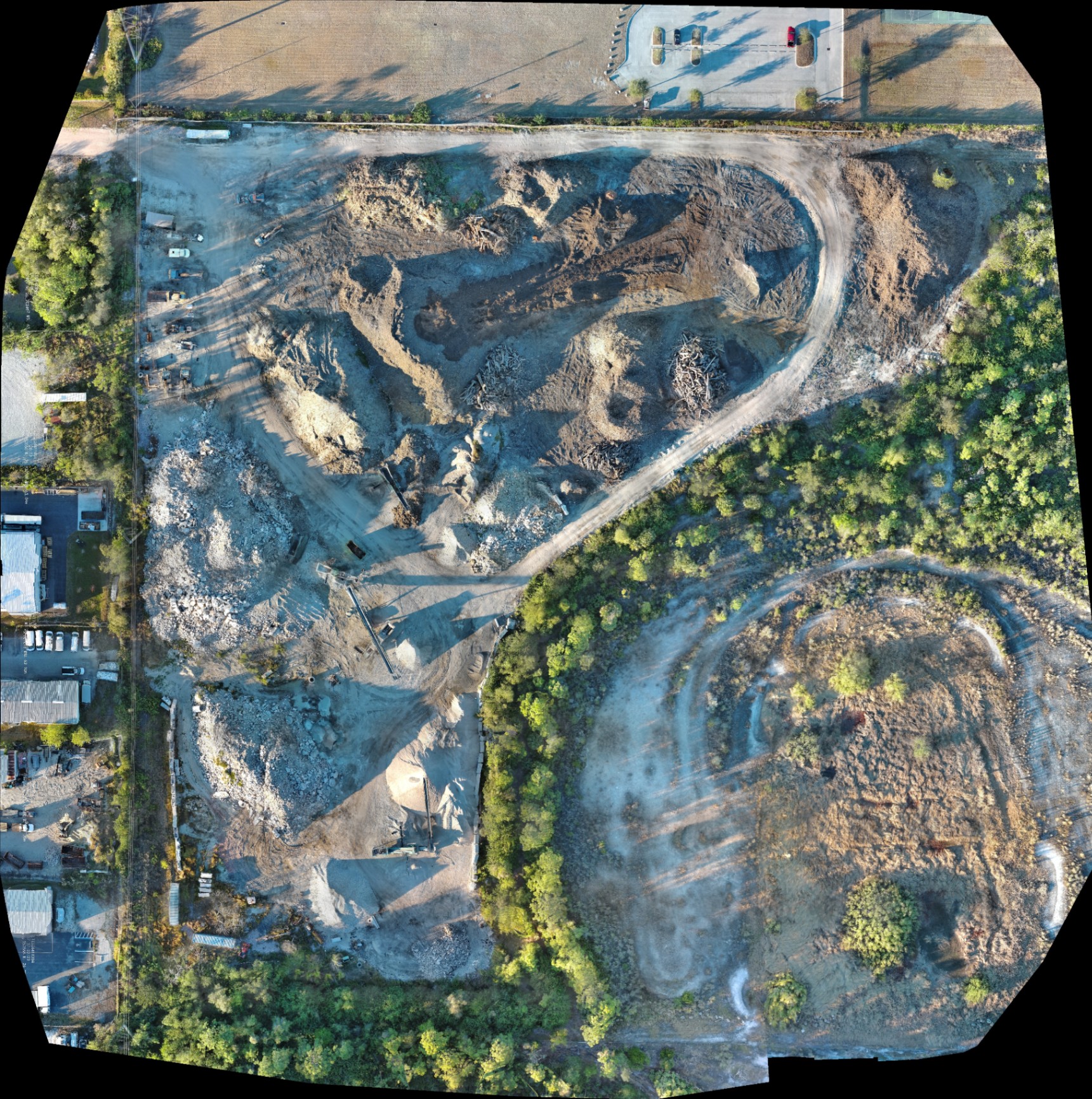
Drone mapping transforms this workflow from a logistical hurdle into a competitive advantage. By leveraging advanced aerial platforms, project managers can digitize their entire job site, creating high-resolution orthomosaics and 3D models that provide a complete view of progress and potential issues. At Cape UAV, we utilize enterprise-level equipment to deliver these insights to construction and property management teams across Cape Coral and the surrounding region.
Here are five ways drone mapping streamlines your site inspection workflow while driving significant ROI.
1. Rapid Data Collection and Faster Decision-Making
The most immediate impact of drone mapping is the sheer speed of data acquisition. Traditional ground-based inspections for large-scale developments can take days or even weeks to complete, involving multiple personnel and manual documentation.
A drone-based workflow allows for the rapid deployment of equipment to survey multiple structures or hundreds of acres in a single morning. This efficiency is critical for industrial site inspections, where facility managers need immediate answers regarding structural integrity or equipment conditions.
Why This Matters:
- Reduced Field Time: Drones capture thousands of data points in the time it takes a ground crew to set up their equipment.
- Rapid Reporting: Data captured by our FAA Part 107–certified pilots can be processed quickly, allowing for same-day or next-day decision-making.
- Consistency: Unlike manual photos, drone mapping follows automated flight paths, ensuring the exact same area is captured every time for accurate progress comparisons.
2. Substantial Cost Reductions
Efficiency translates directly into cost savings. By integrating drone mapping services, companies can reduce field costs by up to 50% compared to traditional methods. These savings stem from the elimination of expensive temporary infrastructure and the reduction of man-hours.
In construction and facility maintenance, the need for scaffolding, cherry pickers, or man-lifts is significantly reduced when a drone can provide high-resolution visual and thermal data from a distance.
| Feature | Traditional Inspection | Drone-Based Inspection |
|---|---|---|
| Labor | Multiple personnel / manual data entry | Single FAA Part 107 pilot |
| Equipment | Lifts, scaffolding, specialized vehicles | Enterprise drone platform |
| Duration | Days to weeks | Minutes to hours |
| Safety Risk | High (working at heights/hazardous areas) | Minimal (remote operation) |
| Data Quality | Subjective / manual photos | High-resolution digital twin |
ROI Advantage:
The ability to identify a site discrepancy early: before concrete is poured or structures are finalized: saves tens of thousands of dollars in rework costs.
3. Improved Safety for Personnel
Safety is a primary driver for drone adoption in industrial and construction sectors. Manual inspections often require personnel to enter confined spaces, climb high-altitude structures, or navigate active excavation sites where heavy machinery is in constant motion.
Drones eliminate the need for "boots on the ground" in high-risk areas. Our pilots operate from a safe distance, capturing every detail of a facility or site without putting a single person at risk of a fall or injury. This proactive safety measure not only protects employees but also reduces insurance liability and potential project shutdowns due to accidents.
4. Precise, High-Resolution Data and Thermal Integration
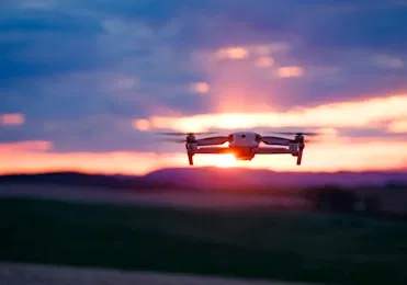
The quality of the data is where enterprise drones truly outshine traditional photography. At Cape UAV, our primary platform for these missions is the Autel Robotics EVO Lite 6T Enterprise (EVO Lite 640T). This platform is equipped with a 50MP visual camera and a professional-grade 640×512 thermal sensor.
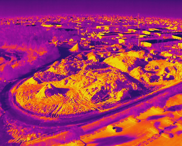
The integration of thermal imaging into site inspections reveals what is invisible to the naked eye. In Southwest Florida, where moisture intrusion and energy efficiency are top concerns, thermal mapping is essential for facility maintenance.
Technical Superiority:
- 12um Pixel Pitch: Our thermal sensors utilize a 12um pixel pitch, providing higher sensitivity to detect minute temperature variations that indicate insulation failures or moisture trapped beneath roof membranes.
- High-Resolution Visuals: The 50MP visual sensor allows for extreme zooming on orthomosaic maps, enabling inspectors to see individual cracks, rust, or loose fasteners on infrastructure.
- Overlay Capabilities: We can overlay thermal data onto high-resolution visual maps, providing a comprehensive view of how heat and moisture interact with the site's physical structures.
5. Real-Time Progress Monitoring and Digital Twins
For large-scale land development, drone mapping provides a visual timeline that is invaluable for project management. By flying regular missions, we create a chronological record of the site’s evolution. This data can be used to generate orthomosaics: highly detailed, top-down maps: that help managers track material movement and equipment locations.
Managers can compare current site conditions against Building Information Modeling (BIM) files to check for discrepancies. This level of transparency ensures that projects stay on schedule and that stakeholders are kept informed with factual, visual data.
Why This Matters:
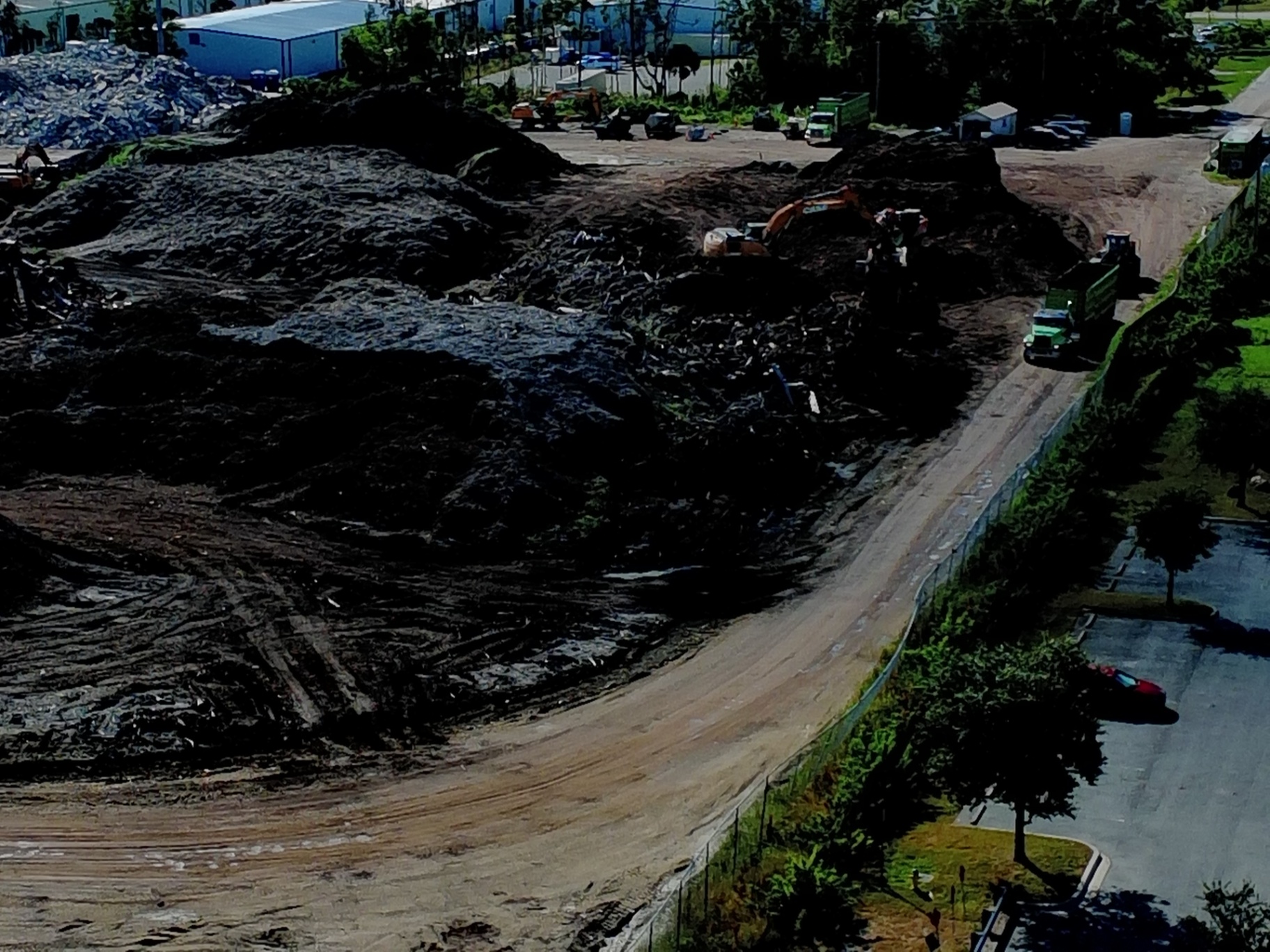
- Volumetric Analysis: High-resolution mapping allows for the calculation of stockpile volumes (dirt, gravel, mulch) without manual measurements.
- Remote Management: Stakeholders can view the entire site from their office, reducing the need for constant site visits and travel.
- Conflict Resolution: If a contractor claims a specific milestone was met, the drone-captured orthomosaic provides an indisputable record of the site’s status on that specific date.
Technical Specs: The Cape UAV Advantage
We believe that professional results require professional equipment. Our commitment to high-resolution data is backed by the technical specs of our fleet:
- Primary Platform: Autel Robotics EVO Lite 6T Enterprise (EVO Lite 640T).
- Visual Sensor: 50MP for crystal-clear site documentation and marketing.
- Thermal Sensor: 640×512 resolution with a 12um pixel pitch for industry-leading thermal sensitivity.
- Pilot Certification: All missions are flown by FAA Part 107–certified pilots ensuring full legal compliance and safety.
(Autel Robotics is a trademark of its respective owner; Cape UAV is not affiliated with or endorsed by Autel Robotics. Results depend on environmental and site conditions.)

Important Disclaimer
Planning and Analysis Notice: Our data is for planning and documentation purposes and is not a substitute for a licensed land survey. Thermal results indicate temperature anomalies and are not a substitute for evaluation by a licensed professional.
Streamline Your Workflow with Cape UAV
Whether you are managing a luxury real estate development, a massive industrial complex, or a new construction project in Cape Coral, drone mapping provides the clarity and data you need to operate efficiently. By replacing slow, manual processes with rapid aerial data collection, you reduce costs, improve safety, and gain a technical edge.
If you are ready to see how high-resolution mapping and thermal imaging can support your next project, explore our drone services or visit our FAQ to learn more about our process.
Ready to start? Contact us today to schedule a consultation and get a precise look at your site from the air.
Important Disclaimer: Our data is for planning purposes and is not a substitute for a licensed land survey. Thermal results indicate anomalies and are not a substitute for evaluation by a licensed professional.