
Solar energy is no longer the "alternative" choice: it’s the backbone of modern power infrastructure. But as portfolios grow from small rooftops to multi-megawatt utility-scale farms, the old way of doing things just doesn't scale. If you’re still sending a technician out with a handheld thermal camera to walk miles of rows in the Florida sun, you aren’t just wasting time; you’re leaving money on the table.
At Cape UAV, we’ve seen how the industry is shifting. The transition from manual, ground-based checks to high-altitude thermal drone inspections isn't just a trend: it's a fundamental change in how assets are managed. By leveraging enterprise-grade hardware and FAA Part 107-certified expertise, we’re helping asset managers identify faults before they lead to catastrophic failure.
The Bottleneck: Why Manual Inspections Are Failing
Traditional solar inspections are a logistics nightmare. To get an accurate picture of a site’s health, a technician usually has to perform IV-curve tracing or manual spot-checking.
The reality of manual inspections:
- Time Consumption: A thorough manual inspection can take between 2 to 5 hours per Megawatt (MW). On a large site, that's weeks of labor.
- Safety Risks: Technicians are exposed to high-voltage equipment, extreme heat, and uneven terrain for extended periods.
- Incomplete Data: Manual sampling only catches what you’re looking at. If a technician skips a row or misses a subtle temperature spike, that fault remains hidden.
When faults go unnoticed, "hotspots" develop. These aren't just minor efficiency drops; they are safety hazards that can lead to fire or permanent module degradation. This is where the drone-first approach changes the game.
The Enterprise Tech Stack: Precision from the Air
Not all drones are created equal. To deliver the data needed for professional asset management, we utilize high-spec hardware like the Autel Robotics EVO Lite 6T Enterprise (EVO Lite 640T).
Why do the specs matter? It comes down to the sensor. The EVO Lite 6T features a 640×512 thermal sensor paired with a 50MP visual camera. This dual-sensor capability allows us to capture thermal anomalies and visual evidence simultaneously.
Technical Specifications That Drive ROI:
- 12um Pixel Pitch: This is a critical metric for thermal imaging. A 12-micrometer pixel pitch allows for higher spatial resolution. Essentially, it means we can fly higher and cover more ground while still maintaining the detail necessary to spot a single failing cell within a panel.
- Dual Imaging: By overlaying 50MP visual data with thermal signatures, we can quickly determine if a hotspot is caused by an internal electrical fault or something as simple as bird droppings or a cracked glass cover.
- Radiometric Data: We don't just take pictures; we capture data. Every pixel in a radiometric thermal image contains a temperature reading, allowing for deep post-flight analysis.
Note: Autel Robotics is a trademark of its respective owner; Cape UAV is not affiliated with or endorsed by Autel Robotics.
Speed: 10 Minutes vs. 5 Hours
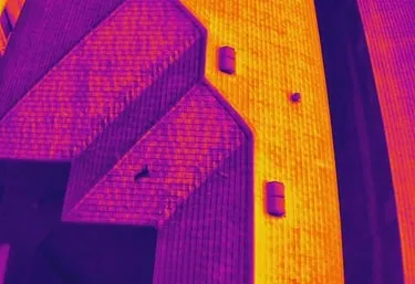
The most immediate "wow" factor for our B2B clients in Southwest Florida is the speed. While a manual team might struggle to finish a single MW in a morning, a drone can complete a thermal survey of 1 megawatt in roughly 10 minutes.
For a 20 MW solar installation: the kind of scale we see in industrial corridors or large-scale utility projects: a manual inspection would take 500+ hours. We can often capture the same site in a single afternoon.
The ROI of Speed:
- Reduced Labor Costs: Drone inspections are typically 40% cheaper than manual methods when you factor in man-hours.
- Minimal Downtime: Because we don't need to shut down arrays to perform the initial thermal scan, your power generation remains uninterrupted.
- Rapid Response: If a storm rolls through Cape Coral or Fort Myers, we can have a drone in the air the next day to assess the entire site for damage, whereas a manual crew might be booked out for weeks.
Detecting the "Silent Killers" of Solar Arrays
A solar panel is only as strong as its weakest cell. Because panels are often wired in strings, a single faulty module can drag down the performance of an entire section. Thermal imaging reveals what the naked eye cannot see.
1. Cell-Level Hotspots
Localized heating within a cell often indicates internal short circuits or "shunting." These spots can reach temperatures high enough to melt the backsheet of the module. Our 12um pixel pitch sensors identify these "bright spots" instantly.
2. Diode Failures
When a bypass diode fails, a whole section of a panel may shut down. On a thermal map, this appears as a perfectly rectangular "patch" that is significantly warmer than the rest of the module.
3. String and Inverter Issues
If an entire string is offline, the thermal signature is unmistakable. All panels in that string will appear uniform but warmer than the functioning panels around them because they aren't converting solar energy into electricity (leaving that energy to dissipate as heat).

Accuracy and Full-Asset Coverage
Traditional sampling is a "best guess" strategy. You check 10% of the modules and assume the other 90% are fine. Thermal drone inspections eliminate the guesswork by providing 100% coverage.
We fly repeatable grid patterns that ensure every single module is captured from an optimal angle. This data is then processed into high-resolution orthomosaics: large, stitch-together maps that allow you to zoom in on any part of the facility with incredible detail.
Why This Matters for Property Managers:
- Warranty Claims: You need proof to file a claim with a manufacturer. A high-resolution thermal report from Cape UAV provides the empirical evidence required to show that a module is performing below spec.
- Baseline Benchmarking: New installations should always have a "birth certificate" inspection. By capturing a full thermal map on day one, you have a baseline to compare against in future years.
Safety: Keeping Boots off the Roof
Safety is a massive line item in any facility maintenance budget. Every time a technician climbs a ladder or walks a sloped roof, the liability risk increases.
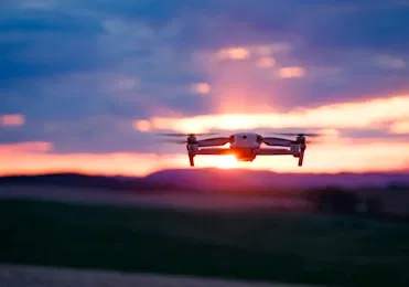
Drone inspections are conducted entirely from the ground. Our FAA Part 107-certified pilots operate from a safe distance, removing the need for lifts, scaffolding, or precarious roof walks. This doesn't just protect the workers; it protects the equipment. Repeated foot traffic on solar arrays can actually cause micro-cracks in the silicon cells: cracks that eventually turn into the very hotspots you were trying to find in the first place.
The Cape UAV Advantage in Southwest Florida
Managing solar assets in Southwest Florida presents unique challenges. From the salt air of the coast to the intense humidity and afternoon thunderstorms, our equipment takes a beating.
Cape UAV specializes in the technical side of drone services. We aren't just "taking pictures." We are providing data-driven insights for construction, land development, and property management firms. Whether it's high-resolution aerial photography for a luxury estate or a complex thermal audit of an industrial solar array, we focus on the technical specs that matter.
ROI Advantage: The Bottom Line
By switching to thermal drone inspections, asset managers typically see:
- $2,100+ savings per MW in inspection costs.
- 99% accuracy in fault detection.
- 75% reduction in total inspection time.
Before a minor anomaly becomes a major insurance claim, thermal imaging gives you the clarity to act.
Important Disclaimer
Thermal results indicate anomalies and are not a substitute for evaluation by a licensed professional.
Our data is for planning purposes and is not a substitute for a licensed land survey.
Summary of Services
If you are managing assets in Cape Coral, Fort Myers, or the surrounding Southwest Florida area, Cape UAV provides the professional drone services you need to stay ahead.
- Thermal Imaging: Facility maintenance, solar inspections, and moisture detection.
- Drone Mapping: High-resolution orthomosaics and 3D modeling for site planning.
- Real Estate: Premium aerial visuals for luxury property showcases.
Ready to see what you've been missing? Contact Cape UAV today to schedule a consultation or learn more about our thermal imaging services.
Important Disclaimer
Thermal results indicate anomalies and are not a substitute for evaluation by a licensed professional. Our data is for planning purposes and is not a substitute for a licensed land survey. Autel Robotics is a trademark of its respective owner; Cape UAV is not affiliated with or endorsed by Autel Robotics. Results of drone inspections depend on environmental conditions and site accessibility.