
Facility maintenance is a constant race against time and deterioration. For property managers and industrial facility owners in Southwest Florida, the stakes are even higher due to extreme humidity, salt air, and intense thermal loading. When it comes to inspecting your assets, you generally have two choices: traditional visual inspections or advanced thermal imaging.
While a visual check is the historical standard, research indicates that visual inspections typically catch only about 20% of structural and system problems. The remaining 80%, the invisible failures, are what eventually lead to catastrophic downtime and expensive emergency repairs.
The Limitation of the Naked Eye
Visual inspections rely on what an inspector can physically see from a ladder, a lift, or the ground. In a facility environment, this means looking for obvious signs of distress: cracked masonry, peeling paint, rusted conduits, or pooling water.
Why This Matters:
- Surface Level Only: You only see the "symptom" once it has reached the surface.
- Safety Risks: Manual inspections often require personnel to work at heights or near energized equipment.
- Time Intensive: Checking a 50,000-square-foot roof visually can take days, often missing the very issues you are looking for.
Visual data is essential for documentation, but it lacks the diagnostic depth required for modern facility maintenance. If you can see the leak with your eyes, the damage to the substrate is likely already extensive.
The Thermal Advantage: Seeing the Unseen
Thermal imaging, or infrared thermography, changes the equation by detecting heat signatures rather than light. Every object with a temperature above absolute zero emits infrared radiation. By capturing this data, we can identify anomalies that are physically impossible to see with a standard camera.
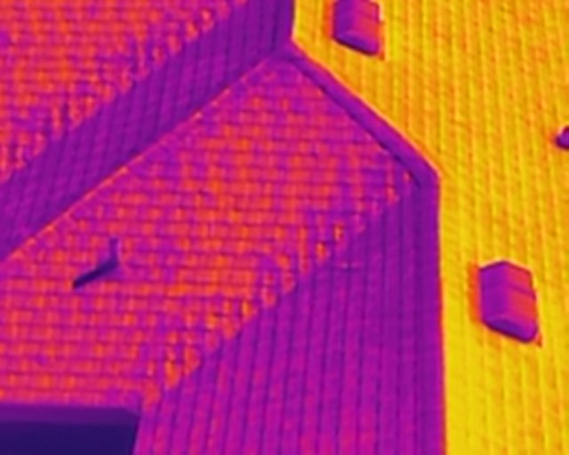
At Cape UAV, we utilize the Autel Robotics EVO Lite 6T Enterprise (EVO Lite 640T) for these missions. This platform is equipped with a professional-grade 640×512 thermal sensor featuring a 12um pixel pitch. This level of technical specification is critical; it allows us to detect minute temperature differentials that signal the earliest stages of equipment or structural failure.
Why 12um Pixel Pitch Matters
In thermal imaging, the pixel pitch determines the detail and sensitivity of the data. A 12um (micrometer) pitch provides higher spatial resolution, allowing our pilots to identify smaller anomalies from greater distances. Whether we are scanning a solar farm or an industrial HVAC system, this precision ensures that "ghost" readings are minimized and actual hot spots are pinpointed with high clarity.
Head-to-Head: Visual vs. Thermal
| Feature | Visual Inspection | Thermal Imaging (UAV) |
|---|---|---|
| Detection Method | Reflected Light (Visible) | Infrared Radiation (Heat) |
| Moisture Detection | Only if surface is wet/stained | Detects trapped moisture in substrate |
| Electrical Analysis | Requires physical contact/proximity | Remote detection of energized "hot spots" |
| Efficiency | Slow, manual, and localized | Rapid, wide-area aerial coverage |
| Safety | High risk (ladders, lifts, roof walks) | Low risk (stand-off aerial capture) |
| Actionable Data | Qualitative (subjective notes) | Quantitative (precise temp data) |
Key Applications in Facility Maintenance
1. Roof Moisture Surveys
In Cape Coral and the surrounding Florida region, flat roofs are prone to moisture entrapment. Traditional inspections might look for "soft spots" by walking the roof: a method that is both subjective and potentially damaging.
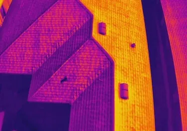
Thermal imaging detects the difference in thermal mass between dry insulation and wet insulation. As the sun sets, dry areas cool quickly, while wet insulation retains heat. Our drones capture this window of time, providing a clear map of exactly where the roof is failing.
ROI Advantage: Instead of replacing an entire 100,000-square-foot roof, you can target the 5% of the area that is actually compromised. This translates to tens of thousands of dollars in avoided capital expenditure.
2. Electrical System Health
Electrical failures are among the leading causes of industrial fires. Loose connections, overloaded circuits, and failing bearings in motors all generate excess heat before they fail.
Using the 50MP visual camera and 640×512 thermal sensor on our Enterprise drones, we can inspect substations, transformers, and rooftop electrical units while they are fully energized. This eliminates the need for facility shutdowns just to perform an inspection.
Why This Matters:
- Zero Downtime: Keep your facility running while we gather data.
- Precision: Identify the specific phase or connection that is overheating.
- Prevention: Address a $500 component before it causes a $50,000 system failure.
3. Envelope and HVAC Efficiency
For large-scale commercial properties, energy loss is a silent budget killer. Thermal imaging reveals where conditioned air is escaping and where insulation has settled or vanished. This is particularly vital for cold storage facilities or high-rise office buildings where HVAC systems work overtime.
Integrating Visual and Thermal Data
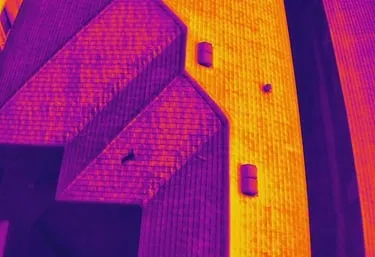
The most effective facility maintenance program doesn't choose one over the other; it integrates both. This is why our drone platforms carry dual-sensor payloads. We provide a side-by-side comparison: a high-resolution visual map (orthomosaic) for context and a thermal map for diagnostics.
For example, a "hot spot" on an industrial roof might look like a simple oil stain in a visual photo. However, the thermal data reveals it is actually a concentrated area of trapped moisture. By overlaying this data onto a precision drone map, facility managers can provide contractors with exact coordinates for repair.
The "Better Together" Workflow:
- Aerial Visual Survey: Captures a high-resolution 2D map of the entire site for documentation.
- Thermal Scan: Identifies anomalies in roofs, electrical panels, and machinery.
- 3D Modeling: Used for planning larger structural repairs or equipment replacements.
- Reporting: A comprehensive data package that identifies the problem, the location, and the severity.
ROI: The Financial Case for Thermal Imaging
Property managers often view inspections as a line-item expense. However, high-resolution aerial thermal imaging should be viewed as an insurance policy with a guaranteed return.
- Labor Savings: A drone can survey a site in 20 minutes that would take a ground crew 8 hours.
- Reduced Insurance Premiums: Many insurers offer better rates or lower deductibles for facilities that maintain a proactive, documented infrared inspection program (often following NFPA 70B standards).
- Extended Asset Life: By identifying and fixing small leaks or overheating components early, you extend the usable life of your most expensive assets: roofs and electrical infrastructure.
Why Southwest Florida Facilities Trust Cape UAV
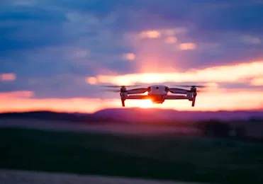
At Cape UAV, we combine local expertise in the Cape Coral market with enterprise-grade technology. Our pilots are FAA Part 107 certified, ensuring that every mission is flown legally and safely within the National Airspace System.
We don't just "take pictures." We provide technical data that supports better decision-making for B2B construction and property management sectors. From identifying heat loss in luxury real estate to monitoring industrial sites, our goal is to deliver clarity, confidence, and control over your facility's future.
Important Disclaimer
Mapping Disclaimer: Our data is for planning purposes and is not a substitute for a licensed land survey.
Thermal Disclaimer: Thermal results indicate anomalies and are not a substitute for evaluation by a licensed professional.
Ready to Upgrade Your Maintenance Strategy?
Stop guessing what is happening beneath the surface of your facility. Whether you need a routine annual check or a post-storm assessment, thermal imaging provides the data you need to act before small issues become major liabilities.
Explore our drone services or contact us today to schedule a technical consultation and see how our 640T thermal sensors can protect your investment.
Important Disclaimer
Thermal results indicate anomalies and are not a substitute for evaluation by a licensed professional. Our data is for planning purposes and is not a substitute for a licensed land survey. Autel Robotics is a trademark of its respective owner; Cape UAV is not affiliated with or endorsed by Autel Robotics.