
Precision drone mapping is the process of using high-end unmanned aerial vehicles (UAVs) equipped with specialized sensors to capture thousands of data points, which are then stitched together to create highly detailed 2D and 3D digital representations of a site. In the fast-moving world of Southwest Florida land development, traditional methods of walking a site with a clipboard or waiting weeks for ground-based reports are no longer sufficient.
For construction managers and property developers in Cape Coral and beyond, this technology offers a level of visibility that was previously impossible. It provides a comprehensive, bird's-eye view that combines high-resolution visual data with technical precision to support project timelines, budget management, and stakeholder communication.
The Evolution of Site Visibility
Construction progress tracking has historically been a manual, labor-intensive process. Project managers often rely on ground-level photos and subjective reports to gauge "work-in-place." This approach leads to information gaps, as critical details are easily missed from the ground.
Precision drone mapping eliminates these blind spots. By deploying enterprise-level technology, we provide a complete digital twin of your project site. This allows you to identify discrepancies between the original design and the actual build: before they become costly change orders.
Why It Matters
- Total Site Coverage: Drones capture every square inch of the site, ensuring no corner is left undocumented.
- Historical Record: Regular flights create a chronological visual timeline of the project from groundbreaking to completion.
- Stakeholder Transparency: High-resolution maps can be shared with investors and clients to provide immediate, verifiable proof of progress.
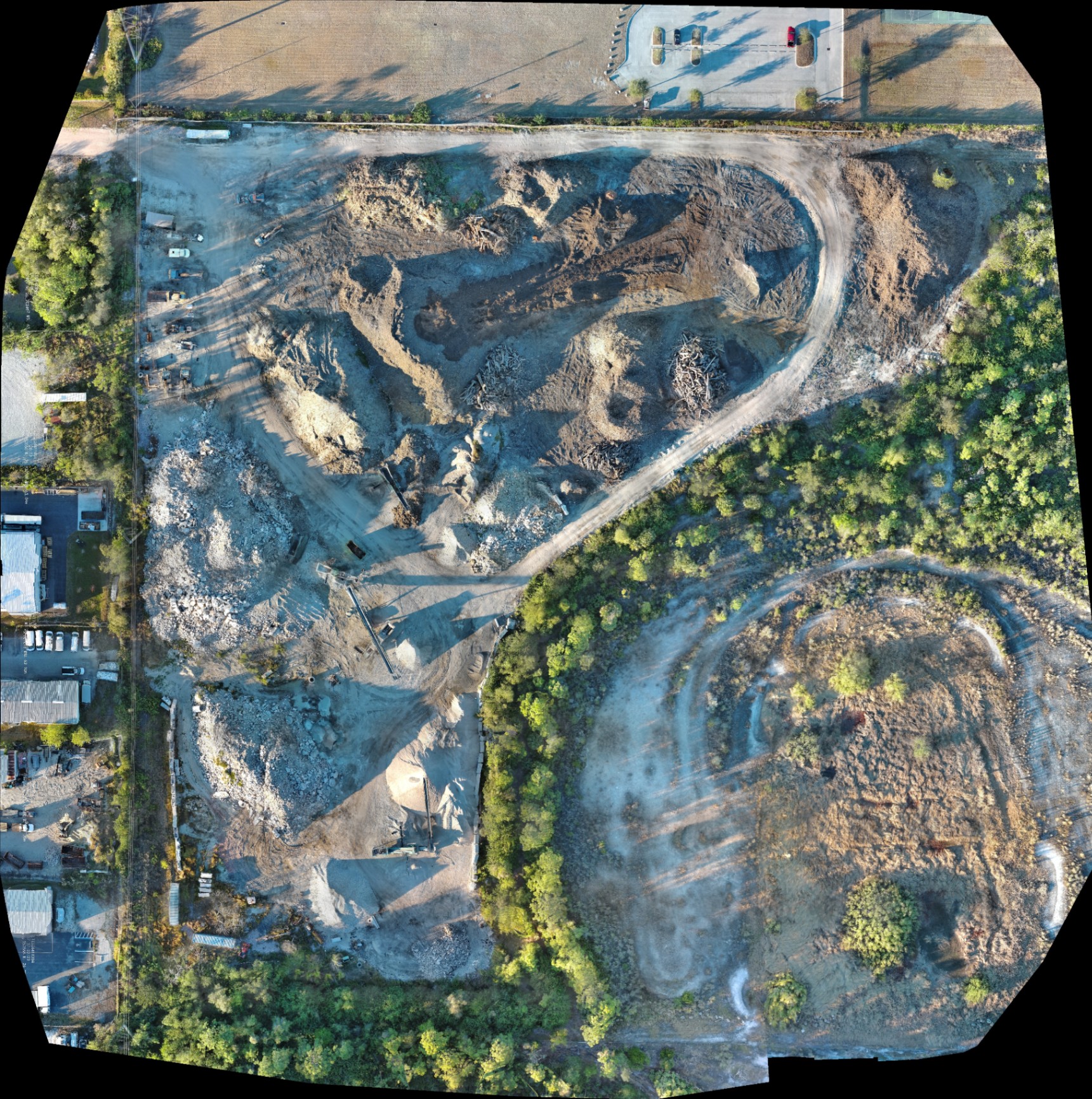
High-Resolution Orthomosaics: A Digital Twin for Your Project
An orthomosaic is a highly detailed, geometrically corrected map composed of hundreds or thousands of individual high-resolution images. Unlike a standard aerial photo, an orthomosaic is uniform in scale and can be used to perform calculations for planning and documentation.
At Cape UAV, we utilize specialized software to process these images into maps that reveal fine details: down to the placement of rebar or the depth of a trench. For land development in the sandy soils of Southwest Florida, seeing the exact state of site preparation is vital for ensuring the foundation of the project is sound.
Why This Matters
- Detailed Documentation: View site conditions with enough clarity to see individual pieces of equipment and material piles.
- Contextual Awareness: Understand how your site interacts with adjacent properties, access roads, and environmental features.
- Planning Efficiency: Use digital maps to plan equipment movement and material staging areas to optimize workflow.
The Technical Edge: Autel Robotics EVO Lite 6T Enterprise
Not all drones are created equal. The quality of the data is directly tied to the quality of the hardware. At Cape UAV, we utilize the Autel Robotics EVO Lite 6T Enterprise (also known as the EVO Lite 640T) to deliver superior results for our B2B clients.
This platform is equipped with a 50MP visual camera capable of capturing ultra-high-definition imagery. When we talk about precision, we are referring to the ability to see the smallest details from hundreds of feet in the air. Furthermore, the inclusion of a 640×512 thermal sensor with a 12um pixel pitch allows us to provide multi-layered data that standard drones simply cannot match.
| Feature | Specification | Construction Benefit |
|---|---|---|
| Visual Resolution | 50 Megapixels | Ultra-clear documentation of assets and progress |
| Thermal Resolution | 640×512 | Detection of moisture, heat leaks, and utility lines |
| Pixel Pitch | 12um | Higher sensitivity and better image detail |
| Pilot Certification | FAA Part 107 | Ensures safe, legal, and professional operation |
Autel Robotics is a trademark of its respective owner; Cape UAV is not affiliated with or endorsed by Autel Robotics.
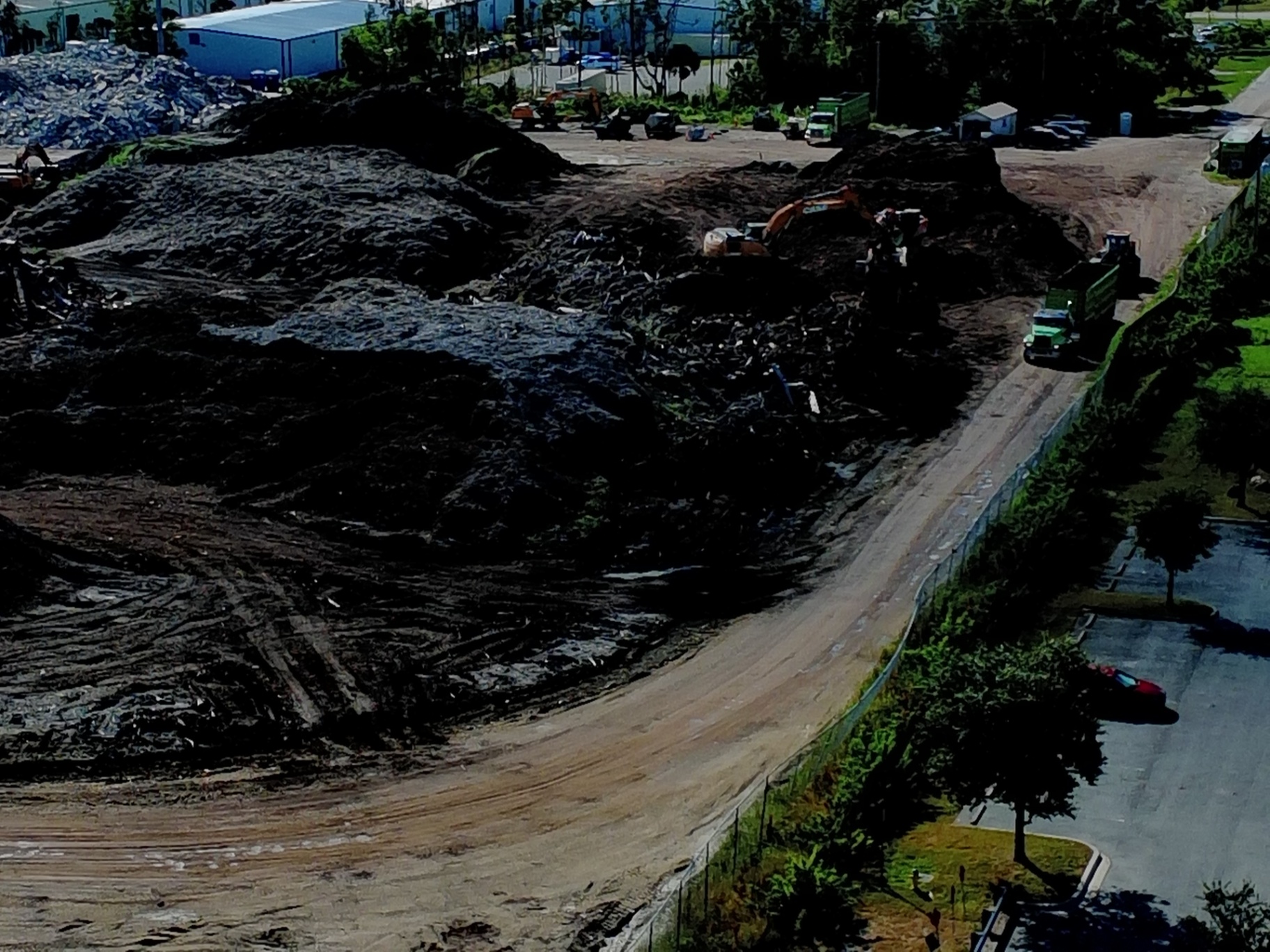
Volumetric Analysis and Material Management
One of the most significant changes in construction tracking is the ability to perform volumetric analysis on-demand. Instead of estimating how much fill dirt is on-site or how much debris needs to be hauled away, precision mapping allows for the calculation of stockpiles through digital surface models (DSM).
By comparing the current site elevation to a baseline, we help project managers track earthmoving progress. This ensures that you are only paying for the material that has actually been moved and that you have enough inventory to meet the next phase of construction.
ROI Advantage
Eliminating guesswork in material management can save tens of thousands of dollars on large-scale land development projects. When you have a precise visual record of stockpile volumes, you reduce the risk of over-ordering materials or facing unexpected shortages that halt production.

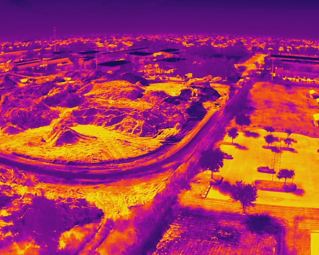
Thermal Imaging: Detecting What the Eye Misses
While visual mapping is essential for tracking what is happening on the surface, thermal imaging allows us to see what is happening beneath it or within structures. Using the 640×512 thermal sensor on our Enterprise equipment, we can identify anomalies that visual cameras would miss.
During construction, this is particularly useful for:
- Detecting Moisture Ingress: Identifying leaks in new roofing or building envelopes before they cause internal damage.
- Utility Mapping: Locating underground lines or heating elements that may be generating heat signatures.
- Concrete Curing: Monitoring temperature variations in large concrete pours to ensure even curing and structural integrity.
Why It Matters
- Proactive Problem Solving: Identify issues like thermal bridging or moisture trapped in insulation early in the build.
- Safety Inspections: Scan electrical panels or heavy machinery on-site for overheating components to prevent fire risks.
Comparing Traditional Methods to Precision Mapping
The difference in efficiency between traditional site tracking and drone-assisted mapping is stark. What used to take a team days to document can now be completed in a single flight.
| Method | Time to Data | Scope of Data | Risk Level |
|---|---|---|---|
| Traditional Site Walk | Days | Limited to ground-level photos and notes | Higher (trips/falls on active sites) |
| Ground Surveying | Weeks | Highly specific points only | Moderate |
| Drone Mapping | Hours | Thousands of data points / Full site view | Low (remote operation) |
Precision drone mapping delivers data in hours, not weeks. This speed allows for more frequent tracking: weekly or even daily: providing a more accurate pulse on the project's health.
Safety and Compliance in Southwest Florida
Operating in Cape Coral and the surrounding areas requires strict adherence to safety standards and local regulations. All missions at Cape UAV are conducted by FAA Part 107 certified pilots. This certification ensures that we are operating within the national airspace system safely and legally, which protects you from the liability of using uncertified operators.
Furthermore, we understand the specific environmental and logistical challenges of the Southwest Florida landscape. From managing flight paths around sensitive coastal areas to navigating the high-heat humidity that can affect electronics, our technical expertise ensures the job is done right every time.
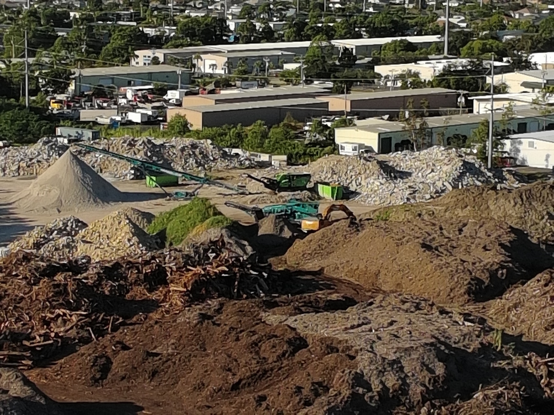
The ROI of Modern Drone Mapping
The ultimate goal of precision mapping is to protect your bottom line. By providing high-resolution visuals and data for planning, we help you:
- Reduce Rework: Catch errors early by comparing site progress to design files.
- Optimize Logistics: Plan the most efficient routes for machinery and material placement.
- Shorten Payment Cycles: Provide indisputable proof of work completed to release draws and pay subcontractors faster.
- Enhance Marketing: Use high-resolution aerial imagery to market the development to potential buyers or tenants while construction is still underway.
Important Disclaimer
Our data is for planning purposes and is not a substitute for a licensed land survey. Thermal results indicate anomalies and are not a substitute for evaluation by a licensed professional.
Why Cape UAV is the Technical Choice
We position ourselves as technical experts, not just "drone pilots." By leveraging the Autel Robotics EVO Lite 6T Enterprise, we provide a level of sensor resolution and data quality that is required for professional industrial and construction applications. Our focus is on delivering the high-resolution orthomosaics and 3D models that drive decision-making for land development and facility maintenance.
If you are ready to stop guessing and start knowing exactly where your project stands, precision mapping is the answer. It provides the clarity, confidence, and control required to manage modern construction projects in an increasingly competitive market.
Important Disclaimer
Our data is for planning purposes and is not a substitute for a licensed land survey. Thermal results indicate anomalies and are not a substitute for evaluation by a licensed professional. Autel Robotics is a trademark of its respective owner; Cape UAV is not affiliated with or endorsed by Autel Robotics.