
In the rapidly evolving landscape of Southwest Florida construction and property management, drones have shifted from "cool gadgets" to essential enterprise tools. Whether you are managing a high-stakes commercial development in Cape Coral or overseeing a luxury estate portfolio in Naples, aerial data is likely part of your workflow.
However, there is a massive divide between "someone who flies a drone" and an FAA Part 107 certified commercial pilot. For a business owner or project manager, hiring an uncertified operator isn't just a shortcut: it is a significant financial and legal liability. At Cape UAV, we prioritize the technical precision and federal compliance required to protect your assets and your bottom line.
The Legal Foundation: What is FAA Part 107?
The Federal Aviation Administration (FAA) governs all US airspace. Under Title 14 of the Code of Federal Regulations, Part 107 is the primary set of rules for non-hobbyist small Unmanned Aircraft Systems (sUAS) operations.
To fly a drone for any "furtherance of a business": which includes real estate photography, construction progress monitoring, or thermal inspections: the pilot must hold a Remote Pilot Certificate. This isn't just a card in a wallet; it represents a documented understanding of national airspace classifications, weather patterns, emergency procedures, and safe flight operations.
Why This Matters to Your Project
If you hire an unlicensed pilot for a commercial project, you are effectively participating in an illegal operation. The FAA has the authority to issue significant fines: often reaching tens of thousands of dollars: to both the pilot and the person or entity that hired them.
ROI Advantage: By hiring a Part 107 certified pilot, you eliminate the risk of federal intervention or project shutdowns due to regulatory violations. You ensure the job is done right the first time, preventing costly rework or legal fees.
Risk Mitigation Through Professional Insurance
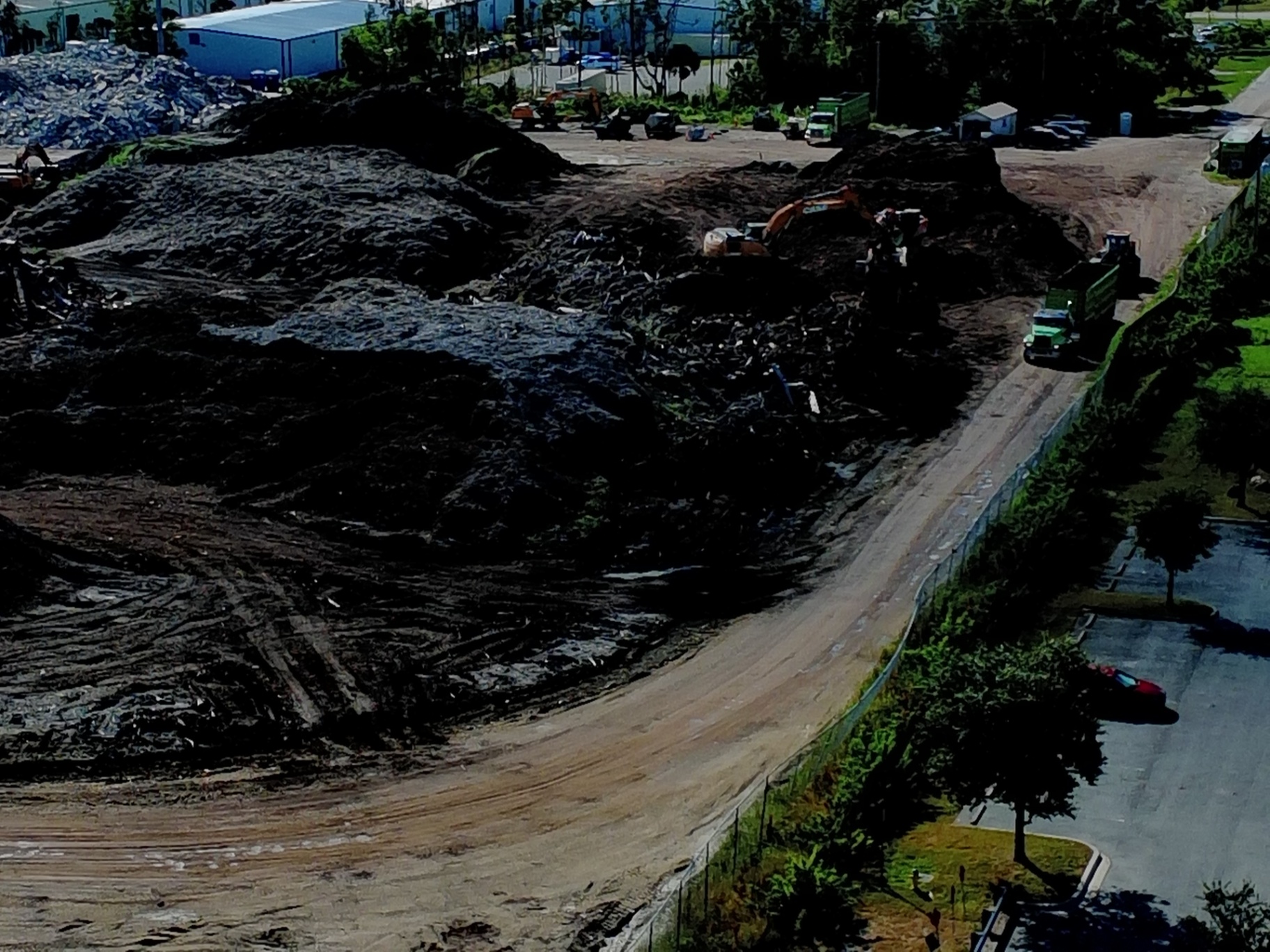
Standard general liability insurance for a business rarely covers aviation-related incidents. A professional drone service provider like Cape UAV carries specialized aviation insurance that protects your property and the public.
Protection Against the Unforeseen
Even with the best technology, flight environments can be unpredictable. High winds, localized magnetic interference, or sudden equipment failure can lead to property damage. A certified pilot operates under strict pre-flight checklists and maintenance schedules to minimize these risks, but they also carry the insurance necessary to cover them if they occur.
- Liability Coverage: Protects against damage to third-party property or bodily injury.
- Professional Accountability: Insurance companies typically only provide coverage to Part 107 certified pilots, meaning if your "drone guy" isn't certified, he almost certainly isn't insured.
ROI Advantage: Professional insurance transfers the risk away from your company’s balance sheet. One minor accident with an uninsured drone can easily wipe out the savings of hiring a cheaper, uncertified operator.
Technical Precision: Enterprise Equipment vs. Consumer Toys
A certified pilot doesn't just fly; they operate complex remote sensing equipment. At Cape UAV, our primary platform is the Autel Robotics EVO Lite 6T Enterprise (EVO Lite 640T). This is a purpose-built industrial tool, not a retail-shelf hobbyist drone.
The Power of 640×512 Thermal Imaging
For facility maintenance and solar inspections, the quality of data is dictated by the sensor. Our equipment features a 640×512 thermal sensor with a 12um pixel pitch. In layman's terms, this allows us to detect minute temperature variations that cheaper sensors miss.
- 12um Pixel Pitch: Provides higher thermal sensitivity and better image detail, essential for identifying moisture intrusion in roofing or overheating components in electrical grids.
- 50MP Visual Camera: Delivers the high-resolution imagery required for detailed high-resolution orthomosaics and 3D modeling.
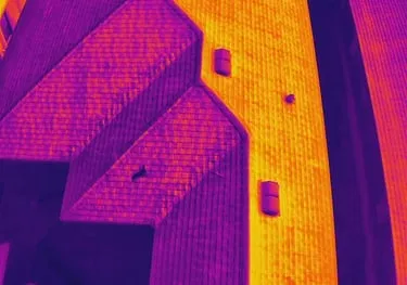
Why This Matters: High-resolution thermal data reveals "hidden" problems: leaks, insulation gaps, and failing solar cells: before they become catastrophic failures.
Important Disclaimer: Thermal results indicate anomalies and are not a substitute for evaluation by a licensed professional.
Precision Mapping for Land Development
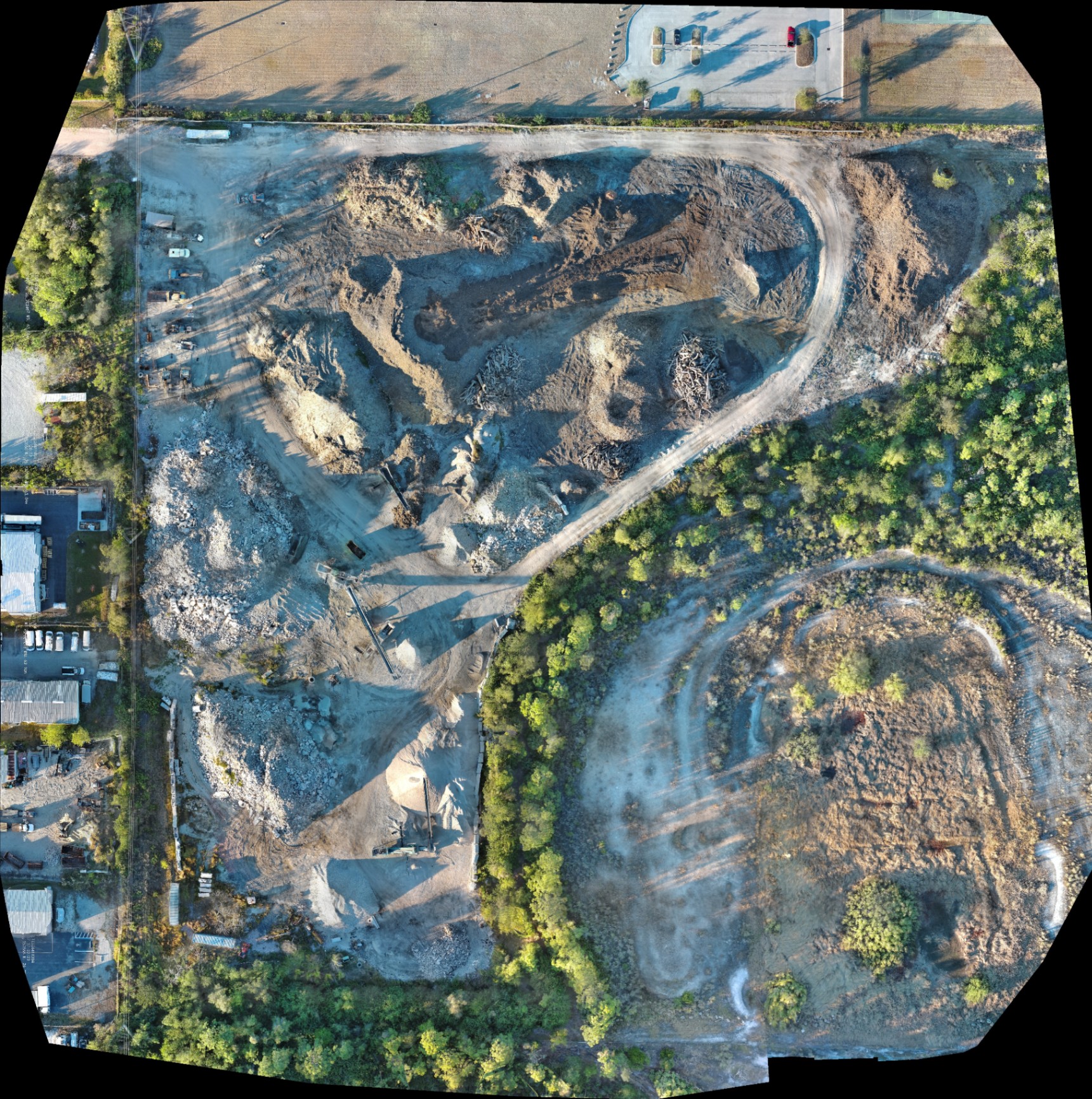
In Southwest Florida, land development moves fast. To keep up, project managers need high-resolution mapping for planning and documentation. A Part 107 pilot understands how to coordinate flights to capture overlapping imagery used to generate 3D models and orthomosaics.
Documenting Progress and Mitigating Disputes
When you have a weekly or monthly high-resolution orthomosaic of your construction site, you have an indisputable record of progress.
- Material Tracking: Visualizing stockpiles and equipment movement without stepping foot on the site.
- Stakeholder Communication: Sharing clear, interactive maps with investors and partners who may not be local to Southwest Florida.
- Site Planning: Using aerial data to overlay site plans and ensure the project is adhering to the intended layout.
Important Disclaimer: Our data is for planning purposes and is not a substitute for a licensed land survey.
Safety and Airspace Management
Southwest Florida has complex airspace. Between Page Field, Southwest Florida International (RSW), and various private airfields, knowing where you can and cannot fly is critical.
A certified pilot uses the Low Altitude Authorization and Notification Capability (LAANC) to obtain near-instant authorization to fly in controlled airspace. They understand how to read sectional charts and monitor NOTAMs (Notices to Air Missions) to ensure they aren't interfering with manned aircraft.
Standard Operating Procedures (SOPs)
Professionalism is defined by the steps taken before the motors even spin. Our workflow includes:
- Airspace Analysis: Determining if waivers or authorizations are required.
- Pre-Flight Equipment Inspection: Ensuring the Autel EVO Lite 6T Enterprise is in peak operating condition.
- Weather Monitoring: Respecting "up to" wind speed limits and visibility requirements.
- On-Site Safety Briefings: Ensuring the project team knows the flight path and landing zones.
The ROI of Hiring Cape UAV
When you hire a professional drone service, you aren't just buying photos; you are buying a technical solution that delivers a clear Return on Investment.
| Factor | Uncertified Hobbyist | Cape UAV (Part 107 Certified) |
|---|---|---|
| Legal Risk | High (Potential FAA Fines) | Zero (Full Compliance) |
| Insurance | Likely None | Fully Insured Aviation Liability |
| Data Quality | Consumer Grade | Enterprise (640×512 Thermal) |
| Planning Utility | Low (Random Photos) | High (Orthomosaics & 3D Models) |
| Safety | Minimal Oversight | Strict FAA Protocols |
By choosing a certified partner, you protect your budget from the hidden costs of poor data, legal complications, and safety mishaps. Whether we are conducting a thermal roof inspection to support your maintenance workflow or providing high-resolution visuals for real estate marketing, our focus remains on precision and professionalism.
Important Disclaimer
Mapping: Our data is for planning purposes and is not a substitute for a licensed land survey.
Thermal: Thermal results indicate anomalies and are not a substitute for evaluation by a licensed professional.
Autel Robotics is a trademark of its respective owner; Cape UAV is not affiliated with or endorsed by Autel Robotics. Equipment include models such as the Autel Robotics EVO Lite 6T Enterprise.
Ready to secure your project with professional aerial data?
At Cape UAV, we provide the technical expertise Southwest Florida businesses need to move forward with confidence. From high-resolution mapping to advanced thermal inspections, we ensure your property and your budget are protected.
Contact Michael Sischo at Cape UAV today to discuss your next project.