
Real estate drone services are no longer an optional luxury: they are a baseline requirement for high-stakes property transactions in Southwest Florida. Whether you are marketing a luxury waterfront estate in Cape Coral or managing a large-scale land development project, the quality of your aerial data directly impacts your bottom line.
Choosing the right provider involves more than just finding someone with a drone. It requires an evaluation of technical specifications, regulatory compliance, and the ability to deliver actionable data beyond simple "pretty pictures." In a market where 85% of buyers expect aerial views, the distinction between a hobbyist and an enterprise-grade service provider like Cape UAV determines the speed and success of your project.
The Regulatory Baseline: FAA Part 107 and Insurance
The first step in choosing a service is verifying legal standing. Any drone operation conducted for "furtherance of a business" must be performed by an FAA Part 107–certified remote pilot. This is not a suggestion: it is a federal requirement.
Why It Matters
- Legal Protection: Unlicensed operations can result in significant fines for both the pilot and the hiring party.
- Safety Standards: Part 107 pilots are trained in airspace restrictions, weather patterns, and emergency procedures.
- Insurance Eligibility: Professional liability and hull insurance typically require a valid Part 107 certification to remain in effect.
At Cape UAV, we prioritize safety and compliance for every mission, ensuring our clients are protected from the risks associated with uncertified "fly-by-night" operators.
Technical Specifications: The Visual Advantage
High-end real estate demands high-resolution visuals. When comparing services, ask specifically about the hardware being deployed. A standard consumer drone lacks the sensor size and optics necessary to capture the fine details of architectural features or expansive landscapes.
For luxury listings, we utilize platforms like the Autel Robotics EVO Lite 6T Enterprise (EVO Lite 640T). This equipment includes a 50MP visual camera capable of capturing the texture of high-end finishes and the vibrant colors of Southwest Florida’s coastal environments.
Key Visual Specs to Look For:
- Sensor Size: Larger sensors perform better in the high-contrast lighting common in Florida.
- Resolution: 4K is the minimum for video; 8K or 50MP is the standard for high-end stills.
- Gimbal Stability: Ensures crisp images even in the 15–20 mph winds often found near the Gulf.

Beyond Visuals: The Thermal Inspection Advantage
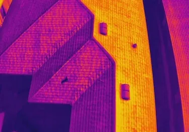
In the current market, "Real Estate Drone Services" has expanded to include thermal imaging. This technology allows property managers and luxury home buyers to see what the naked eye cannot: moisture intrusion, insulation gaps, and failing electrical components.
We emphasize a "thermal-first" approach for property inspections. Our enterprise platforms utilize a 640×512 thermal sensor with a 12um pixel pitch. This technical specification is critical; a smaller pixel pitch (12um vs. the older 17um) allows for higher detail and better temperature sensitivity at greater distances.
ROI Advantage
Detecting a roof leak or an overheating electrical panel during a pre-listing inspection can save tens of thousands of dollars in "surprises" during the closing process. It provides the seller with a position of transparency and the buyer with a position of confidence.
Precision Mapping for Land Development
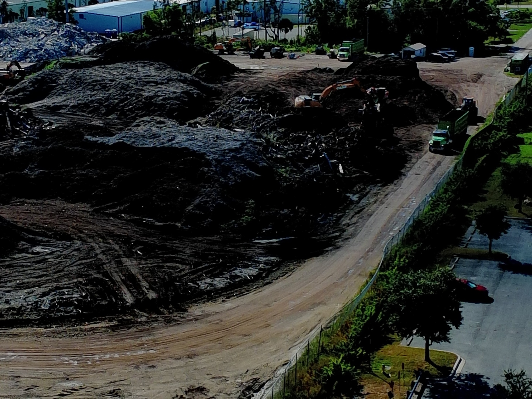
For B2B clients in construction and land development, standard photography is insufficient. You need drone mapping. This involves creating high-resolution orthomosaics: thousands of individual photos stitched together into a single, geographically accurate map.
Why This Matters
- Project Monitoring: Track earth-moving progress and material movement weekly.
- Site Planning: Use detailed maps for site layout and equipment staging.
- Documentation: Maintain a permanent visual record of every phase of construction.
Our data is used for planning and documentation purposes, offering a level of site-wide clarity that traditional ground-based methods simply cannot match. It eliminates the need for expensive lifts or repeated site visits.
Comparing Service Tiers: Hobbyist vs. Prosumer vs. Enterprise
To choose the best service, you must understand the different tiers of equipment and expertise available in the Southwest Florida market.
| Feature | Hobbyist/Entry-Level | Prosumer | Cape UAV Enterprise (EVO Lite 640T) |
|---|---|---|---|
| Visual Resolution | 12MP – 20MP | 20MP | 50MP |
| Thermal Capability | None | Low-Res (160×120) | High-Res (640×512) |
| Pixel Pitch | N/A | 17um | 12um |
| Certification | Often Missing | Part 107 | Part 107 + Advanced Training |
| Data Types | Photos/Video | Photos/Video/Basic Maps | Thermal/Orthomosaics/3D Models |
Note: Autel Robotics is a trademark of its respective owner; Cape UAV is not affiliated with or endorsed by Autel Robotics. Results depend on environmental and flight conditions.
ROI and Market Impact
The financial case for professional drone services is quantifiable. Listings with aerial photography sell up to 70% faster than those without. In the competitive luxury real estate market of Cape Coral and Naples, high-resolution visuals are the first thing a potential buyer sees.
The Financial Breakdown:
- Reduction in Days on Market: Faster sales reduce holding costs and interest payments.
- Avoided Maintenance Costs: Thermal inspections catch "invisible" issues before they escalate into structural failures.
- Enhanced Planning: High-resolution mapping reduces project delays caused by site-level misunderstandings.
By positioning Cape UAV as your technical partner, you aren't just buying a photo; you are investing in a data-driven strategy to protect and promote your assets.
Conclusion: Making the Right Choice
Choosing the best drone service means looking past the surface. You need a partner who understands the technical specs of a 12um thermal sensor, the legal requirements of the FAA, and the marketing nuances of Southwest Florida real estate. Whether it's an industrial inspection or a high-end property listing, the equipment and the expertise must match the stakes of the project.
Important Disclaimer
Mapping Disclaimer: Our data is for planning purposes and is not a substitute for a licensed land survey.
Thermal Disclaimer: Thermal results indicate anomalies and are not a substitute for evaluation by a licensed professional.
For more information on how our technical aerial services can support your next project, visit our FAQ page or contact us directly to discuss your specific requirements.
Important Disclaimer
Our data is for planning purposes and is not a substitute for a licensed land survey. Thermal results indicate anomalies and are not a substitute for evaluation by a licensed professional.